
Desur is a Town panchayat in Tiruvanamalai district in the Indian state of Tamil Nadu.

Dhanuha is a census town in Jaunpur district in the state of Uttar Pradesh, India.

Egra is a city with a municipality in Purba Medinipur district in the state of West Bengal, India. It is the headquarters of the Egra subdivision. This town was built by Utkal king 500 years back. Its name was "Agarpattanam".
Madhogarh is a town and a nagar panchayat in Jalaun district in the Indian state of Uttar Pradesh. Madhogarh is famous for ghee.

Meghraj is a town in the Indian state of Gujarat.

Peerkankaranai is a neighborhood in Southern part of the metropolitan city of Chennai in the Indian state of Tamil Nadu.

Ratlam Railway Colony, also known as Ratlam Kasba, is a census town in Ratlam District in the Indian state of Madhya Pradesh.It stretches from Dat ki Pul to the Railway hospital. The colony ends at Gandhinagar and the railway station on the opposite side. It is home to two railway schools, a full-sized basketball court, a full-size track and field ground and a volleyball court. The colony boasts two clubs with badminton courts and pool table.

Salumbar is a statutory town in Udaipur district in the Indian state of Rajasthan.

Thevaram is a town in Theni district in the Indian state of Tamil Nadu. Thevaram is located in Tamil Nadu near on border of Kerala at the Eastern side foot-hill of the Western Ghats. It is connected with State Highway SH100.
Jafarabad is a town and nagar panchayat in Jaunpur district in the Indian state of Uttar Pradesh.

Bhoom is a town with a municipal council in Osmanabad district, Maharashtra, India, and it is the headquarters of Bhoom tahsil. Bhoom municipal corporation is established in 1948. Bhoom is a small town situated in a valley of the Banashankar hill ranges of Sahyadri. It is situated on the banks of the River Banaganga, which eventually flows into the Bhima. In 1717, Sambhaji II of Kolhapur gave Bhoom as jagir to Shrimant Senakhaskhel Yashwantrao Thorat (a chief and military leader of his troops) for his bravery. In 19th century Bhoom was under Nizam territory during the British raj in India. However it was independently ruled by the ' Thorat ' royal family. Shrimant Vijaysinh Amarsinh Thorat is the present head of Bhoom. He was the President of Bhoom Municipal Council from 1991 -2006.

Kasba is a satellite town of Purnia city and part of Purnia Urban Agglomeration in Purnia district in the Indian state of Bihar.

Kasba is a census town in Raiganj CD Block in Raiganj subdivision of Uttar Dinajpur district in the Indian state of West Bengal.

Kasba is an upazila of Brahmanbaria District, Chittagong Division in east-central Bangladesh. Kasba is located approximately 150 km north of Chittagong. It was part of greater Comilla District until 1984.
Peth Vadgaon is a city and education hub in Kolhapur district in the Indian state of Maharashtra. It is governed by a municipal council.

Kerur is a City in Bagalkot district in Karnataka, which located on NH 218. It has an average elevation of 617 meters (2024 feet). It's a birthplace of Jagadish Shettar, a former Chief Minister of Karnataka. Kerur is a Town Panchayat city in district of Bagalkot, Karnataka. The Kerur city is divided into 16 wards for which elections are held every five years. The Kerur Town Panchayat has population of 19,731 of which 9,929 are males while 9,802 are females as per report released by Census India 2011.
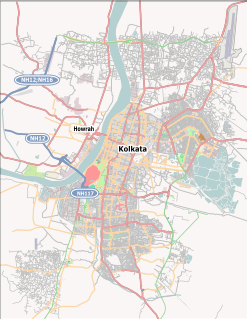
Ward No. 107, Kolkata Municipal Corporation is an administrative division of Kolkata Municipal Corporation in Borough No. 12, covering parts of Tiljala, Kasba, Haltu and East Calcutta Township (Ruby) neighbourhoods in South Kolkata in the Indian state of West Bengal.
Bachuwapar is a Kasba/Town in Ambedkar Nagar district in the Indian state of Uttar Pradesh and is Subpost Office of Rajesultanpur.

Chandpur Rurki is a village in Shaheed Bhagat Singh Nagar district of Punjab State, India. It is located 5.1 kilometres (3.2 mi) away postal head office Saroa, 27.4 kilometres (17.0 mi) from Banga, 31 kilometres (19 mi) from district headquarter Shaheed Bhagat Singh Nagar and 95.6 kilometres (59.4 mi) from state capital Chandigarh. The village is administrated by Sarpanch an elected representative of the village.
Maharaja Hat is a census town in Raiganj CD Block in Raiganj subdivision of Uttar Dinajpur district in the Indian state of West Bengal.

