Saint-Julien-l'Ars

Last updated
Saint-Julien-l'Ars
Church in St. Julien l'Ars, 17 July 2012.JPG
The church in St. Julien l'Ars
Blason ville fr Saint-Julien-l'Ars (vienne).svg
Location of Saint-Julien-l'Ars
Saint-Julien-l'Ars
France location map-Regions and departements-2016.svg
Red pog.svg
Saint-Julien-l'Ars
Aquitaine-Limousin-Poitou-Charentes region location map.svg
Red pog.svg
Saint-Julien-l'Ars
Coordinates: 46°33′34″N0°30′39″E / 46.5594°N 0.5108°E / 46.5594; 0.5108
Country France
Region Nouvelle-Aquitaine
Department Vienne
Arrondissement Poitiers
Canton Chasseneuil-du-Poitou
Intercommunality CU Grand Poitiers
Government
  Mayor (20212026) Béatrice Vanneste [1]
Area
1
18.46 km2 (7.13 sq mi)
Population
 (2021) [2]
2,863
  Density160/km2 (400/sq mi)
Time zone UTC+01:00 (CET)
  Summer (DST) UTC+02:00 (CEST)
INSEE/Postal code
86226 /86800
Elevation104–130 m (341–427 ft)
(avg. 120 m or 390 ft)
1 French Land Register data, which excludes lakes, ponds, glaciers > 1 km2 (0.386 sq mi or 247 acres) and river estuaries.

Saint-Julien-l'Ars is a commune in the Vienne department in the Nouvelle-Aquitaine region in west-central France.

Contents

Geography

The climate is oceanic with temperate summers.

Population

The inhabitants are called Sacto-Julianais in French. [3]

Historical population
YearPop.±% p.a.
1968 1,234    
1975 1,432+2.15%
1982 1,724+2.69%
1990 1,903+1.24%
1999 2,061+0.89%
2007 2,212+0.89%
2012 2,447+2.04%
2017 2,660+1.68%
Source: INSEE [4]

History

The town of Saint-Julien-l'Ars is located on D951 nine miles east of Poitiers' town center. Traces of occupation dating from the Gallo-Roman period were found there (vestiges of workshops, a sculpted head, etc.). [5] A Merovingian cemetery was found in the proximity of the church.

The Chateau in Saint Julien Chateau St. Julien (Eastside), 17 July 2012.jpg
The Chateau in Saint Julien

Owned by the Counts of Poitiers, [6] it was granted to Trinity Abby of Poitiers in 964, which gave it as a fief to the Cléret family who built the château originally as a Keep near Roman cross roads and on the ruins of an old Roman castrum and kept the estate until 1687. Chateau St. Julien l'Ars still stands after extensive renovations done in the 1860s by Robert de Beauchamp. The estate is now owned and operated as a destination wedding venue by the Gubelman family who acquired the estate in 2001.

Before 1790, Saint-Julien-l'Ars was part of the Archparish [Note 1] of Morthemer, Castellany and Bailiwick of Poitiers.

Saint-Julien-l'Ars welcomed the progress of the French Revolution and planted the Tree of Freedom to symbolize it. It became the rallying point for all the major festivals and events related to the revolution including the anniversary of the execution of King Louis XVI. [7]

Following the decree of the National Convention of 25 Vendémiaire Year II (16 October 1793), communes with names that reflected royalty, feudalism or superstition were invited to change their names; thus the commune's name was changed to La Reunion. [8]

Saint-Julien-l'Ars merged with the commune of Savigny-l'Evescault on 10 November 1819. It returned to being a separate commune on 12 January 1870. [9]

Saint-Julien-l'Ars Station was commissioned on 18 June 1883 by the State, to exploit the Mignaloux-Nouaille-to-Chauvigny section of the Saint-Benoît-to-Blanc rail line. [10]

See also

Notes

  1. This is a translation of the French term "archiprêtré" which refers to a level in the Roman Catholic hierarchy which is between a parish and diocese. See the French Wikipedia page Archiprêtré.

Related Research Articles

<span class="mw-page-title-main">Indre</span> Department of France

Indre ; is a department in central France named after the river Indre. The inhabitants of the department are known as the Indriens and Indriennes. Indre is part of the current administrative region of Centre-Val de Loire. The region is bordered by the departments of Indre-et-Loire to the west, Loir-et-Cher to the north, Cher to the east, Creuse, and Haute-Vienne to the south, and Vienne to the southwest. The préfecture (capital) is Châteauroux and there are three subpréfectures at Le Blanc, La Châtre and Issoudun. It had a population of 219,316 in 2019.

<span class="mw-page-title-main">Haute-Vienne</span> Department of France in Nouvelle-Aquitaine

Haute-Vienne is a département in the Nouvelle-Aquitaine region in southwest-central France. Named after the Vienne River, it is one of the twelve départements that together constitute Nouvelle-Aquitaine. The prefecture and largest city in the department is Limoges, the other towns in the department each having fewer than twenty thousand inhabitants. Haute-Vienne had a population of 372,359 in 2019.

<span class="mw-page-title-main">Yzeures-sur-Creuse</span> Commune in Centre-Val de Loire, France

Yzeures-sur-Creuse is a commune in the Indre-et-Loire department, central France.

<span class="mw-page-title-main">Arrondissement of Montmorillon</span> Arrondissement in Nouvelle-Aquitaine, France

The arrondissement of Montmorillon is an arrondissement of France in the Vienne department in the Nouvelle-Aquitaine region. It has 90 communes. Its population is 67,025 (2016), and its area is 2,876.1 km2 (1,110.5 sq mi).

<span class="mw-page-title-main">Arrondissement of Poitiers</span> Arrondissement in Nouvelle-Aquitaine, France

The arrondissement of Poitiers is an arrondissement of France in the Vienne department in the Nouvelle-Aquitaine region. It has 83 communes. Its population is 259,699 (2016), and its area is 2,131.5 km2 (823.0 sq mi).

<span class="mw-page-title-main">Ardoix</span> Commune in Auvergne-Rhône-Alpes, France

Ardoix is a commune in the Ardèche department in the Auvergne-Rhône-Alpes region of southern France.

<span class="mw-page-title-main">Alboussière</span> Commune in Auvergne-Rhône-Alpes, France

Alboussière is a commune in the Ardèche department in the Auvergne-Rhône-Alpes region in Southern France.

<span class="mw-page-title-main">Barbaira</span> Commune in Occitanie, France

Barbaira is a commune in the Aude department in the Occitanie region of southern France.

<span class="mw-page-title-main">Aguessac</span> Commune in Occitanie, France

Aguessac is a commune in the Aveyron department in the Occitanie region of southern France.

<span class="mw-page-title-main">Ambeyrac</span> Commune in Occitanie, France

Ambeyrac is a commune in the Aveyron department in the Occitanie region of southern France.

<span class="mw-page-title-main">Arnac-sur-Dourdou</span> Commune in Occitanie, France

Arnac-sur-Dourdou is a commune in the Aveyron department in the Occitanie region of southern France.

<span class="mw-page-title-main">Arvieu</span> Commune in Occitanie, France

Arvieu is a commune in the Aveyron department in the Occitanie region of southern France.

<span class="mw-page-title-main">Auriac-Lagast</span> Commune in Occitanie, France

Auriac-Lagast is a commune in the Aveyron department in the Occitanie region of southern France.

<span class="mw-page-title-main">Les Adjots</span> Commune in Nouvelle-Aquitaine, France

Les Adjots is a commune in the Charente department in the Nouvelle-Aquitaine region of southwestern France.

<span class="mw-page-title-main">Alloue</span> Commune in Nouvelle-Aquitaine, France

Alloue is a commune in the Charente department in the Nouvelle-Aquitaine region of southwestern France.

<span class="mw-page-title-main">Archingeay</span> Commune in Nouvelle-Aquitaine, France

Archingeay is a commune in the Charente-Maritime department in the Nouvelle-Aquitaine region of southwestern France.

<span class="mw-page-title-main">Aulnay, Charente-Maritime</span> Commune in Nouvelle-Aquitaine, France

Aulnay, commonly referred to as Aulnay-de-Saintonge, is a commune in the Charente-Maritime department, region of Nouvelle-Aquitaine, France.

<span class="mw-page-title-main">Saint-Martin-l'Ars</span> Commune in Nouvelle-Aquitaine, France

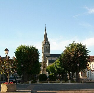
Saint-Martin-l'Ars is a commune in the Vienne department and Nouvelle-Aquitaine region of western France.

<span class="mw-page-title-main">Vienne (department)</span> Department of France

Vienne is a landlocked department in the French region of Nouvelle-Aquitaine. It takes its name from the river Vienne. It had a population of 438,435 in 2019.

Grand-Poitiers is the communauté urbaine, an intercommunal structure, centred on the city of Poitiers. It is located in the Vienne department, in the Nouvelle-Aquitaine region, western France. It was created on 1 January 2017 as a communauté d'agglomération and transformed into a communauté urbaine on 1 July 2017. Its area is 1064.7 km2. Its population was 196,530 in 2020, of which 90,033 in Poitiers proper.

References

  1. "Répertoire national des élus: les maires". data.gouv.fr, Plateforme ouverte des données publiques françaises (in French). 9 August 2021.
  2. "Populations légales 2021". The National Institute of Statistics and Economic Studies. 28 December 2023.
  3. Le nom des habitants du 86 - Vienne, habitants.fr
  4. Population en historique depuis 1968, INSEE
  5. Bulletin du Pays chauvinois n° 15 (1976) et n° 28 (1990)
  6. ancienne abbaye de la Trinité [ permanent dead link ] de Poitiers. Archives départementales
  7. Robert Petit, Les Arbres de la liberté à Poitiers et dans la Vienne, Poitiers : Éditions CLEF 89/Fédération des œuvres laïques, 1989, p. 177
  8. Charles Bouyssi, Communes et paroisses d’Auvergne, mis en ligne en 2002 Archived 2008-11-14 at the Wayback Machine , consulté le 18 novembre 2008
  9. Archives départementales de la Vienne
  10. "Ligne de Saint-Benoît au Blanc". Histoire de lignes oubliées... 17 November 2013. Retrieved 23 August 2016..