Saint-Lin–Laurentides

Last updated • 2 min readFrom Wikipedia, The Free Encyclopedia

Saint-Lin–Laurentides
Ville de Saint-Lin–Laurentides
Route 335 (St-Lin).jpg
Route 335
Saint-Lin-Laurentides Quebec location diagram.png
Location within Montcalm RCM.
Canada Central Quebec location map.png
Red pog.svg
Saint-Lin–Laurentides
Location in central Quebec.
Coordinates: 45°51′N73°46′W / 45.850°N 73.767°W / 45.850; -73.767 [1]
CountryFlag of Canada (Pantone).svg  Canada
Province Flag of Quebec.svg  Quebec
Region Lanaudière
RCM Montcalm
Settled1807
ConstitutedMarch 1, 2000
Government
[2]
  MayorMathieu Maisonneuve
   Federal riding Montcalm
   Prov. riding Rousseau
Area
   City 118.80 km2 (45.87 sq mi)
  Land118.29 km2 (45.67 sq mi)
  Urban
17.29 km2 (6.68 sq mi)
Population
 (2021) [3]
   City 24,030
  Density203.2/km2 (526/sq mi)
   Urban
19,963
  Urban density1,154.6/km2 (2,990/sq mi)
  Pop 2016-2021
Increase2.svg 15.6%
  Dwellings
9,615
Time zone UTC−5 (EST)
  Summer (DST) UTC−4 (EDT)
Postal code(s)
J5M
Area code(s) 450 and 579
Highways [4] Qc158.svg R-158
Qc335.svg R-335
Qc337.svg R-337
Website www.saint-lin-laurentides.com

Saint-Lin–Laurentides is a small city located in the Montcalm Regional County Municipality of Quebec, Canada. Its official name uses an en dash; however, the city's own website uses the two-hyphen version of its name: Saint-Lin-Laurentides. In the Canada 2021 Census its population was 24,030.

Contents

Saint-Lin was the birthplace of former Canadian Prime Minister Wilfrid Laurier, whose paternal home is now a National Historic Site of Canada.

History

Church of St-Lin, 2009 Eglise de St-Lin.jpg
Church of St-Lin, 2009

Saint-Lin–Laurentides was formed on 1 March 2000, when the Municipality of Saint-Lin and the Town of Laurentides were merged. [5]

Saint-Lin was first settled in 1807 when pioneers from Saint-Pierre-du-Portage (now L'Assomption) arrived. In 1828, the Saint-Lin-de-Lachenaie Parish was founded. In 1845, the Parish Municipality of Saint-Lin was established, but was abolished 2 years later in 1847 when it was absorbed into the county municipality. That same year, its post office opened. In 1855, the municipality was reestablished as Saint-Lin-de-Lachenaye, with Carolus Laurier, father of Sir Wilfrid Laurier, as first mayor. [5]

Laurentides was originally the Village Municipality of Saint-Lin, which became an incorporate entity in 1856. In 1883, it changed name and statutes and became the Town of Laurentides. Also that year, the local post office opened. [6]

Demographics

In the 2021 Census of Population conducted by Statistics Canada, Saint-Lin—Laurentides had a population of 24,030 living in 9,289 of its 9,615 total private dwellings, a change of

Historical Census Data – Saint-Lin-Laurentides, Quebec [8]
YearPop.±%
2001 12,379    
2006 14,159+14.4%
2011 17,463+23.3%
2016 20,786+19.0%
2021 24,030+15.6%

Mother tongue:

Home of Sir Wilfrid Laurier Lieu historique national du Canada de Sir-Wilfrid-Laurier 20.JPG
Home of Sir Wilfrid Laurier

Education

The Commission scolaire des Samares operates francophone public schools

Sir Wilfrid Laurier School Board operates English-language public schools. Schools serving the town:

Related Research Articles

<span class="mw-page-title-main">Berthierville</span> City in Quebec, Canada

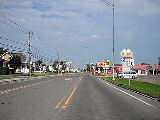
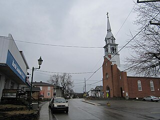
Berthierville (also called Berthier-en-haut, and legally called Berthier before 1942) is a town located between Montreal and Trois-Rivières on the north shore of the Saint Lawrence River in Quebec, Canada. Berthierville is the seat of D'Autray Regional County Municipality, and is served by Autoroute 40, and is the junction of Routes 138 and 158. It is surrounded by the parish municipality of Sainte-Geneviève-de-Berthier.

<span class="mw-page-title-main">Lavaltrie</span> City in Quebec, Canada

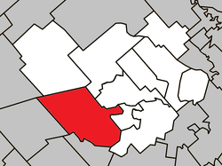
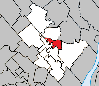
Lavaltrie is a city located within the D'Autray Regional County Municipality in the southern part of the region of Lanaudière, Quebec, Canada, northeast of Montreal outside the suburban sprawl of the North Shore. The population was 14,425 as of the Canada 2021 Census within a land surface area of about 70 square kilometres, with the majority of the territory being used for agricultural activities..

<span class="mw-page-title-main">Saint-Charles-Borromée</span> City in Quebec, Canada

Saint-Charles-Borromée, Quebec is a city in southwest-central Quebec, Canada, on the l'Assomption River. In Joliette Regional County Municipality, Saint-Charles-Borromée has the Maison Antoine-Lacombe, a heritage home that hosts many exhibits throughout the year. The town is also home to the Centre Saint-Jean-Bosco, which annually hosts the Mémoires et Racines Festival of folk music from various countries and Quebec.

<span class="mw-page-title-main">Sainte-Julienne</span> Municipality in Quebec, Canada

Sainte-Julienne is a community and municipality in Lanaudière, Quebec, Canada. According to the 2021 Canadian census, the community has a population of 11,173 The, now closed, Sainte-Julienne Aerodrome is located in Sainte-Julienne.

<span class="mw-page-title-main">Chertsey, Quebec</span> Municipality in Quebec, Canada

Chertsey is a municipality in the regional county municipality of Matawinie in Quebec, Canada, located in the administrative region of Lanaudière.

<span class="mw-page-title-main">Saint-Esprit, Quebec</span> Municipality in Quebec, Canada

Saint-Esprit is a municipality in the Lanaudière region of Quebec, Canada, part of the Montcalm Regional County Municipality. It is located on both banks of the Saint-Esprit River, a tributary of the L'Assomption River.

<span class="mw-page-title-main">Saint-Calixte, Quebec</span> Municipality in Quebec, Canada

Saint-Calixte is a municipality and town in the Lanaudière region of Quebec, Canada, part of the Montcalm Regional County Municipality. Its proximity to the city of Montreal, and its natural environment, make Saint-Calixte a destination for camping in the summertime. There are also many cottages that surround the many lakes in the region. In 2013, Quebec's largest amusement/camping site, Camping et parc d'amusement Atlantide, a 10 million dollar investment, opened its doors in the municipality. The development of the theme park and camping site is arising hopes of new development in Saint-Calixte.

<span class="mw-page-title-main">Saint-Paul, Quebec</span> Municipality in Quebec, Canada

Saint-Paul is a municipality in the Lanaudière region of Quebec, Canada, part of the Joliette Regional County Municipality.

<span class="mw-page-title-main">Notre-Dame-de-Lourdes, Lanaudière</span> Municipality in Quebec, Canada

Notre-Dame-de-Lourdes is a municipality in the Lanaudière region of Quebec, Canada, part of the Joliette Regional County Municipality. It is located along the eastern shores of the L'Assomption River.

<span class="mw-page-title-main">Notre-Dame-des-Prairies</span> City in Quebec, Canada

Notre-Dame-des-Prairies is a town in the Lanaudière region of Quebec, Canada, part of the Joliette Regional County Municipality. It is a suburb of Joliette, located along the eastern shores of the L'Assomption River.

<span class="mw-page-title-main">Sainte-Élisabeth, Quebec</span> Municipality in Quebec, Canada

Sainte-Élisabeth is a municipality in the Lanaudière region of Quebec, Canada, part of the D'Autray Regional County Municipality.

<span class="mw-page-title-main">Saint-Norbert</span> Parish municipality in Quebec, Canada

Saint-Norbert is a parish municipality in D'Autray Regional County Municipality the Lanaudière region of Quebec, Canada.

<span class="mw-page-title-main">Saint-Cuthbert</span> Municipality in Quebec, Canada

Saint-Cuthbert is a municipality in Quebec, Canada, located between Montreal and Trois-Rivieres, just north of Berthierville. It is part of the D'Autray Regional County Municipality in the Lanaudière administrative region. The population as of the 2021 Canadian census was 1,821.

<span class="mw-page-title-main">Saint-Félix-de-Valois</span> Municipality in Quebec, Canada

Saint-Félix-de-Valois is a municipality in the Lanaudière region of Quebec, Canada, part of the Matawinie Regional County Municipality.

<span class="mw-page-title-main">Sainte-Marcelline-de-Kildare</span> Municipality in Quebec, Canada

Sainte-Marcelline-de-Kildare is a municipality in the Lanaudière region of Quebec, Canada, part of the Matawinie Regional County Municipality.

<span class="mw-page-title-main">Saint-Alphonse-Rodriguez, Quebec</span> Municipality in Quebec, Canada

Saint-Alphonse-Rodriguez is a municipality in the Lanaudière region of Quebec, Canada, part of the Matawinie Regional County Municipality.

<span class="mw-page-title-main">Sainte-Béatrix, Quebec</span> Municipality in Quebec, Canada

Sainte-Béatrix is a municipality in the Lanaudière region of Quebec, Canada, part of the Matawinie Regional County Municipality.

<span class="mw-page-title-main">Notre-Dame-de-la-Merci</span> Municipality in Quebec, Canada

Notre-Dame-de-la-Merci is a municipality in the Lanaudière region of Quebec, Canada, part of the Matawinie Regional County Municipality.

<span class="mw-page-title-main">Saint-Côme, Quebec</span> Municipality in Quebec, Canada

Saint-Côme is a municipality in the Lanaudière region of Quebec, Canada, part of the Matawinie Regional County Municipality.

The Centre de services scolaire des Samares is a francophone school district headquartered in Saint-Félix-de-Valois, in the Canadian province of Quebec. It comprises several primary schools and high schools across municipalities in the Lanaudière region. The commission is overseen by a board of elected school trustees.

References

  1. "Banque de noms de lieux du Québec: Reference number 360840". toponymie.gouv.qc.ca (in French). Commission de toponymie du Québec.
  2. 1 2 "Répertoire des municipalités: Geographic code 63048". www.mamh.gouv.qc.ca (in French). Ministère des Affaires municipales et de l'Habitation.
  3. 1 2 Statistics Canada 2021 Census - Saint-Lin-Laurentides census profile
  4. Official Transport Quebec Road Map
  5. 1 2 "Saint-Lin–Laurentides (Ville)" (in French). Commission de toponymie du Québec. Retrieved 2009-09-24.
  6. "Laurentides (Ville)" (in French). Commission de toponymie du Québec. Retrieved 2009-09-24.
  7. "Population and dwelling counts: Canada, provinces and territories, and census subdivisions (municipalities), Quebec". Statistics Canada. February 9, 2022. Retrieved August 29, 2022.
  8. Statistics Canada: 2001, 2006, 2011, 2016 census
  9. "de l'Aubier." Commission scolaire des Samares. Retrieved on September 23, 2017.
  10. "des Trois-Temps (pavillon de l'Arc-en-Ciel)." Commission scolaire des Samares. Retrieved on September 23, 2017.
  11. "des Trois-Temps (pavillon de l'Oiseau-Bleu)." Commission scolaire des Samares. Retrieved on September 23, 2017.
  12. "des Trois-Temps (pavillon Sir-Wilfrid-Laurier)." Commission scolaire des Samares. Retrieved on September 23, 2017.
  13. "JOLIETTE ELEMENTARY ZONE." Sir Wilfrid Laurier School Board. Retrieved on September 17, 2017.
  14. "LAURENTIA ELEMENTARY ZONE." Sir Wilfrid Laurier School Board. Retrieved on September 4, 2017.
  15. "Joliette High School Zone Sec 1-5." Sir Wilfrid Laurier School Board. Retrieved on September 5, 2017.