
Sir Sidney Kidman, known as Sid Kidman and popularly named "the Cattle King", was an Australian pastoralist and entrepreneur who owned or co-owned large areas of land in Australia in his lifetime.
Quinyambie or Quinyambie Station is a pastoral lease currently operating as a cattle station.
Durham Downs Station, most commonly known as Durham Downs, is a pastoral lease that operates as a cattle station in Durham, Shire of Bulloo in South West Queensland, Australia. The property is situated in a remote and arid location along Cooper Creek, where it often experiences drought and floods. It was originally established in the 1870s and belongs to S. Kidman & Co, which since 2016 has been owned by Gina Rinehart.
Headingly Station often just referred to as Headingly is a pastoral lease that operates as a cattle station. It is located about 156 kilometres (97 mi) south of Camooweal and 133 kilometres (83 mi) west of Dajarra in Queensland.
Diamantina Lakes Station, most commonly known as Diamantina Lakes, was a pastoral lease that once operated as a cattle station in central west Queensland, and is now Diamantina National Park, a national park.

Glengyle Station is a pastoral lease that operates as a cattle station in central west Queensland.
Tickalara Station, most commonly known as Tickalara, is a pastoral lease that operates as a cattle station in south west Queensland.
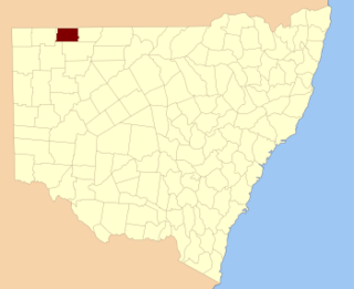
Yancannia Station, most commonly known as Yancannia, is a pastoral lease that operates as a sheep station in north west New South Wales.
Caryapundy Station, most commonly known as Caryapundy or Caryapundy Swamp, is a pastoral lease that once operated as a cattle station in the channel country of outback New South Wales.
Sturts Meadows Station, most commonly known as Sturts Meadows, is a pastoral lease that has operated as a cattle station and a sheep station in outback New South Wales.

Carandotta Station, most commonly referred to as Carandotta but often spelled as Carrandotta, is a pastoral lease that operates as a cattle station in Queensland, Australia. It is within the localities of Carrandotta and Piturie in the Shire of Boulia.
Bulloo Downs Station, most commonly referred to as Bulloo Downs, is a pastoral lease that operates as a cattle station in the Shire of Bulloo, Queensland, Australia. It is located on the traditional lands of the Bitjara.
Corona Station is a pastoral lease that operates as a sheep station in the outback of New South Wales, Australia.
Naryilco Station, also known as Naryilco Downs, is a pastoral lease in Queensland, Australia, that operates as a cattle station.
Warbreccan Station is a pastoral lease that operates as a cattle station. It is located about 62 kilometres (39 mi) north of Jundah and 172 kilometres (107 mi) south west of Longreach in the outback of Queensland. The Thomson River runs through Warbreccan giving it 15 miles (24 km) of double frontage. Currently the property occupies and area 155,000 hectares and has a two bedroom homestead with a three bedroom unit attached to it. A separate three bedroom open plan overseers home is located close by. Numerous creeks and permanent waterholes are found throughout the country which is a mix of pebbly black soil open downs to the south and mulga land in the north. The downs are grassed with a mix of Mitchell and Flinders grasses.
Urisino Station, most commonly known as Urisino, is a pastoral lease that has operated as both a sheep station and a cattle station in outback New South Wales.
Elsinora Station, most commonly known as Elsinora, is a pastoral lease that has operated as both a sheep station and a cattle station in outback New South Wales. It is situated approximately 160 kilometres (99 mi) north of White Cliffs and 240 kilometres (149 mi) north west of Bourke close to the Queensland border.

Thurloo Downs Station, most commonly known as Thurloo Downs, is a pastoral lease that has operated as both a sheep station and a cattle station in outback New South Wales. It is located approximately 175 kilometres (109 mi) north of White Cliffs and 255 kilometres (158 mi) north west of Bourke on the Berawinnia Creek close to the Queensland border.

Bolwarry, New South Wales is a civil parish of Tongowoko County, New South wales. The parish is east of Tibooburra.
Connulpie, New South Wales is a remote civil Parish, of the County of Delalah a cadasteral division of New South Wales.
