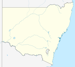
Urisino

Last updated

Australia New South Wales location map blank.svg
Red pog.svg
Urisino Station
Location in New South Wales

Urisino Station, most commonly known as Urisino, is a pastoral lease that has operated as both a sheep station and a cattle station in outback New South Wales.

Contents

It is situated about 140 kilometres (87 mi) north east of White Cliffs and 200 kilometres (124 mi) west of Bourke. The vegetation is predominantly composed of mulga and mixed native species including bimble box. In 2014 the area had found to have been overgrazed by sheep and feral goats. [1]

History

Urisino was owned by Samuel Wilson in the 1860s. [2] By 1883 the owners had spent £28,800 on improvements. [3] In 1894 approximately 120,000 sheep were being shorn at Urisino. [4]

In 1913 the property was running sheep and was being managed by Mr Tooth who was also the manager of Elsinora and Thurloo Downs Stations. [5]

Ursino was later a strategic watering hole for stock belonging to Sidney Kidman. [2] Kidman acquired the property in 1918 [6] along with Elsinora and Thurloo Downs from Goldsbrough, Mort and Co. [7] and held it until 1923. [2]

The property occupied an area of 81,200 acres (32,860 ha) in 1935 and received an average rainfall of 9 inches (229 mm). [8]

The station was abandoned and in disrepair in 1992 when it was acquired by Andrea Rudd and Paul Hansen. The pair restored the homestead making it suitable tourist accommodation. [9]

Since 2007 the station has been the focus of the largest carbon project in Australia's history; the Urisino Forest Regeneration Project. [10] The project works to de-stock the overgrazing feral animals in a humane way, allowing the flora and fauna to recover from the previous drought-stricken state. It is recognised under the Australian Carbon Farming Initiative. [11]

See also

Related Research Articles

<span class="mw-page-title-main">Cobar</span> Town in New South Wales, Australia

Cobar is a town in central western New South Wales, Australia whose economy is based mainly upon base metals and gold mining. The town is 712 km (442 mi) by road northwest of the state capital, Sydney. It is at the crossroads of the Kidman Way and Barrier Highway. The town and the local government area, the Cobar Shire, are on the eastern edge of the outback. At the 2016 census, the town of Cobar had a population of 3,990. The Shire has a population of approximately 4,700 and an area of 44,065 square kilometres (17,014 sq mi).

<span class="mw-page-title-main">Nyngan</span> Town in New South Wales, Australia

Nyngan is a town in the centre of New South Wales, Australia, in the Bogan Shire local government area within the Orana Region of central New South Wales. At the 2016 census, Nyngan had a population of 1,988 people. Nyngan is situated on the Bogan River between Narromine and Bourke, on the junction of the Mitchell Highway and Barrier Highway, 656 km (408 mi) south of Charleville and 576 km (358 mi) north-west of Sydney by road. The Barrier Highway starts at Nyngan, and runs west to Cobar and on through Wilcannia and Broken Hill into South Australia.

<span class="mw-page-title-main">Bourke, New South Wales</span> Town in New South Wales, Australia

Bourke is a town in the north-west of New South Wales, Australia. The administrative centre and largest town in Bourke Shire, Bourke is approximately 800 kilometres (500 mi) north-west of the state capital, Sydney, on the south bank of the Darling River. it is also situated:

<span class="mw-page-title-main">Sidney Kidman</span> Australian pastoralist and entrepreneur

Sir Sidney Kidman, known as Sid Kidman and popularly named "the Cattle King", was an Australian pastoralist and entrepreneur who owned or co-owned large areas of land in Australia in his lifetime.

<span class="mw-page-title-main">Kidman Way</span> Highway in New South Wales

Kidman Way is a state rural road in the western Riverina and western region of New South Wales, Australia. The 643-kilometre (400 mi) highway services the Murrumbidgee Irrigation Area and outback communities and links the Newell Highway with the Sturt, Mid-Western, Barrier, Mitchell and Kamilaroi highways. The road is designated route B87 for its entire length, with its northern terminus at Bourke and its southern terminus just north of Jerilderie. Kidman Way is fully sealed and is accessible by two or four-wheel drive.

<span class="mw-page-title-main">Bourke Shire</span> Local government area in New South Wales, Australia

Bourke Shire is a local government area in the Orana region of New South Wales, Australia. The Shire is located adjacent to the Darling River, which is known as the Barwon River upstream from Bourke; and located adjacent to the Mitchell Highway. The northern boundary of the Shire is located adjacent to the border between New South Wales and Queensland. The shire is a wool and beef producing area.

<span class="mw-page-title-main">Wanaaring, New South Wales</span> Town in New South Wales, Australia

Wanaaring is a remote outback village in north western New South Wales, Australia. Situated on the Paroo River, some 980 kilometres from Sydney, and 180 km west of Bourke. At the 2016 census, Wanaaring had a population of 140.

Durham Downs Station, most commonly known as Durham Downs, is a pastoral lease that operates as a cattle station in Durham, Shire of Bulloo in South West Queensland, Australia. The property is situated in a remote and arid location along Cooper Creek, where it often experiences drought and floods. It was originally established in the 1870s and belongs to S. Kidman & Co, which since 2016 has been owned by Gina Rinehart.

Boorara Station, most commonly known as Boorara, is a pastoral lease that operates as a sheep and cattle station in south west Queensland.

Yancannia Station, most commonly known as Yancannia, is a pastoral lease that operates as a sheep station in north west New South Wales.

Sturts Meadows Station, most commonly known as Sturts Meadows, is a pastoral lease that has operated as a cattle station and a sheep station in outback New South Wales.

Corona Station is a pastoral lease that operates as a sheep station in the outback of New South Wales, Australia.

<span class="mw-page-title-main">Mount Poole Station</span> Pastoral lease in New South Wales

Mount Poole Station is a pastoral lease operating as a sheep station in New South Wales.

Naryilco Station, also known as Naryilco Downs, is a pastoral lease in Queensland, Australia, that operates as a cattle station.

<span class="mw-page-title-main">Toorale Station</span> Defunct pastoral lease in New South Wales

Toorale Station is a defunct pastoral lease that once operated as a sheep station and cattle station in New South Wales. The station was purchased by the Federal and New South Wales Governments, and Toorale National Park was declared on a portion in 2010. The remaining area is now part of a 54,385 hectares state conservation area.

Salisbury Station is a pastoral lease that operates as a sheep station in the outback of New South Wales.

Elsinora Station, most commonly known as Elsinora, is a pastoral lease that has operated as both a sheep station and a cattle station in outback New South Wales. It is situated approximately 160 kilometres (99 mi) north of White Cliffs and 240 kilometres (149 mi) north west of Bourke close to the Queensland border.

<span class="mw-page-title-main">Thurloo Downs</span> Pastoral lease in New South Wales

Thurloo Downs Station, most commonly known as Thurloo Downs, is a pastoral lease that has operated as both a sheep station and a cattle station in outback New South Wales. It is located approximately 175 kilometres (109 mi) north of White Cliffs and 255 kilometres (158 mi) north west of Bourke on the Berawinnia Creek close to the Queensland border.

Nocoleche Station now known as Nocoleche Nature Reserve was a pastoral lease that operated as both a sheep station and a cattle station in outback New South Wales. It is located approximately 150 kilometres (93 mi) north east of White Cliffs and 178 kilometres (111 mi) west of Bourke on the Paroo River south of the Queensland border.

<span class="mw-page-title-main">Parish of Wallandra</span> Civil parish in New South Wales, Australia

Wallandra Parish in Cobar Shire is a civil parish of Rankin County, a Cadastral division of New South Wales. The Parish is on the Darling River upstream of Wilcannia, New South Wales and is located at 30.5511°N 144.3351°E. The only town of the parish is Tilpa, New South Wales.

References

  1. "Australian Farm Abatement Registry – Details for Urisino". Australian Carbon traders. Archived from the original on 20 March 2012. Retrieved 20 September 2015.
  2. 1 2 3 "Urisino Bush Xanadu, a cultural oasis, a unique cultural icon". Carbon Heritage. Archived from the original on 30 May 2010. Retrieved 20 September 2015.
  3. "Western Improvements". The Riverine Grazier . Hay, New South Wales: National Library of Australia. 26 December 1883. p. 4. Retrieved 23 September 2015.
  4. "The Pastoralists and shearers. The new shearing agreement". The Sydney Morning Herald . Sydney, New South Wales: National Library of Australia. 26 June 1894. p. 3. Retrieved 10 October 2015.
  5. "Afghan Carriers in Bourke District". The Cobar Herald . Cobar, New South Wales: National Library of Australia. 31 October 1913. p. 6. Retrieved 20 September 2015.
  6. "Pastoralism - Unincorporated Area of New South Wales Heritage Study" (PDF). OutbackNSW.com.au. River Junction Research. 2006. Archived from the original (PDF) on 4 May 2013. Retrieved 20 September 2015.
  7. "Wanaaring Whispers". Western Herald . Bourke, New South Wales: National Library of Australia. 27 July 1918. p. 2. Retrieved 21 September 2015.
  8. "Wanaaring Lands for make-ups". Western Herald . Bourke, New South Wales: National Library of Australia. 27 December 1935. p. 7. Retrieved 20 September 2015.
  9. "Life anew for old Urisino". National Library of Australia. 1 April 1997. Archived from the original on 9 April 2017. Retrieved 20 September 2015.
  10. "Urisino forest regeneration". Climate Friendly. Archived from the original on 23 March 2016. Retrieved 16 March 2016.
  11. "Urisino". urisino.com. Archived from the original on 21 March 2016. Retrieved 16 March 2016.

29°42′18″S144°05′24″E / 29.70500°S 144.09000°E / -29.70500; 144.09000