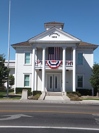
Churchill County is a county in the western U.S. state of Nevada. As of the 2020 census, the population was 25,516. Its county seat is Fallon. Named for Mexican–American War hero brevet Brigadier General Sylvester Churchill, the county was formed in 1861. Churchill County comprises the Fallon, NV Micropolitan Statistical Area. It is in northwestern Nevada. Churchill County is noteworthy in that it owns and operates the local telephone carrier, Churchill County Communications.

Lyon County is a county in the U.S. state of Nevada. As of the 2020 census, the population was 59,235. Lyon County comprises the Fernley, NV Micropolitan Statistical Area which is part of the Reno-Carson City-Fernley, NV Combined Statistical Area.

Nevada is the only U.S. state where prostitution is legally permitted in some form. Prostitution is legal in 10 of Nevada's 17 counties, although only six allow it in every municipality. Six counties have at least one active brothel, which mainly operate in isolated, rural areas. The state's most populated counties, Clark and Washoe, are among those that do not permit prostitution. It is also illegal in Nevada's capital, Carson City, an independent city.

Interstate 580 (I-580) is a 35.019-mile (56.358 km) auxiliary Interstate Highway in Western Nevada. It runs concurrently with US Route 395 (US 395) from an intersection with US 50 near the southern boundary of Carson City to the Reno Spaghetti Bowl interchange with I-80 in Reno. The freeway provides a high-speed direct route between Lake Tahoe and Carson City to Reno and I-80.

Steamboat Springs is a small volcanic field of rhyolitic lava domes and flows in western Nevada, located south of Reno. There is extensive geothermal activity in the area, including numerous hot springs, steam vents, and fumaroles. The residential portions of this area, located mostly east of Steamboat Creek and south of modern-day SR 341, are now known simply as Steamboat.

Mound House is a small unincorporated community in Lyon County, Nevada on U.S. Route 50 that is situated between Nevada's capital, Carson City, and Dayton. Its elevation is 4,974 feet (1,516 m). It is in Lyon County, one of eight Nevada counties that allow for legalized prostitution, and is home to four brothels.

U.S. Route 50 (US 50) is a transcontinental highway in the United States, stretching from West Sacramento, California, in the west to Ocean City, Maryland, on the east coast. The Nevada portion crosses the center of the state and was named "The Loneliest Road in America" by Life magazine in July 1986. The name was intended as a pejorative, but Nevada officials seized it as a marketing slogan. The name originates from large desolate areas traversed by the route, with few or no signs of civilization. The highway crosses several large desert valleys separated by numerous mountain ranges towering over the valley floors, in what is known as the Basin and Range province of the Great Basin.

Dixie Valley, Nevada, was a small ranching town in Churchill County, Nevada until the area was acquired in 1995 by the US Navy for the Fallon Range Training Complex (FRTC).
Marietta, Nevada, was a town in Mineral County, Nevada. It is now a ghost town.
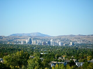
Western Nevada (WNV) is a region and the northwestern portion of the U.S. state of Nevada that includes Reno, Carson City, Carson Valley and Virginia City. Lyon County and Churchill County are sometimes also referred to as part of Western Nevada.

Solar power in Nevada is growing due to a Renewable Portfolio Standard which requires 50% renewable energy by 2030. The state has abundant open land areas and some of the best solar potential in the country.
Roach is a ghost town and railroad siding in Clark County, Nevada, United States. It is located along the Union Pacific Railroad, between Jean, Nevada and Nipton, California.
Hazen is an unincorporated community in Churchill County, Nevada, United States. The community is approximately 12 miles (19 km) southeast of Fernley and 16 miles (26 km) northwest of Fallon, on U.S. Route 50 Alternate.
Rhodes, Nevada is a former rail station and Post Office on the Carson and Colorado Railway in Mineral County, Nevada.
Eagleville is a former populated place in Mineral County, Nevada that is now a ghost town.
The Soda Lake Geothermal Field is located on the northeast flank of the Soda Lakes volcano, west of the city of Fallon, Nevada in Churchill County.
In 1954, the state of Nevada was struck by a series of earthquakes that began with three magnitude 6.0+ events in July and August that preceded the Mw 7.1–7.3 mainshock and M 6.9 aftershock, both on December 12. All five earthquakes are among the largest in the state, and the largest since the Cedar Mountain earthquake of 1932 and Pleasant Valley event in 1915. The earthquake was felt throughout much of the western United States.
Joseph Conforte was an American legal brothel owner from Sparks, Nevada, professional boxing promoter, restaurateur, and philanthropist. Born in Italy, Conforte was the owner of the Mustang Ranch and a prominent advocate for legal prostitution, becoming a fixture in Sparks, Nevada. He was married to Sally Conforte.
Jessica Elzora Burgess, better known as Sally Conforte, was the first legal brothel owner and the second female boxing manager in U.S. history. She is known as the matriarch of legal prostitution. She is infamous for her role in the murder of boxer Oscar Bonavena from Argentina and for swindling the IRS. She was married to Mustang Ranch owner Joe Conforte.


