Coppereid

Last updated

Coppereid, Nevada
White Cloud City Nevada 1910.jpg
Detail from 1910 USGS map of White Cloud Canyon and Coppereid
USA Nevada location map.svg
Red pog.svg
Coppereid
Usa edcp location map.svg
Red pog.svg
Coppereid
Coordinates: 39°50′56″N119°13′08″W / 39.84889°N 119.21889°W / 39.84889; -119.21889 [1]
CountryUnited States
StateNevada
County Churchill
Elevation
[1]
4,147 ft (1,264 m)

Coppereid, also known as White Cloud City is a ghost town in Churchill County, Nevada. It had a total population of 40 people. The site of Coppereid is south of Lovelock, east of the Carson Sink in the Stillwater Range. [2]

Contents

Geography

Coppereid is approximately 2,000 feet north and 2,400 feet west of the southeast corner of Nevada. [3]

Soil

Coppereid has very soft, shallow, and well drained soils. They are found on mountain slopes. They are mostly dry throughout the year, except for Winter, where they become moist. [3]

History

From 1893 to 1896, a small copper smelter was in operation. [4]

Coppereid was named after John T. Reid. Coppereid had a post office from April 1907 to June 1914. [2]

On December 2, 1909, Fallon became the supply for the site due to the fact that it was closer than Lovelock. [5]

Related Research Articles

<span class="mw-page-title-main">Fallon, Nevada</span> City in Nevada, United States

Fallon is a city in Churchill County in the U.S. state of Nevada. The population was 9,327 at time of the 2020 census. Fallon is the county seat of Churchill County and is located in the Lahontan Valley.

<span class="mw-page-title-main">Lovelock, Nevada</span> Incorporated city in Nevada, United States

Lovelock is the county seat of Pershing County, Nevada, United States, in which it is the only incorporated city. It is the namesake of a nearby medium-security men's prison and a Cold War-era gunnery range. Formerly a stop for settlers on their way to California and later a train depot, the town's economy remains based on farming, mining and increasingly on tourism.

<span class="mw-page-title-main">Ely, Nevada</span> City in Nevada, United States

Ely is the largest city and county seat of White Pine County, Nevada, United States. Ely was founded as a stagecoach station along the Pony Express and Central Overland Route. In 1906 copper was discovered. Ely's mining boom came later than the other towns along US 50. The railroads connecting the transcontinental railroad to the mines in Austin, Nevada and Eureka, Nevada have long been removed, but the railroad to Ely is preserved as a heritage railway by the Nevada Northern Railway and known as the Ghost Train of Old Ely. As of the 2020 census, the population was 3,924.

<span class="mw-page-title-main">Bodie, California</span> Ghost town in Mono County

Bodie is a ghost town in the Bodie Hills east of the Sierra Nevada mountain range in Mono County, California, United States. It is about 75 miles (121 km) southeast of Lake Tahoe, and 12 mi (19 km) east-southeast of Bridgeport, at an elevation of 8,379 feet (2554 m). Bodie became a boom town in 1876 after the discovery of a profitable line of gold; by 1879 it had a population of 7,000–10,000.

<span class="mw-page-title-main">Spirit Cave mummy</span> Human mummy found in Nevada

The Spirit Cave mummy is the oldest human mummy found in North America. It was discovered in 1940 in Spirit Cave, 13 miles (21 km) east of Fallon, Nevada, United States, by the husband-and-wife archaeological team of Sydney and Georgia Wheeler. He was said to be forty years old when he died. Analysis of the remains showed similarities to North and South American indigenous peoples and in 2016, the remains were repatriated to the Fallon Paiute-Shoshone Tribe of Nevada. The Spirit Cave mummy was one of the first to be dated using accelerated mass spectrometer radiocarbon dating. In turn, its discovery and analysis gave much insight and motivation of further research into the chronology of the western great basin.

<span class="mw-page-title-main">U.S. Route 50 in Nevada</span> Section of U.S. Highway in Nevada, United States

U.S. Route 50 (US 50) is a transcontinental highway in the United States, stretching from West Sacramento, California, in the west to Ocean City, Maryland, on the east coast. The Nevada portion crosses the center of the state and was named "The Loneliest Road in America" by Life magazine in July 1986. The name was intended as a pejorative, but Nevada officials seized it as a marketing slogan. The name originates from large desolate areas traversed by the route, with few or no signs of civilization. The highway crosses several large desert valleys separated by numerous mountain ranges towering over the valley floors, in what is known as the Basin and Range province of the Great Basin.

<span class="mw-page-title-main">Metropolis, Nevada</span> Ghost town in Nevada, United States

Metropolis, Nevada is a ghost town in Elko County, Nevada, 12 mi (19 km) northwest of Wells.

<span class="mw-page-title-main">History of Nevada</span> Aspect of history

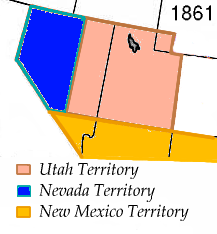
The History of Nevada as a state began when it became the 36th state on October 31, 1864, after telegraphing the Constitution of Nevada to the Congress days before the November 8 presidential election. Statehood was rushed to help ensure three electoral votes for Abraham Lincoln's reelection and add to the Republican congressional majorities.

Vernon was a small mining town, now a ghost town, located in Pershing County, Nevada northwest of Lovelock.

<span class="mw-page-title-main">Wonder, Nevada</span> Ghost Town in Nevada, United States

Wonder, Nevada, is a ghost town in Churchill County, Nevada, approximately 39 miles (63 km) east of Fallon.

<span class="mw-page-title-main">Lahontan Valley</span> Basin in Nevada, United States

The Lahontan Valley is a basin in Churchill County, Nevada, United States. The valley is a landform of the central portion of the prehistoric Lake Lahontan's lakebed of 20,000-9,000 years ago. The valley and the adjacent Carson Sink represent a small portion of the lake bed. Humboldt Lake is to the valley's northeast. Pyramid Lake is west. Walker Lake is to the south. The valley is part of the larger Great Basin Desert, however during the California Gold Rush the valley was often called the Forty Mile Desert.

The Seven Troughs Range is a mountain range in western Pershing County, Nevada.

Alpha was a gold mining town in Nevada County, located about 2 miles southeast of the town of Washington, California and about 15 miles northeast of Nevada City, California. It lay at an elevation of 4120 feet, about 2 miles below the South Yuba River and just west of Scotchman Creek.

<span class="mw-page-title-main">White Hills, Arizona</span> Census-designated places in Mohave County, Arizona

White Hills is an unincorporated community and census-designated place (CDP) in Mohave County, Arizona, United States. It is 12.5 miles (20.1 km) northwest of Dolan Springs. As of the 2020 census, White Hills had a population of 345.

Telluride is a ghost town in Lander County, state of Nevada in the United States.

Eagleville is a former populated place in Mineral County, Nevada that is now a ghost town.

<span class="mw-page-title-main">Jessup, Nevada</span> Ghost town in Nevada, United States

Jessup, also briefly known as White Canyon, is a ghost town in Churchill County, Nevada and was founded in 1908 after gold and silver mine claims were located. At its peak, it supported a population of around 300, with grocery stores and a post office, among other things. There are at least eight formerly active mines in the area. It is located a few miles north of Interstate 80 between Fernley and Lovelock. Southern Pacific provided prospectors access to the town by stopping in nearby White Plains. All that remains today is a few dilapidated wood buildings and abandoned mines.

Oreana is a ghost town in Pershing County, Nevada, United States.

References

  1. 1 2 U.S. Geological Survey Geographic Names Information System: Coppereid (historical)
  2. 1 2 Carlson, Helen S. (1985). Nevada Place Names: A Geographical Dictionary. Reno: University of Nevada Press. p. 86. ISBN   087417094X . Retrieved May 15, 2020.
  3. 1 2 "Coppereid Series". Natural Resources Conservation Service Nevada . United States Department of Agriculture. May 5, 2016. Retrieved July 11, 2020.
  4. Tingley, Joseph V. (1990). Prepared for the Bureau of Land Management. "White Cloud District" (PDF). Mineral Resource Inventory. 90–1: 238 via American Pacific Mining Corporation.
  5. "Fallon Supply Point for the Mines of Coppereid". Nevada Mining News. December 3, 2009. Retrieved July 11, 2020 via Newspapers.com.