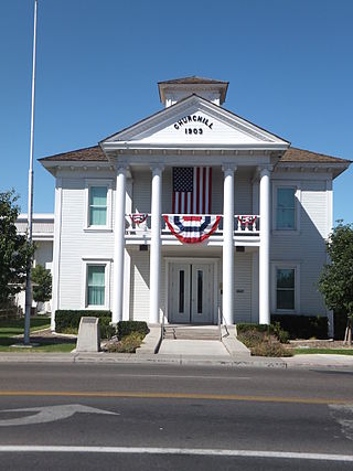
Churchill County is a county in the western U.S. state of Nevada. As of the 2020 census, the population was 25,516. Its county seat is Fallon. Named for Mexican–American War hero brevet Brigadier General Sylvester Churchill, the county was formed in 1861. Churchill County comprises the Fallon, NV Micropolitan Statistical Area. It is in northwestern Nevada. Churchill County is noteworthy in that it owns and operates the local telephone carrier, Churchill County Communications.
Ragtown, Nevada, is a Churchill County ghost town of an abandoned 1854 trading post west of Fallon.

Belmont is a ghost town in Nye County, Nevada, United States along former State Route 82. The town is a historic district listed in the National Register of Historic Places. It is Nevada Historical Marker number 138.
The Eagle Salt Works Railroad was a 13.5 mile shortline railroad that ran northeast from a connection with the Southern Pacific Company at Luva to Leete, Nevada. The line then branched from the old Central Pacific grade and went southeast for about 2 miles to the Eagle Salt Works.

Strawberry is a ghost town in White Pine County in the U.S. state of Nevada along Nevada State Route 892. The town was known for its 12,000-tree orchard and huge fields of strawberries. Strawberry is mainly used today as a ranching settlement. The post office was in operation from 1899 until 1938.
Schellbourne, formerly known as Fort Schellbourne and Schell Creek Station is a ghost town located in the Schell Creek Range in White Pine County in Nevada, United States, located 43 miles (69 km) north of Ely. The town was a stopover along the Central Overland Route, Pony Express and original routing of the Lincoln Highway. It is today Nevada Historical Marker number 51. The site was listed on the National Register of Historic Places in 1972. Its boundaries were increased in 1977.

Fairview is a ghost town in Churchill County, Nevada, in the United States of America.
Lander is a ghost town in Lander County in Nevada in the United States. The site is approximately 24 miles southeast of Battle Mountain.
Thorne, Nevada is a rail junction and former town located in Mineral County, Nevada.
Rand is an extinct town in Mineral County, in the U.S. state of Nevada. The GNIS classifies Rand as a populated place with a "RR Locale" description. Rand was a station on the Carson and Colorado Railway.
Allred is a ghost town situated in Nye County, Nevada. A post office in the settlement opened on April 17, 1911 with Allen Oxborrow and George Kump as postmasters. The post office was closed more than a year later on October 31, 1912. There are no visible remains left of Allred.
Norton Furnace is a ghost town in Bristol County, Massachusetts, United States. The settlement was located approximately 2 mi (3.2 km) south of Norton.
Eagleville is a former populated place in Mineral County, Nevada that is now a ghost town.
Bernice is a ghost town in Churchill County, in the U.S. state of Nevada. It was approximately 20 miles (32 km) northeast of Dixie Valley.
Boyer is a ghost town in northeastern Churchill County, in the U.S. state of Nevada.
White Plains is a ghost town in Churchill County, in the U.S. state of Nevada.
White Rock is an extinct town in Elko County, in the U.S. state of Nevada.
National is an extinct town in Humboldt County, in the U.S. state of Nevada.
Hilltop is an extinct town in Lander County in the U.S. state of Nevada. The Geographic Names Information System classifies it as a populated place. It was named for its lofty elevation.

Mineral Hill is a ghost town in Eureka County, Nevada, US.


