San Carlos is a census-designated place (CDP) in Gila County, Arizona, United States. The population was 4,038 at the 2010 census, up from 3,716 at the 2000 census.

San Carlos is the 10th canton in the province of Alajuela in Costa Rica. The canton covers an area of 3,347.98 square kilometres (1,292.66 sq mi), making it the largest canton in the country. It has a population of 178,460. ranking it fifth.
Boulder Creek Provincial Park is a provincial park in British Columbia, Canada, located to the west of BC Highway 16 near Smithers, in the Bulkley Valley.

Jesmond Dene, an unincorporated community neighboring Escondido in San Diego County, California, lies just east of Interstate 15 north of Escondido and has a zip code of 92026. The community is inside area code 760.
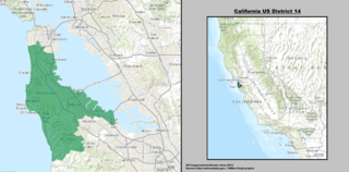
California's 14th congressional district is a congressional district in the U.S. state of California.

York Landing, Manitoba is a community in Manitoba, Canada. It is located along the eastern bank of the Nelson River, roughly halfway between Lake Winnipeg and Hudson Bay, and it is located 116 kilometres from Thompson, Manitoba.
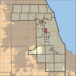
Oak Park Township is one of 29 townships in Cook County, Illinois and its boundaries are coterminous with the village of Oak Park. As of the 2010 census, its population was 51,878.

La Roca de la Sierra is a municipality in the province of Badajoz, Extremadura, Spain. It has a population of 1,579 and an area of 108.58 km². It is the location of the Monastery of San Isidro de Loriana, a Bien de Interes Cultural in a state of ruin.

Los Chiles is the 14th canton in the province of Alajuela in Costa Rica. The canton covers an area of 1,358.86 square kilometres (524.66 sq mi), and has a population of 28,694. The capital city of the canton is also called Los Chiles.

Peaceful Pines is an unincorporated community in Alpine County, California. It lies at an elevation of 6207 feet.
Avocado is an unincorporated community in Fresno County, California.
The Utu Utu Gwaitu Paiute Tribe of the Benton Paiute Reservation, also known as the Benton Paiute Tribe, is a federally recognized Great Basin tribe in Mono County, California.

Mountain View is a community in the southeastern section of the city of San Diego. It is bordered by Mount Hope and Greenwood Memorial Park on the north, Interstate 15 and the neighborhoods of Stockton and Logan Heights on the west, Interstate 805 and Lincoln Park on the east, and Southcrest and National City on the south. Major thoroughfares include Imperial Avenue and Ocean View Boulevard.

The Hayward Area Recreation and Park District (H.A.R.D.) is the park management agency for most of the parks in the city of Hayward, California and environs. It was created in 1944 and is an independent special district under California law. H.A.R.D. is the largest recreation district in California. It manages parks in the bordering city of San Leandro, and the unincorporated regions of Castro Valley and San Lorenzo. It manages the park grounds for numerous schools in the region. Events and classes are scheduled and listed in a quarterly brochure. The parks 2010-2011 budget was $24,383,637.

Chiapas Fútbol Club, commonly known as Jaguares de Chiapas, was a football club based in Tuxtla Gutiérrez, Mexico, that played in the Mexican football league system Mexican Liga MX. The team played their home matches at the Estadio Víctor Manuel Reyna.
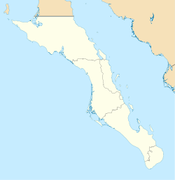
Cabo San Lázaro is a cape in the municipality of Comondú, in the Mexican state of Baja California Sur.
Ronald Raymond James is an American politician and businessman. James, who was elected Mayor of San Jose, California in 1967, served as the city's first popularly elected mayor from 1967 until 1971. He retired from office in 1971 after one term and was succeeded by then-San Jose Vice Mayor Norm Mineta.
Clear Springs is an unincorporated community in southern Texas County, in the U.S. state of Missouri. The community is on Missouri Route Y one mile east of Missouri Route 137. The spring is on the South Prong Jacks Fork 1.5 miles south of the community site.