San Alfonso Airport was a rural airstrip 14 kilometres (8.7 mi) west of Alhué, a town in the Santiago Metropolitan Region of Chile.
Alto Palena Airport is an airport serving Palena, a small town in the mountains of the Los Lagos Region of Chile. Palena is 5 kilometres (3.1 mi) from the Argentina border. The airport is just north of the town, and south of a bend in the Palena River.
Chaitén Airfield was an airport serving Chaitén, a town in the Los Lagos Region of Chile. The airport was damaged and closed after the 2008 eruption of Chaitén Volcano.
Chile Chico Airport Spanish: Aeródromo Chile Chico, is an airport serving Chile Chico, a lakeside town in the Aysén Region of Chile. Chile Chico is on the south shore of General Carrera Lake, 3 kilometres (1.9 mi) west of the Argentina border. The airport is 5 kilometres (3.1 mi) southeast of the town.

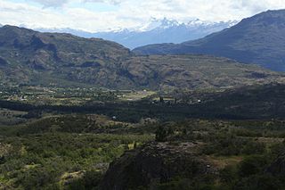
Cochrane Airport Spanish: Aeródromo Cochrane, is an airport serving Cochrane, a town in the Aysén Region of Chile. The airport is just northwest of the town, at the foot of Cerro Tamanguito (sv).
San Lorenzo Airport Spanish: Aeropuerto de San Lorenzo, is an airport 23 kilometres (14 mi) east of Quilleco, a small town in the Bío Bío Region of Chile. The airport is in the valley of the Duqueco River, near the hamlet of Duqueco. A penstock fed hydroelectric station is 1.6 kilometres (1 mi) east of the airport.
Futaleufú Airfield is an airport serving Futaleufú, a town in the Los Lagos Region of Chile.
San Rafael Airport Spanish: Aeródromo de San Rafael de Los Andes, is an airport serving Los Andes, a city in the Valparaíso Region of Chile. The airport is 5 kilometres (3.1 mi) west-northwest of the city.
San Andrés Airport is an airport 6 kilometres (3.7 mi) north of Retiro, a town in the Maule Region of Chile.
San Guillermo Airport, is an airport 8 kilometres (5.0 mi) northwest of Retiro, a town in the Maule Region of Chile.
San Miguel Airport is an airport 9 kilometres (5.6 mi) east of Romeral, a town in the Maule Region of Chile.
Santa Marta Airport is an airstrip 10 kilometres (6 mi) southeast of San Carlos, a town in the Bío Bío Region of Chile.
San Nicolás Santa Eugenia Airport is an airport 8 kilometres (5.0 mi) north of San Nicolás, a town in the Bío Bío Region of Chile.
Quilpe Airport is an airstrip serving San Pablo, a town and commune in the Los Lagos Region of Chile.
Verfrut Airport is an airstrip 14 kilometres (9 mi) south-southeast of San Pedro, a town in the Santiago Metropolitan Region of Chile. The airport is also 6 kilometres (3.7 mi) south of the Estación Terrena Longovilo (es), a large satellite communications facility.

San Pedro de Atacama Airport is a high elevation airport serving San Pedro de Atacama, a town in the Antofagasta Region of Chile. The airport is 3 kilometres (1.9 mi) east of the town.
San Sebastián Airport is an airport in the north of Tierra del Fuego in the Magallanes y Antártica Chilena Region of Chile. It is 3 kilometres (1.9 mi) west of the border with Argentina, and serves the San Sebastián border crossing station.
Panguilemo Airport is an airport 5 kilometres (3.1 mi) northeast of Talca, capital of the Maule Region of Chile.
Las Breas Airport is an airport 20 kilometres (12 mi) south-southeast of Taltal, a Pacific coastal town in the Antofagasta Region of Chile.
Barriles Airport Spanish: Aeropuerto Barriles is an airport 15 kilometres (9.3 mi) east-southeast of Tocopilla, a Pacific coastal town in the Antofagasta Region of Chile.


