Lacock is a village and civil parish in the county of Wiltshire, England, about 3 miles (5 km) south of the town of Chippenham, and about 3.7 miles (6.0 km) outside the Cotswolds area. The village is owned almost in its entirety by the National Trust and attracts many visitors by virtue of its unspoiled appearance.

Melksham is a town and civil parish on the River Avon in Wiltshire, England, about 4.5 miles (7 km) northeast of Trowbridge and 6 miles (10 km) south of Chippenham. At the 2021 census, the parish had a population of 18,113.
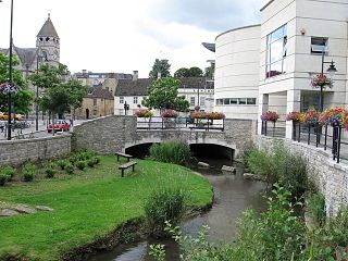
Calne is a town and civil parish in Wiltshire, southwestern England, at the northwestern extremity of the North Wessex Downs hill range, a designated Area of Outstanding Natural Beauty.

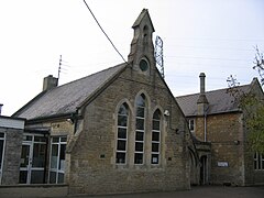
Broughton Gifford is a village and civil parish about 1.5 miles (2.4 km) west of Melksham in Wiltshire, England. The parish includes the hamlets of Norrington Common and The Common.

Corsham is a historic market town and civil parish in west Wiltshire, England. It is at the southwestern edge of the Cotswolds, just off the A4 national route. It is 28 miles (45 km) southwest of Swindon, 20 miles (32 km) east of Bristol, 8 miles (13 km) north-east of Bath, and 4 miles (6 km) southwest of Chippenham.

Melksham Without is a civil parish in the county of Wiltshire, England. It surrounds, but does not include, the town of Melksham and is the largest rural parish in Wiltshire, with a population of 7,230 and an area of 29 square kilometres. The parish includes the villages of Beanacre, Berryfield, Shaw and Whitley, and the hamlets of Outmarsh and Redstocks. It also includes the outer Melksham suburbs of Bowerhill and The Spa, and the dispersed settlement of Sandridge which includes Sandridge Common.

Bromham is a village and civil parish in Wiltshire, England. The village is 3+1⁄2 miles (6 km) northwest of Devizes and the same distance east of Melksham.

Box is a large village and civil parish within the Cotswolds Area of Outstanding Natural Beauty in Wiltshire, England, about 3 miles (5 km) west of Corsham and 5 miles (8 km) northeast of Bath. Box also falls in the easternmost part of the Avon Green Belt. Besides the village of Box, the parish includes the villages of Ashley and Box Hill; Hazelbury manor; and the hamlets of Alcombe, Blue Vein, Chapel Plaister, Ditteridge, Henley, Kingsdown, Middlehill, and Wadswick. To the east the parish includes much of Rudloe, formerly a hamlet but now a housing estate, and the defence establishments and related businesses on the site of the former RAF Rudloe Manor.

Rowde is a village and civil parish in the English county of Wiltshire, on the A342 about 1.7 miles (2.7 km) northwest of Devizes. The parish includes the hamlet of Tanis.

Chippenham railway station is on the Great Western Main Line (GWML) in South West England, serving the town of Chippenham, Wiltshire. It is 93 miles 76 chains down the line from the zero point at London Paddington and is situated between Swindon and Bath Spa on the GWML. The Wessex Main Line diverges from the GWML to the southwest of Chippenham and runs to Trowbridge via Melksham.

Sandy Lane is a small village in Wiltshire, England, about 4.5 miles (7 km) south-east of Chippenham and 3 miles (5 km) south-west of Calne. It lies on the A342 Chippenham-Devizes road, just north of its junction with the A3102 to Calne.
Semington is a village and civil parish in Wiltshire, England. The village is about 2 miles (3 km) south of Melksham and about 3 miles (5 km) northeast of Trowbridge. The parish includes the hamlets of Little Marsh and Littleton.

Bowerhill is a village near Melksham, Wiltshire, England, in the civil parish of Melksham Without. Central Bowerhill is approximately 1.75 miles (2.8 km) south of Melksham town centre.

Beanacre is a small village in Wiltshire, England, about 1.5 miles (2.4 km) north of Melksham on the A350 towards Chippenham. It is in the civil parish of Melksham Without. The Bristol Avon passes to the east of the village where a stream from Sandridge joins it.

Berryfield is a small village to the south of the town of Melksham, in Wiltshire, England. The village is separated from the southwestern outskirts of Melksham by the A350 road and about 500 metres of farmland; it falls within the civil parish of Melksham Without. The Bristol Avon is about 0.6 miles (1 km) west of the village. Although close to Melksham town, Berryfield remains a separate community.

Seend Cleeve is a large hamlet or sub-village immediately west of Seend in Wiltshire, England. It lies about 2.3 miles (3.7 km) southeast of the town of Melksham.

Seend is a village and civil parish about 3 miles (5 km) southeast of the market town of Melksham, Wiltshire, England. It lies about 3.5 miles (6 km) west of Devizes and 5.5 miles (9 km) northeast of the county town of Trowbridge. The parish includes the sub-village of Seend Cleeve and the hamlets of Inmarsh, Martinslade, Seend Head, Sells Green and The Stocks.
Shaw is a village in the civil parish of Melksham Without, Wiltshire, England. It is about 1.7 miles (2.7 km) northwest of Melksham on the A365 Melksham to Box road, where the B3353 diverges to Corsham.

Whitley is a village in the civil parish of Melksham Without, Wiltshire, England, which had a population of 1,914 at the 2011 census. The village lies about 2 miles (3.2 km) northwest of Melksham on the B3353 Shaw to Corsham road. The hamlet of West Hill is to the west, on the road to Atworth.

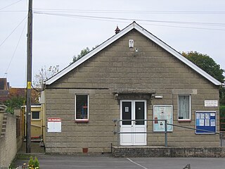
Heywood is a civil parish and small village in the county of Wiltshire in southwestern England. The village is approximately 1.5 miles (2.4 km) north of Westbury and 3.5 miles (5.6 km) south of the county town of Trowbridge.