Sankt Margarethen, Germany

Last updated
Sankt Margarethen
DEU St. Margarethen (Holstein) COA.svg
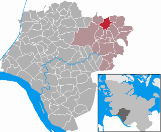
Location of Sankt Margarethen within Steinburg district
Sankt Margarethen in IZ.png
Germany adm location map.svg
Red pog.svg
Sankt Margarethen
Germany Schleswig-Holstein adm location map.svg
Red pog.svg
Sankt Margarethen
Coordinates: 53°53′26″N9°15′24″E / 53.89056°N 9.25667°E / 53.89056; 9.25667
Country Germany
State Schleswig-Holstein
District Steinburg
Municipal assoc. Wilstermarsch
Government
   Mayor Volker Bolten
Area
  Total13.24 km2 (5.11 sq mi)
Elevation
3 m (10 ft)
Population
 (2022-12-31) [1]
  Total824
  Density62/km2 (160/sq mi)
Time zone UTC+01:00 (CET)
  Summer (DST) UTC+02:00 (CEST)
Postal codes
25572
Dialling codes 04858
Vehicle registration IZ
Website www.wilstermarsch.de

Sankt Margarethen (English: Saint Margaret) is a municipality in the district of Steinburg, in Schleswig-Holstein, Germany. It is part of the Amt Wilstermarsch in the Hamburg Metropolitan Region.

Contents

Geography

Location

Sankt Margarethen is situated on the lower course of the Elbe River, eight kilometers east of Brunsbüttel and the mouth of the Kiel Canal. The municipality is crossed by Bundesstraße 431 and the German Ferry Route.

Administrative divisions

The municipality of Sankt Margarethen is divided into the following districts:

Heideducht
Kirchducht
Osterbünge
Stuven

History

Sankt Margarethen was first mentioned in a document in 1344 as "Elredeluete". The village was previously known as "Elredefleth", but due to the threat posed by the Elbe river, it was demolished and relocated to its current location. The new village was inaugurated on the day of Margaret the Virgin in July 1500.

Politics

Municipal council

In the municipal elections on May 14, 2023, a total of eleven seats were allocated. Once again, all seats were won by the Independent Voters' Association St. Margarethen (Unabhängige Wählergemeinschaft St. Margarethen). The voter turnout was 54.9%.

Mayor

The Mayor of Sankt Margarethen is Volker Bolten. His deputies are Hauke Carstens and Inken Rotzoll (all three from UWStM).

Coat of arms

The design of the coat of arms of Sankt Margarethen was created by the heraldic designer Lothar Leissner from Itzehoe, who designed all the coats of arms in Schleswig-Holstein. The coat of arms was approved on March 9, 1993.

Blazon: "Divided by waves, silver and blue. Above, the red-clad Saint Margaret, wearing a golden martyr's crown, holding a lowered golden sword in her right hand and a golden book in her left, accompanied on each side by two six-pointed blue stars stacked on top of each other. Below, a silver dragon lying on its back with a red tongue, covered by the tip of the sword."

Explanation of the coat of arms: The saint in the coat of arms of the municipality of St. Margarethen refers both to the origin of the name of the place and its past. The martyr Margaret was thrown into a Roman dungeon and tortured for her Christian faith. She resisted attempts to convert her to paganism; this struggle is symbolized in the coat of arms by the dragon. The resistance of the inhabitants against the destructive forces of water is comparable to Margaret's fight against the dragon of temptation. The four stars in the coat of arms represent the community parts of Heideducht, Kirchducht, Osterbünge, and Stuven. At the same time, the number four signifies the close relationships between St. Margarethen and the neighboring communities of Büttel, Kudensee, and Landscheide. The lower blue half of the shield symbolizes the water of the Elbe. Furthermore, the dominant colors in the coat of arms, blue, silver, and red, are the colors of Schleswig-Holstein.

Notable people

Sons and daughters of the municipality

People associated with the municipality

Related Research Articles

<span class="mw-page-title-main">Dithmarschen</span> District in Schleswig-Holstein, Germany

Dithmarschen is a district in Schleswig-Holstein, Germany. It is bounded by the districts of Nordfriesland, Schleswig-Flensburg, Rendsburg-Eckernförde, and Steinburg, by the state of Lower Saxony, and by the North Sea. From the 13th century up to 1559 Dithmarschen was an independent peasant republic within the Holy Roman Empire and a member of the Hanseatic League.

<span class="mw-page-title-main">Steinburg</span> District in Schleswig-Holstein, Germany

Steinburg is a district in Schleswig-Holstein, Germany, administered from Itzehoe. It is bounded by the districts of Dithmarschen, Rendsburg-Eckernförde, Segeberg and Pinneberg, and by the Elbe River.
<span class="mw-page-title-main">Pinneberg (district)</span> District in Schleswig-Holstein, Germany

Pinneberg is a district in Schleswig-Holstein, Germany. It is bounded by the districts of Steinburg and Segeberg, the city of Hamburg and the state of Lower Saxony. The island of Heligoland is also part of the district.

Duchy of Lauenburg is the southernmost Kreis, or district, officially called District of Duchy of Lauenburg, of Schleswig-Holstein, Germany. It is bordered by the district of Stormarn, the city of Lübeck, the state of Mecklenburg-Vorpommern, the state of Lower Saxony, and the city state of Hamburg. The district of Herzogtum Lauenburg is named after the former Duchy of Saxe-Lauenburg.

<span class="mw-page-title-main">Amt Neuhaus</span> Municipality in Lower Saxony, Germany

Amt Neuhaus is a municipality in the District of Lüneburg, in Lower Saxony, Germany. Amt means "municipal office" in German. The original "municipal office of Neuhaus" existed since at least the 17th century until 1885, consecutively as part of Saxe-Lauenburg, Electorate of Hanover (1689-1810), Kingdom of Hanover (1814-1866), and the Prussian Province of Hanover (1866-1885).

<span class="mw-page-title-main">Ellerbek</span> Municipality in Schleswig-Holstein, Germany

Ellerbek is a municipality in the district of Pinneberg in Schleswig-Holstein in Germany. It consists of the two parts, Ellerbek-Dorf and Neu-Ellerbek.

<span class="mw-page-title-main">Schwarzenbek</span> Town in Schleswig-Holstein, Germany

Schwarzenbek is a town in the district of Lauenburg, in Schleswig-Holstein, Germany. It is situated approximately 10 km northeast of Geesthacht, and 35 km east of Hamburg. Schwarzenbeks' coat of arms shows a black wolf on a yellow field, beneath the wolf, the water symbolizes the river Schwarze Beke.
<span class="mw-page-title-main">Bosau</span> Municipality in Schleswig-Holstein, Germany

Bosau is a municipality on the Great Plön Lake the district of Ostholstein, in Schleswig-Holstein, Germany. It is situated approximately 13 km west of Eutin, and 30 km southeast of the state capital of Kiel.

<span class="mw-page-title-main">Gelting</span> Municipality in Schleswig-Holstein, Germany

Gelting is a municipality in the district of Schleswig-Flensburg, in Schleswig-Holstein, Germany. It is situated near the Baltic Sea, approx. 33 km northeast of Schleswig, and 30 km east of Flensburg.

<span class="mw-page-title-main">Jerichow</span> Town in Saxony-Anhalt, Germany

Jerichow is a town on the east side of the river Elbe, in the District of Jerichower Land, of the state of Saxony-Anhalt in Germany. With about 270 square kilometres (100 sq mi), the municipality of Jerichow is one of the largest municipalities in area size in Germany.
<span class="mw-page-title-main">Marnerdeich</span> Municipality in Schleswig-Holstein, Germany

Marnerdeich is a municipality in the district of Dithmarschen, in Schleswig-Holstein, Germany.
<span class="mw-page-title-main">Osterby, Rendsburg-Eckernförde</span> Municipality in Schleswig-Holstein, Germany

Osterby is a municipality in the district of Rendsburg-Eckernförde, in Schleswig-Holstein, Germany. It is mostly rural.

<span class="mw-page-title-main">Krogaspe</span> Municipality in Schleswig-Holstein, Germany

Krogaspe is a municipality in the district of Rendsburg-Eckernförde, in Schleswig-Holstein, Germany. Krogaspe is located north west of Neumünster close to Autobahn A7 and county highway 205 to Rendsburg.

<span class="mw-page-title-main">Westerrönfeld</span> Municipality in Schleswig-Holstein, Germany

Westerrönfeld is a municipality in the district of Rendsburg-Eckernförde, in Schleswig-Holstein, Germany. The name literally means "The field west of the Rön", the Rön being a little tributary of the river Eider. Westerrönfeld is located on the southern bank of the Kiel Canal.
<span class="mw-page-title-main">Hennstedt, Steinburg</span> Municipality in Schleswig-Holstein, Germany

Hennstedt is a municipality in the district of Steinburg, in Schleswig-Holstein, Germany.

<span class="mw-page-title-main">Aasbüttel</span> Municipality in Schleswig-Holstein, Germany

Aasbüttel is a municipality in the district of Steinburg, in Schleswig-Holstein, Germany.

<span class="mw-page-title-main">Neuendorf-Sachsenbande</span> Municipality in Schleswig-Holstein, Germany

Neuendorf-Sachsenbande is a municipality in Wilstermarsch, in the district of Steinburg, in Schleswig-Holstein, Germany. The town is notable for containing the lowest accessible point in Germany, which is 3.54 m (11.61 ft) below sea level.

<span class="mw-page-title-main">Travenbrück</span> Municipality in Schleswig-Holstein, Germany

Travenbrück is a municipality in the district of Stormarn, in Schleswig-Holstein, Germany. The towns of Neverstaven, Nütschau, Schlamersdorf, Sühlen, Tralau and Vinzier are in the municipality.

<span class="mw-page-title-main">Eiderstedt (Amt)</span> Amt in Germany

Eiderstedt is an Amt in the district of Nordfriesland, in Schleswig-Holstein, Germany. The Amt covers the peninsula of Eiderstedt, excepted for the town of Tönning.

<span class="mw-page-title-main">Coat of arms of Lübeck</span>

The city of Lübeck has for a long time had a double coat of arms — one with the eagle as a symbol of the Imperial freedom enjoyed by the city from 1226 to 1937; one with Hanseatic colors of silver over red and the so-called Lübeck plate.

References

  1. "Bevölkerung der Gemeinden in Schleswig-Holstein 4. Quartal 2022" (XLS) (in German). Statistisches Amt für Hamburg und Schleswig-Holstein.