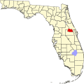
Sanlando Springs | |
---|---|
Coordinates: 28°41′01″N81°22′54″W / 28.68361°N 81.38167°W | |
Country | United States |
State | Florida |
County | Seminole |
Elevation | 56 ft (17 m) |
Time zone | UTC-5 (Eastern (EST)) |
• Summer (DST) | UTC-4 (EDT) |
Area code(s) | 407, 689 & 321 |
GNIS feature ID | 290643 [1] |
Sanlando Springs is a second magnitude freshwater spring [2] and an unincorporated community in Seminole County, Florida, United States, [1] just west of Longwood, Florida. Originally named Hoosier Springs by early settler Ingram Fletcher, the springs were later renamed for its location between the cities of Sanford and Orlando. From the 1930s through 1970, it was a privately owned and operated recreation area and park that was open to the general public for an entrance fee. [3]
In 1970, the property was sold for conversion into a private residential development to be known as The Springs. [4]
The spring itself is located behind the clubhouse of The Springs, a gated community. Although managed by the St. Johns River Water Management District, it is a private recreation and swimming area for residents of the community and respective guests and is no longer open to the general public.[ citation needed ]
The main swimming area formerly boasted a diving platform over the spring, approximately 6 ft (1.8 m) above the waters' surface until removed by the community board. There is also a floating man-made dock, approximately 40 ft (12.2 m) from the shoreline, to which guests may swim. The waters of the main spring eventually empty into the Wekiva River and from there into the St. Johns River. Sanlando Springs, along with nearby Rock Springs, Wekiwa Springs and Palm Springs, form the headwaters of the Wekiva River.[ citation needed ]
During times of heavy rain, such as the 2005 Atlantic Hurricane Season, the springs have been known to flood dramatically and certain areas of the spring during these times may be hazardous.
Near the main spring are several sulfur springs, which are generally unfit for swimming due to foul odor and possible presence of potentially dangerous wildlife, such as alligators.
Orange County is a county located in the central part of the U.S. state of Florida. As of the 2020 census, the county had a population of 1,429,908, making it the fifth-most populous county in Florida and the 28th-most populous county in the United States. Its county seat is Orlando, which, along with it being the county's largest city, is the core of the Orlando metropolitan area, which had a population of 2.67 million in 2020.
Seminole County is a county located in the central portion of the U.S. state of Florida. As of the 2020 census, the population was 470,856, making it the 13th-most populated county in Florida. Its county seat and largest city is Sanford. Seminole County is part of the Orlando-Kissimmee-Sanford, Florida Metropolitan Statistical Area.
Interstate 4 (I-4) is an Interstate Highway located entirely within the US state of Florida, maintained by the Florida Department of Transportation (FDOT). Spanning 132.30 miles (212.92 km) along a generally southwest–northeast axis, I-4 is entirely concurrent with State Road 400 (SR 400). In the west, I-4 begins at an interchange with I-275 in Tampa. I-4 intersects with several major expressways as it traverses Central Florida, including US Highway 41 (US 41) in Tampa; US 301 near Riverview; I-75 near Brandon; US 98 in Lakeland; US 27 in unincorporated Davenport; US 192 in Celebration; Florida's Turnpike in Orlando; and US 17 and US 92 in multiple junctions. In the east, I-4 ends at an interchange with I-95 in Daytona Beach, while SR 400 continues for roughly another four miles (6.4 km) and ends at an intersection with US 1 on the city line of Daytona Beach and South Daytona.
Apopka is a city in Orange County, Florida. The city's population was 54,873 at the 2020 census. It is part of the Orlando–Kissimmee–Sanford Metropolitan Statistical Area. Apopka comes from Seminole word Ahapopka for "potato-eating place".
Palatka is a city in and the county seat of Putnam County, Florida, United States. Palatka is the principal city of the Palatka Micropolitan Statistical Area, which is home to 72,893 residents. The Palatka micropolitan area is included in the Jacksonville—Kingsland–Palatka, FL-GA Combined Statistical Area.
Longwood is a city in Seminole County, Florida, United States. It is part of the Orlando–Kissimmee–Sanford, Florida Metropolitan Statistical Area. The population was 15,087 at the 2020 census.
Sanford is a city and the county seat of Seminole County, Florida. It is located in Central Florida and its population was 61,051 as of the 2020 census. It is part of the Orlando–Kissimmee–Sanford Metropolitan Statistical Area.
Wekiwa Springs is a census-designated place and an unincorporated area in Seminole County, Florida, United States. The population was 23,169 at the 2000 census. It is part of the Orlando–Kissimmee–Sanford, Florida Metropolitan Statistical Area.
The St. Johns River is the longest river in the U.S. state of Florida and is the most significant one for commercial and recreational use. At 310 miles (500 km) long, it flows north and winds through or borders 12 counties. The drop in elevation from headwaters to mouth is less than 30 feet (9 m); like most Florida waterways, the St. Johns has a very slow flow speed of 0.3 mph (0.13 m/s), and is often described as "lazy".
State Road 429 (SR 429), also known as the Daniel Webster Western Beltway or Western Expressway south of US 441, and the Wekiva Parkway north of US 441, is a controlled-access toll road built and maintained by the Central Florida Expressway Authority (CFX), the Florida's Turnpike Enterprise, and the Florida Department of Transportation (FDOT). Its mainline extends 51.77 miles (83.32 km) from I-4 (SR 400) in Four Corners north to I-4 in Sanford. Control cities are Apopka and Tampa although the control cities for traffic at the entrances at US 441 and north are Orlando, Tampa, and Daytona Beach. SR 429 was originally planned as a western half of SR 417.
Ponce de Leon Springs State Recreation Area is a Florida State Park in Holmes County, Florida, USA, located in the town of Ponce de Leon. The initial acquisition of the park on September 4, 1970, used funds from the Land Acquisition Trust Fund for the stated purpose of developing, operating, and maintaining the property. The plan was to develop the park for outdoor recreation, historic conservation, and to offer abundant opportunity for nature appreciation and wildlife viewing. Today, it grants park-goers the opportunities to swim in the spring and hike along the park's nature trails.
Rock Springs Run State Reserve is a 14,000-acre (5,700 ha) State Park in the U.S. state of Florida. The main entrance is located about 30 miles (48 km) north of Orlando in Sorrento, 3 miles (4.8 km) west of the Wekiva River bridge on State Road 46 and extends into Orange and Seminole Counties to the south. The park contains a number of Indian mounds, pine flatwoods, swamps and artesian springs, and a number of creeks and rivers. Among them are Seminole Creek, Wekiwa Springs Run, Rock Springs Run, and the Wekiva River.
Wekiwa Springs State Park is a 7,000-acre (28 km2) Florida State Park in Apopka, Florida. It is located 20 minutes north of Orlando, off Interstate 4 at exit 94, near Altamonte Springs and Longwood. The park also contains the head water of the Wekiva River. It also serves as the headquarters of one of the state's five AmeriCorps Florida State Parks chapters.
The Florida Trail is one of eleven National Scenic Trails in the United States, created by the National Trails System Act of 1968. It runs 1,500 miles (2,400 km), from Big Cypress National Preserve to Fort Pickens at Gulf Islands National Seashore, Pensacola Beach. Also known as the Florida National Scenic Trail, the trail provides permanent non-motorized recreation for hiking and other compatible activities within an hour's drive of most Floridians.
The Wekiva River is a 16.0-mile-long (25.7 km) river in Central Florida, north of Orlando in the United States. It originates in Apopka and joins the St. Johns River, the longest river in the state, in DeBary. The Wekiva River system includes the main stem joined by three main tributaries - Rock Springs Run, Blackwater Creek, and the Little Wekiva River - and about 30 contributing groundwater springs. It is designated as a Florida State Canoe Trail, an Outstanding Florida Water, and an Aquatic Preserve by the Florida Department of Environmental Protection. The Wekiva River system is also one of the two rivers in Florida federally designated as a National Wild and Scenic River for its scenery, recreation, geology, and diverse habitats.
Lake Jesup is the largest lake in Seminole County, Florida, United States and is one of many that make up the St. Johns River. Located along the middle basin of the St. Johns, the lake encompasses an area of approximately 16,000 acres (65 km2), including open water and floodplain. It is named in honor of Brigadier General Thomas Jesup, an American military officer who served in the Second Seminole War. The lake is bisected by one of the state's longest free-standing bridges, part of the Seminole County Expressway.
Indian Mound Village is an unincorporated community in Seminole County, Florida, United States, located on the St. Johns River.
The Little Wekiva River is a stream in the Greater Orlando area of Florida in the United States. The 15-mile (24 km) long, northward flowing stream is a tributary of the Wekiva River, which later joins the St. Johns River, the longest river in the state of Florida. The Little Wekiva drainage basin is about 42 square miles (110 km2) located in the urbanized area north and west of Downtown Orlando.
Gemini Springs Park is a 210-acre (85 ha) public nature park in DeBary, Florida, United States featuring two springs. The park, completed in 1996, is situated on bayou northwest of Lake Monroe.