
Starr County is located in the U.S. state of Texas. As of the 2020 census, its population was 65,920. Its county seat is Rio Grande City. The county was created in 1848. It is named for James Harper Starr, who served as secretary of the treasury of the Republic of Texas.

Real County is a county located on the Edwards Plateau in the U.S. state of Texas. As of the 2020 census, its population was 2,758. The county seat is Leakey. The county is named for Julius Real (1860–1944), a former member of the Texas State Senate. The Alto Frio Baptist Encampment is located in an isolated area of Real County southeast of Leakey.

Jim Hogg County is a county located in the U.S. state of Texas. As of the 2020 census, the population was 4,838. Its county seat is Hebbronville. The county is named for James Stephen Hogg, the governor of Texas from 1891 to 1895.

Hansford County is a county located in the U.S. state of Texas. As of the 2020 census, its population was 5,285. Its county seat is Spearman. The county was created in 1876 and organized in 1889. It is named for John M. Hansford, a Texas state congressman and judge.

Guadalupe County is a county located in the U.S. state of Texas. As of the 2020 census, its population was 172,706. The county seat is Seguin. The county was founded in 1846 and is named after Guadalupe River.

Coleman County is a county located in the U.S. state of Texas. As of the 2020 census, its population was 7,684. The county seat is Coleman. The county was founded in 1858 and organized in 1864. It is named for Robert M. Coleman, a signer of the Texas Declaration of Independence and soldier at the Battle of San Jacinto.

Catarina is a census-designated place (CDP) in Dimmit County, Texas, United States. The population was 118 at the 2010 census. The community has no U.S. Post Office.
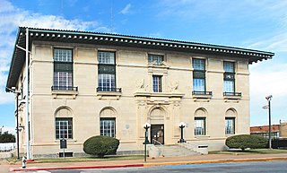
Sherman is a city in and the county seat of Grayson County, Texas, United States. The city's population in 2020 was 43,645. It is one of the two principal cities in the Sherman–Denison metropolitan statistical area, and is the largest city in the Texoma region of North Texas and southern Oklahoma.
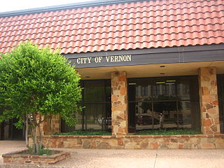
Vernon is a city and the county seat of Wilbarger County, Texas, United States. and as of the 2010 Census had a population of 11,002.
Santa Catarina may refer to:

The San Isidro Independent School District is a public school district based in the community of San Isidro, Texas, United States. In addition to San Isidro, the district also serves several other unincorporated communities in rural northeastern Starr County, including: Delmita, Santa Anna, El Centro, La Gloria, La Reforma, Santa Catarina, and Santa Elena.
Leverett's Chapel is an unincorporated community in northwestern Rusk County, Texas, United States. According to the Handbook of Texas, the community had a population of 450 in 2000. It is located within the Longview, Texas metropolitan area.
Delmita is a census-designated place in Starr County, Texas, United States. Its elevation is 272 feet (83 m). Although Delmita is unincorporated, it has a post office, with the ZIP code of 78536. This CDP was new for the 2010 census with a population of 216.

Central Texas is a region in the U.S. state of Texas roughly bordered on the West by San Saba to the Southeast by Bryan and the South by San Marcos to the North by Hillsboro. Central Texas overlaps with and includes part of the Texas Hill Country and corresponds to a physiographic section designation within the Edwards Plateau, in a geographic context.
Santa Elena is an unincorporated community in Starr County, Texas, United States. It is situated along FM 755 in northeastern Starr County, approximately six miles northwest of San Isidro. According to the Handbook of Texas, the community had an estimated population of 64 in 2000.
La Gloria is an unincorporated community in Starr County, Texas, United States. It is situated at the junction of Farm Roads 755 and 1017 in northeastern Starr County, approximately four miles northeast of San Isidro. This area is mainly made up of ranches that were given as Spanish and Mexican land grants in the 18th and 19th centuries, where some of those original land grant families still remain. According to the Handbook of Texas, the community had an estimated population of 102 in 2000.
La Reforma is an unincorporated community in Starr County, Texas, United States. It is situated along FM 1017 in northeastern Starr County. According to the Handbook of Texas, the community had an estimated population of 45 in 2000.

Cestohowa is an unincorporated community in Karnes County, Texas, United States. In 2000 it had a population of 110.

Travis County has had two locations named Montopolis. The first was during the Republic of Texas period north of the Colorado River. The second is today's Montopolis neighborhood in Austin, Texas south of the river. Located southeast of the city's urban core, today's neighborhood is in ZIP code 78741. Montopolis is bounded by Lake Lady Bird on the north, by Grove Street and the Pleasant Valley neighborhood on the west, to the south by Texas State Highway 71, and by U.S. Route 183 on the east. The southeast corner abuts Austin-Bergstrom International Airport. Montopolis is in City Council District 3.


