
Starr County is located in the U.S. state of Texas. As of the 2020 census, its population was 65,920. Its county seat is Rio Grande City. The county was created in 1848. It is named for James Harper Starr, who served as secretary of the treasury of the Republic of Texas.
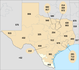
Area code 956 is a telephone area code in the North American Numbering Plan for the Lower and Middle Rio Grande Valley regions in the U.S. state of Texas. The numbering plan area includes the communities of Brownsville, McAllen, Laredo and South Padre Island. The area code was created May 25, 1997, in a split from area code 210.
Wadsworth is an unincorporated community in Matagorda County, Texas, United States. According to the Handbook of Texas, the community had an estimated population of 180 in 2000.

The San Isidro Independent School District is a public school district based in the community of San Isidro, Texas, United States. In addition to San Isidro, the district also serves several other unincorporated communities in rural northeastern Starr County, including: Delmita, Santa Anna, El Centro, La Gloria, La Reforma, Santa Catarina, and Santa Elena.
Water Valley is an unincorporated community in Tom Green County, Texas, United States. According to the Handbook of Texas, the community had an estimated population of 120 in 2000. The community is part of the San Angelo, Texas, metropolitan statistical area.
Rochelle is an unincorporated community in McCulloch County, Texas, United States. According to the Handbook of Texas, the community had an estimated population of 163 in 2000.
Tarpley is an unincorporated community in Bandera County, Texas, United States. According to the Handbook of Texas, the community had a population of 30 in 2000. It is part of the San Antonio Metropolitan Statistical Area.
Delmita is a census-designated place in Starr County, Texas, United States. Its elevation is 272 feet (83 m). Although Delmita is unincorporated, it has a post office, with the ZIP code of 78536. This CDP was new for the 2010 census with a population of 216.

Waring is an unincorporated community in northwestern Kendall County, Texas, United States. It lies along local roads and the Guadalupe River, northwest of the city of Boerne, the county seat of Kendall County. Its elevation is 1,345 feet (410 m). Although Waring is unincorporated, it has a post office, with the ZIP code of 78074; the ZCTA for ZIP Code 78074 had a population of 59 at the 2000 census. The community is part of the San Antonio Metropolitan Statistical Area.

Heidenheimer is an unincorporated community in Bell County, Texas, United States. According to the Handbook of Texas, the community had an estimated population of 144 in 2000. The community is part of the Killeen–Temple–Fort Hood Metropolitan Statistical Area.
Campbellton is an unincorporated community in Atascosa County, Texas, United States. According to the Handbook of Texas, the community had an estimated population of 350 in 2000. Campbellton is part of the San Antonio Metropolitan Statistical Area.
Doole is an unincorporated community in McCulloch County, Texas, United States. According to the Handbook of Texas, the community had an estimated population of 74 in 1990.
Harwood is a ghost town in Gonzales County, Texas, United States. According to the Handbook of Texas, the community had an estimated population of 112 in 2000.
La Gloria is an unincorporated community in Starr County, Texas, United States. It is situated at the junction of Farm Roads 755 and 1017 in northeastern Starr County, approximately four miles northeast of San Isidro. This area is mainly made up of ranches that were given as Spanish and Mexican land grants in the 18th and 19th centuries, where some of those original land grant families still remain. According to the Handbook of Texas, the community had an estimated population of 102 in 2000.
La Reforma is an unincorporated community in Starr County, Texas, United States. It is situated along FM 1017 in northeastern Starr County. According to the Handbook of Texas, the community had an estimated population of 45 in 2000.
Santa Catarina is an unincorporated community in Starr County, Texas, United States. It is situated along FM 755 in northeastern Starr County, approximately 20 miles northeast of Rio Grande City and six miles southwest of La Gloria. According to the Handbook of Texas, the community had an estimated population of 15 in 2000.
Placedo is a census-designated place (CDP) in Victoria County, Texas, United States. This was a new CDP for the 2010 census, with a population of 692.
Panola is an unincorporated community in Panola County, Texas, United States. According to the Handbook of Texas, the community had an estimated population of 296 in 2000.
Pandora is an unincorporated community in Wilson County, Texas, United States. According to the Handbook of Texas, the community had an estimated population of 125 in 2000. Pandora is part of the San Antonio Metropolitan Statistical Area.
Santa Anna is a census-designated place (CDP) in Starr County, Texas, United States. This was a new CDP for the 2010 census with a population of 13.


