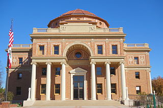
Atascadero is a city in San Luis Obispo County, California, United States, located on U.S. Route 101. Atascadero is part of the San Luis Obispo-Paso Robles metropolitan statistical area, which encompasses the extents of the county. Atascadero is farther inland than most other cities in the county, and as a result, usually experiences warmer, drier summers, and cooler winters than other nearby cities such as San Luis Obispo and Pismo Beach. The main freeway through town is U.S. 101. The nearby State Routes 41 and 46 provide access to the Pacific Coast and the Central Valley of California.

Seven Oaks Dam is a 550-foot (170 m) high earth and rock fill embankment dam across the Santa Ana River in the San Bernardino Mountains, about 4 miles (6.4 km) northeast of Redlands in San Bernardino County, southern California. It impounds Seven Oaks Reservoir in the San Bernardino National Forest.

The Salinas River is the longest river of the Central Coast region of California, running 175 miles (282 km) and draining 4,160 square miles (10,800 km2). It flows north-northwest and drains the Salinas Valley that slices through the central California Coast Ranges south of Monterey Bay. The river begins in southern San Luis Obispo County, originating in the Los Machos Hills of the Los Padres National Forest. From there, the river flows north into Monterey County, eventually making its way to connect with the Monterey Bay, part of the Pacific Ocean, approximately 5 miles (8.0 km) south of Moss Landing. The river is a wildlife corridor, and provides the principal source of water from its reservoirs and tributaries for the farms and vineyards of the valley.

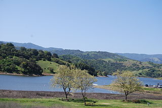
Lake Nacimiento is an 18-mile (29 km) long lake on the Nacimiento River in northern San Luis Obispo County, California. The lake contains many arms including Snake Creek and Dip Creek, nearer the dam, and the central Las Tablas and Franklin Creeks.

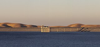
San Luis Dam is a major earth-filled dam in Merced County, California, which forms San Luis Reservoir, the largest off-stream reservoir in the United States. The dam and reservoir are located in the Diablo Range to the east of Pacheco Pass and about 10 miles (16 km) west of Los Banos. San Luis Dam, a jointly-owned state and federal facility, stores more than 2 million acre feet (2.5 km3) of water for the California State Water Project and the federal Central Valley Project. Although the dam is located in the valley of San Luis Creek, the majority of its water comes from man-made aqueducts which are supplied from other rivers in Northern California.

The San Luis Reservoir is an artificial lake on San Luis Creek in the eastern slopes of the Diablo Range of Merced County, California, approximately 12 mi (19 km) west of Los Banos on State Route 152, which crosses Pacheco Pass and runs along its north shore. It is the fifth largest reservoir in California. The reservoir stores water taken from the San Joaquin-Sacramento River Delta. Water is pumped uphill into the reservoir from the O'Neill Forebay which is fed by the California Aqueduct and is released back into the forebay to continue downstream along the aqueduct as needed for farm irrigation and other uses. Depending on water levels, the reservoir is approximately nine miles (14 km) long from north to south at its longest point, and five miles (8 km) wide. At the eastern end of the reservoir is the San Luis Dam, the fourth largest embankment dam in the United States, which allows for a total capacity of 2,041,000 acre-feet (2,518,000 dam3). Pacheco State Park lies along its western shores.

Santa Margarita is a town and census-designated place located in San Luis Obispo County, California. It was founded in 1889 near Cuesta Peak and San Luis Obispo along State Route 58. The town's name comes from the Mexican Alta California land grant of Rancho Santa Margarita. It is home to the Santa Margarita de Cortona Asistencia site. The population was 1,259 at the 2010 census.

The Nacimiento River is a 64.8-mile-long (104.3 km) river in southern Monterey County and northern San Luis Obispo County, California. A large portion of the river's run is on military reservations. The river's upper reaches are inside Fort Hunter Liggett, Lake Nacimiento is in the middle and the lower reaches are inside Camp Roberts. It is the largest tributary of the Salinas River in terms of streamflow.

Lake San Antonio is a lake located primarily in southern Monterey County, California, and partially in northern San Luis Obispo County, California. The lake is formed by San Antonio Dam on the San Antonio River. The dam is 202 feet tall and was completed in 1965 under Monterey County District Engineer Loran Bunte Jr. The lake and dam are owned by the Monterey County Water Authority. The lake has a capacity of 350,000 acre-feet (430,000,000 m3).

Whale Rock Reservoir is a reservoir near Cayucos in San Luis Obispo County, California.

Lopez Lake is a reservoir near the city of Arroyo Grande in San Luis Obispo County, California. The lake is formed by Lopez Dam on Arroyo Grande Creek, 9 mi (14 km) upstream from the Pacific Ocean. The creek drains about 60 sq mi (160 km2) above the dam and 90 sq mi (230 km2) below. The dam was built in 1969 and is operated by the San Luis Obispo County Flood Control and Water Conservation District. The earth-fill dam was retrofitted to protect against earthquakes between 2001 and 2003. The winter of 2022-2023 brought the reservoir to the capacity of 49,200 acre-feet (60,700,000 m3). In March 2023 the lake overflowed into the spillway for the first time since 1998, some 25 years prior.

Twitchell Reservoir is a reservoir in southern San Luis Obispo County and northern Santa Barbara County in California. The reservoir has a capacity of 197,756 acre⋅ft (243,928,000 m3) and is formed by Twitchell Dam on the Cuyama River about 66 miles (106 km) from its headwaters in the Chumash Wilderness Area and about 6 miles (9.7 km) from its confluence with the Sisquoc River, where they form the Santa Maria River. Twitchell Dam was built by the United States Bureau of Reclamation between 1956 and 1958. The original names were Vacquero Dam and Vacquero Reservoir, but they were changed to honor T. A. Twitchell of Santa Maria, a proponent of the project.

The Los Vaqueros Reservoir and watershed is located in the northern Diablo Range, within northeastern Contra Costa County, northern California. It was completed by the Contra Costa Water District (CCWD) in 1998 to improve the quality of drinking water for its 550,000 customers in Central and Eastern Contra Costa County. The reservoir is accessible via Vasco Road, a road which connects Brentwood and Livermore.

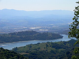
Anderson Lake, also known as Anderson Reservoir, is an artificial lake in Morgan Hill, located in southern Santa Clara County, California. The reservoir is formed by the damming of Coyote Creek just below its confluence with Las Animas Creek. A 4,275-acre (1,730 ha) county park surrounds the reservoir and provides limited fishing, picnicking, and hiking activities. Although swimming is prohibited, boating, water-skiing, and jet-skiing are permitted in the reservoir.

The Land Conservancy of San Luis Obispo County (LCSLO) is a non-profit land trust organization that has been operating in San Luis Obispo County, California since 1984. The LCSLO is dedicated to the voluntary and collaborative preservation and improvement of lands that hold significant scenic, agricultural, habitat, and cultural values. Their work aims to benefit both the local community and the wildlife that depends on these lands.

Agate Lake is a reservoir located 1,510 feet (460 m) above sea level in Jackson County, Oregon, United States. It is 13 miles (21 km) northeast of Medford, just north of Roxy Ann Peak. The lake is formed by the 86-foot (26 m) tall Agate Dam, which impounds Dry Creek, in the Rogue River watershed.

Calero Reservoir, also called Calero Lake, is a reservoir in San Jose, California, located in the Calero neighborhood of Almaden Valley in South San Jose. It is the site of Calero County Park, which also includes a large area covering the lake and hundreds of acres of hills around it.

Nacimiento Dam is a dam on the Nacimiento River about 10 miles (16 km) northwest of Paso Robles, California in the United States. The primary purpose of the dam is to provide groundwater recharge for agriculture in Monterey County and northern San Luis Obispo County supported by the Salinas Valley aquifer, as well as flood control, domestic water supply, and hydropower. It forms Lake Nacimiento, popular for boating, fishing and camping, and known locally as the "Dragon Lake" due to its shape.
Salsipuedes Creek is the name of several streams in California. "Salsipuedes" means "leave if you can" in Spanish.

The Salinas Dam is a dam built on the Salinas River in San Luis Obispo County, California. Designed by Raymond A. Hill, the gravity dam features an arched design with an open spillway. The War Department began construction on the dam in mid-1941, as World War II began to reach the Pacific. The original intent of the dam was to supply water to Camp San Luis Obispo, which the Army was considering expanding to meet military needs. However, the camp’s wells ultimately provided sufficient water to the camp, and the reservoir water was never required or used by the military. Today, the dam operations are leased by the city of San Luis Obispo, to supply water to the city and surrounding agricultural areas. The reservoir created by the dam is known as the Santa Margarita Lake, or Santa Margarita Reservoir.


