
Krishna district is a district in the coastal Andhra Region in Indian state of Andhra Pradesh, with Machilipatnam as its administrative headquarters. It is surrounded on the East by Bay of Bengal, West by Guntur, Bapatla and North by Eluru and NTR districts and South again by Bay of Bengal.

Khammam district is a district in the eastern region of the Indian state of Telangana. The city of Khammam is the district headquarters. The district shares boundaries with Suryapet, Mahabubabad, Bhadradri districts and with Eluru and NTR districts.
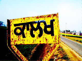
Kalakh is a village in Ludhiana district, Punjab, India.

Nemali is a village located in the Gampalagudem mandal, NTR district of the Indian state of Andhra Pradesh. It is under the administration of Tiruvuru revenue division.. The word Nemali means "peacock" in Telugu.
Tunikipadu is a village located in the Gampalagudem mandal, NTR district of the Indian state of Andhra Pradesh. It is under the administration of Tiruvuru revenue division.
Konduru is a village located in the G. Konduru mandal, NTR district of the Indian state of Andhra Pradesh. It is under the administration of Vijayawada revenue division.
Guduru is a village in Guduru Mandal in Krishna district of the Indian state of Andhra Pradesh. It is a Guduru Mandal head quarter, located 7 KM towards west from District head quarters Machilipatnam. Guduru Pin code is 521149 and postal head office is Guduru S.O

Mylavaram is a town and Suburb of Vijayawada in NTR district of the Indian state of Andhra Pradesh. It is located in Mylavaram mandal of Vijayawada revenue division. Mylavaram town has higher literacy rate compared to Andhra Pradesh. In 2011, literacy rate of Mylavaram village was 69% compared to 67.02% of Andhra Pradesh.

Penuganchiprolu is a village situated in the NTR district of Andhra Pradesh, India. Serving as the mandal headquarters for Penuganchiprolu mandal, it falls under the administration of the Nandigama revenue division. It is situated 71 kilometers northwest of the district headquarters, Vijayawada, and 50 kilometers south of the nearest city, Khammam.
Elaprolu is a village in NTR district of the Indian state of Andhra Pradesh. It is located in Ibrahimpatnam mandal of Vijayawada revenue division.
Chandarlapadu mandal is one of the 20 mandals in NTR District of the Indian state of Andhra Pradesh. It is under the administration of Nandigama revenue division and headquarters located at Chandarlapadu. The mandal is situated on the banks of Krishna River, bounded by Jaggayyapeta, Nandigama, Kanchikacherla mandals.

Lemalle is a village in Palnadu district, Andhra Pradesh, India on the way to Amaravati from Guntur. 14th Mile is also part of Lemalle grama panchayat and commercial area of this village.
Yerrupalem or Yerupalem or Errupalem is a village in Yerrupalem mandal of Khammam district, Telangana, India falling within the Madhira Assembly Constituency.
Pala Kastali is a village in Block Jawan Sikandarpur, Aligarh district of Uttar Pradesh, India. It is 5 km from Aligarh. The village has most population of Bais Rajput. Pala Kastali's Pin Code is 202122. Nearest railway station is Manzurgarhi and nearest Airport is Agra Airport. School near the village is Blackdale public school.
Gosaveedu is a village situated in both the Indian states of Andhra Pradesh and Telangana. Half of the village is located within the Gampalagudem mandal, NTR district, as part of the Tiruvuru revenue division. The remaining portion of Gosaveedu extends into the Yerrupalem mandal in the Khammam district, specifically falling under the Khammam revenue division.
Nandigama mandal is one of the 20 mandals in NTR district of the Indian state of Andhra Pradesh. It is under the administration of Nandigama revenue division and the headquarters are located at Nandigama. The mandal is bounded Penuganchiprolu, Kanchikacherla, Chandarlapadu mandals and also a portion of it by the state of Telangana.

NTR: Mahanayakudu is a 2019 Indian Telugu-language biographical film, based on the real life and political career of N. T. Rama Rao, produced by Nandamuri Balakrishna, Sai Korrapati, Vishnu Vardhan Induri under NBK Films, Vaaraahi Chalana Chitram, Vibri Media banners and directed by Krish Jagarlamudi. It is the second movie in a two-part series, with the first being NTR: Kathanayakudu. The film stars Nandamuri Balakrishna, Vidya Balan, Nandamuri Kalyan Ram, Rana Daggubati in the lead roles and its music is composed by M. M. Keeravani. The film received positive reviews and yet bombed badly at the box office.
Kotha Kamalapuram is a panchayat in the Singareni mandal of the Khammam district in the Indian state of Telangana.

NTR district is a district in coastal Andhra Region in the Indian state of Andhra Pradesh. The district headquarters is located at Vijayawada. The district is named after former Chief Minister of Andhra Pradesh N. T. Rama Rao. The district shares boundaries with Guntur, Palnadu, Krishna, Eluru, Khammam and Suryapet districts

Eluru district is a district in coastal Andhra Region in the Indian state of Andhra Pradesh. With Eluru as its administrative headquarters, it was proposed on 26 January 2022 to become one of the resultant twenty six districts in the state once a final notification is issued by the government of Andhra Pradesh. It is formed from Eluru revenue division and Jangareddygudem revenue division from West Godavari district and Nuzvid revenue division from Krishna district.


