Related Research Articles

John Forrest National Park is a national park in the Darling Scarp, 24 km (15 mi) east of Perth, Western Australia. Proclaimed as a national park in November 1900, it was the first national park in Western Australia and the second in Australia after Royal National Park.
Tumbarumba is a town in New South Wales, Australia, about 480 kilometres (300 mi) southwest of the state capital, Sydney. Tumbarumba is located on the periphery of the Riverina and South West Slopes regions at the western edge of the Snowy Mountains. The 2016 census showed the population of the town and surrounding area to be 1,862 people. Locals refer to the town as 'Tumba'.

Leongatha is a town in the foothills of the Strzelecki Ranges, South Gippsland Shire, Victoria, Australia, located 135 kilometres (84 mi) south-east of Melbourne. At the 2021 census, Leongatha had a population of 5,869.

Waroona is a town located in the Peel region of Western Australia along the South Western Highway, between Pinjarra and Harvey. The town is the seat of the Shire of Waroona. At the 2016 census, Waroona had a population of 2,934.

Yarloop is a town in the South West of Western Australia along the South Western Highway, between Waroona and Harvey. At the 2016 census, Yarloop had a population of 395. On 7 January 2016 a bushfire destroyed most of the town.

Mount Stirling is a mountain in the Victorian Alps of the Great Dividing Range, located in the Hume region of Victoria, Australia. The mountain has an elevation of 1,747–1,749 metres (5,732–5,738 ft) above sea level.

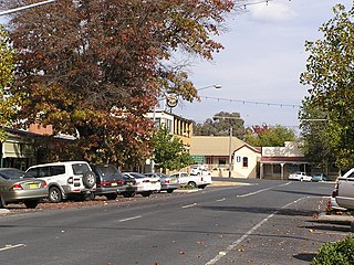
Murgon is a rural town and locality in the South Burnett Region, Queensland, Australia. In the 2016 census, the locality of Murgon had a population of 2,378 people.
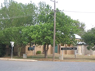
Mangoplah is a town approximately 36 kilometres (22 mi) south of Wagga Wagga in the Riverina region of New South Wales, Australia. At the 2016 census, Mangoplah had a population of 309. The name of the town is believed to mean "Kooris singing" in the Wiradjuri aboriginal language.
Northcliffe is a town located in the lower South West region of Western Australia, about 28 kilometres (17 mi) south of the town of Pemberton. It is part of the Shire of Manjimup. At the 2006 census, Northcliffe had a population of 412. Currently, Northcliffe serves a population of around 770 people within the town and surrounding areas. Approximately 31% of the population have post-secondary qualifications.

Kilkivan is a town and locality in the Gympie Region of Queensland, Australia. At the 2016 census, Kilkivan had a population of 713.

Gladstone Region is a local government area in Queensland, Australia. The council covers an area of 10,484 square kilometres (4,048 sq mi), had a resident population at August 2021 of 63,515, and has an estimated operating budget of A$84 million.
The Noojee railway line is a closed railway line in Victoria, Australia. Branching off from the Gippsland line at Warragul station, it was built to service the timber industry in the upper Latrobe River area, transporting timber as well as providing a general goods and passenger service to townships in the area. The final section of the line between Neerim South and Noojee traversed increasingly hilly terrain and featured a number of large timber trestle bridges. Extensively and repeatedly damaged by bushfires over the years, the line was closed in the 1950s and dismantled. The last remaining large trestle bridge on the line has been preserved and has become a popular local tourist attraction.

Tingoora is a rural town and a locality in the South Burnett Region, Queensland, Australia.

The Black Saturday bushfires were a series of bushfires that either ignited or were already burning across the Australian state of Victoria on and around Saturday, 7 February 2009, and were among Australia's all-time worst bushfire disasters. The fires occurred during extreme bushfire weather conditions and resulted in Australia's highest-ever loss of human life from a bushfire, with 173 fatalities. Many people were left homeless as a result.

The Nicholson River is a perennial river of the Mitchell River catchment, located in the East Gippsland region of the Australian state of Victoria.

The Cynwyd Line is a SEPTA Regional Rail line from Center City Philadelphia to Cynwyd in Montgomery County, Pennsylvania. Originally known as the Ivy Ridge Line, service was truncated on May 17, 1986, at its current terminus at Cynwyd.

David Andrew Elliott is a retired Australian politician. Elliott served as the New South Wales Minister for Transport and the Minister for Veterans in the Perrottet ministry between 21 December 2021 and 25 March 2023. Elliott was a member of the New South Wales Legislative Assembly representing Baulkham Hills for the Liberal Party between 2011 and 2023.
The 2018 Tathra bushfire was a bushfire that burned between 18 and 19 March 2018 and primarily affected parts of the South Coast region in the Australian state of New South Wales. The fire, understood to have been caused by a failure in electrical infrastructure, began in the locality of Reedy Swamp, near Tarraganda, which spread east towards Tathra in the municipality of the Bega Valley Shire.
References
- ↑ Wakely, Laura (7 December 2010). "On the right track at long last". Star News Group. Archived from the original on 21 December 2010. Retrieved 1 September 2019.
- ↑ "Mitchell Shire Bushfire Community Rebuild Update" (PDF). Mitchell Shire Council. October 2010. Archived from the original (PDF) on 21 February 2011. Retrieved 1 September 2019.