Belozersk is a town and the administrative center of Belozersky District in Vologda Oblast, Russia, located on the southern bank of Lake Beloye, from which it takes the name, 214 kilometers (133 mi) northwest of Vologda, the administrative center of the oblast. Population: 9,616 (2010 Census); 10,975 (2002 Census); 12,352 (1989 Census). It was previously known as Beloozero.

Sheksna is an urban locality and the administrative center of Sheksninsky District of Vologda Oblast, Russia, located along the left bank of the Sheksna River, 83 kilometers (52 mi) from Vologda. Municipally, it is incorporated as Sheksninskoye Urban Settlement, one of the two urban settlements in the district. Population: 20,953 (2010 Census); 21,615 (2002 Census); 15,928 (1989 Census).
Kharovsk is a town and the administrative center of Kharovsky District in Vologda Oblast, Russia, located on the left bank of the Kubena River, 90 kilometers (56 mi) north of Vologda, the administrative center of the oblast. Population: 10,079 (2010 Census); 11,460 (2002 Census); 13,083 (1989 Census).

Ustyuzhna is a town and the administrative center of Ustyuzhensky District in Vologda Oblast, Russia, located on the Mologa River, 260 kilometers (160 mi) west of Vologda, the administrative center of the oblast. Population: 9,501 (2010 Census); 10,507 (2002 Census); 10,035 (1989 Census).

Kirillov is a town and the administrative center of Kirillovsky District in Vologda Oblast, Russia, located on the shores of Lakes Siverskoye and Dolgoye, 129 kilometers (80 mi) northwest of Vologda, the administrative center of the oblast. Population: 7,728 (2010 Census); 8,229 (2002 Census); 8,817 (1989 Census).
Sokol is a town in the center of Vologda Oblast, Russia, located on both banks of the Sukhona River. Population: 38,452 (2010 Census); 43,042 (2002 Census); 46,604 (1989 Census).; 36,000 (1970).
Gryazovets is a town and the administrative center of Gryazovetsky District in Vologda Oblast, Russia, located on the Rzhavka River, 47 kilometers (29 mi) south of Vologda, the administrative center of the oblast. Population: 15,528 (2010 Census); 16,172 (2002 Census); 16,424 (1989 Census).
Babayevo is a town and the administrative center of Babayevsky District in Vologda Oblast, Russia, located in the south of the district, on the Kolp River 246 kilometers (153 mi) west of Vologda, the administrative center of the oblast. Population: 12,073 (2010 Census); 12,604 (2002 Census); 14,211 (1989 Census).
Chagodoshchensky District is an administrative and municipal district (raion), one of the twenty-six in Vologda Oblast, Russia. It is located in the southwest of the oblast and borders with Babayevsky District in the northeast, Ustyuzhensky District in the southeast, Pestovsky District of Novgorod Oblast in the south, Khvoyninsky District of Novgorod Oblast in the southwest, and with Boksitogorsky District of Leningrad Oblast in the northwest. The area of the district is 2,400 square kilometers (930 sq mi). Its administrative center is the urban locality of Chagoda. Population: 13,865 (2010 Census); 15,624 ; 17,866 (1989 Census). The population of Chagoda accounts for 49.9% of the district's total population.

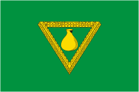
Kaduysky District is an administrative and municipal district (raion), one of the twenty-six in Vologda Oblast, Russia. It is located in the west of the oblast and borders with Belozersky District in the north, Cherepovetsky District in the east and in the south, Ustyuzhensky District in the southwest, and with Babayevsky District in the west. The area of the district is 3,300 square kilometers (1,300 sq mi). Its administrative center is the urban locality of Kaduy. Population: 17,109 (2010 Census); 18,653 ; 19,988 (1989 Census). The population of Kaduy accounts for 66.0% of the district's total population.
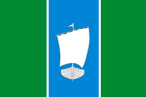
Sheksninsky District is an administrative and municipal district (raion), one of the twenty-six in Vologda Oblast, Russia. It is located in the center of the oblast and borders with Kirillovsky District in the north, Vologodsky District in the east, Poshekhonsky District of Yaroslavl Oblast in the south, and with Cherepovetsky District in the west. The area of the district is 2,500 square kilometers (970 sq mi). Its administrative center is the urban locality of Sheksna. Population: 33,375 (2010 Census); 36,007 ; 34,679 (1989 Census). The population of Sheksna accounts for 62.8% of the district's total population.

Vashkinsky District is an administrative and municipal district (raion), one of the twenty-six in Vologda Oblast, Russia. It is located in the northwest of the oblast and borders with Vytegorsky District in the north, Kirillovsky District in the east, and with Belozersky District in the south and west. The area of the district is 2,900 square kilometers (1,100 sq mi). Its administrative center is the rural locality of Lipin Bor. District's population: 8,089 (2010 Census); 10,002 ; 11,977 (1989 Census). The population of Lipin Bor accounts for 45.4% of the district's total population.
Kichmengsky Gorodok is a rural locality and the administrative center of Kichmengsko-Gorodetsky District, Vologda Oblast, Russia, located on the left bank of the Yug River, at its confluence with the Kichmenga River. It also serves as the administrative center of Kichmengsky Selsoviet, one of the seventeen selsoviets into which the district is administratively divided. Municipally, it is the administrative center of Kichmengskoye Rural Settlement. Population: 6,443 (2010 Census); 6,754 (2002 Census); 6,766 (1989 Census).
Verkhovazhye is a rural locality and the administrative center of Verkhovazhsky District of Vologda Oblast, Russia, located on the right bank of the Vaga River. It also serves as the administrative center of Verkhovazhsky Selsoviet, one of the fourteen selsoviets into which the district is administratively divided. Municipally, it is the administrative center of Verkhovazhskoye Rural Settlement. Population: 5,025 (2010 Census); 5,206 (2002 Census); 4,684 (1989 Census).
Vozhega (Russian: Вожега is an urban locality and the administrative center of Vozhegodsky District of Vologda Oblast, Russia. It also serves as the administrative center of Vozhegodsky Selsoviet, although it is not part of it. Municipally, it is incorporated as Vozhegodskoye Urban Settlement, the only urban settlement in the district. Vozhega is located several kilometers off the course of the Vozhega River, on the right bank of the river. Population: 6,725 ; 6,835 ; 7,370 .
Vokhtoga (Russian: Вохтога is an urban locality in Gryazovetsky District of Vologda Oblast, Russia. Municipally, it is incorporated as Vokhtogskoye Urban Settlement, one of the two urban settlements in the district. Vozhega is located on the right bank of the Lezha River, a right tributary of the Sukhona. Population: 6,375 ; 7,247 ; 7,623 .
Chyobsara is an urban locality in Sheksninsky District of Vologda Oblast, Russia, located 73 kilometers (45 mi) from Vologda. Municipally, it is incorporated as Chyobsarskoye Urban Settlement, one of the two urban settlements in the district. Population: 1,440 (2010 Census); 1,776 (2002 Census); 2,732 (1989 Census).
Kaduy is an urban locality and the administrative center of Kaduysky District of Vologda Oblast, Russia, located on the Voron River at the confluence with the Sivets River, 56 kilometers (35 mi) west of the city of Cherepovets. Municipally, it is incorporated as Kaduyskoye Urban Settlement, one of the two urban settlements in the district. Population: 11,284 (2010 Census); 11,798 (2002 Census); 11,153 (1989 Census).
Khokhlovo is an urban locality in Kaduysky District of Vologda Oblast, Russia. Municipally, it is incorporated as Khokhlovskoye Urban Settlement, one of the two urban settlements in the district. Population: 2,509 (2010 Census); 2,527 (2002 Census); 2,807 (1989 Census).