Schley | |
|---|---|
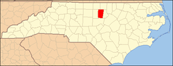
 Schley Location within the state of North Carolina | |
| Coordinates: 36°09′10″N79°03′41″W / 36.15278°N 79.06139°W | |
| Country | United States |
| State | North Carolina |
| County | Orange |
| Elevation | 584 ft (178 m) |
| Time zone | UTC-5 (Eastern (EST)) |
| • Summer (DST) | UTC-4 (EDT) |
| GNIS feature ID | 994411 |
Schley (pronounced Sly [1] ) is an unincorporated community, in Orange County, North Carolina, United States, located southwest of Caldwell and northeast of Hillsborough. It lies at an elevation of 584 feet (178 m). [2]
One of the main landmarks in the area is the Schley Grange Hall at the intersection of Hwy 57 and Schley Road. Schley has a very active farming community.