McDade, North Carolina | |
|---|---|
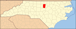
 Location of McDade in North Carolina  McDade, North Carolina (the United States) | |
| Coordinates: 36°11′21″N79°10′14″W / 36.18917°N 79.17056°W | |
| Country | United States |
| State | North Carolina |
| County | Orange |
| Elevation | 728 ft (222 m) |
| Time zone | UTC-5 (Eastern (EST)) |
| • Summer (DST) | UTC-4 (EDT) |
| Area code | 919 |
| GNIS feature ID | 989555 [1] |
McDade is an unincorporated community in Orange County, North Carolina, United States, located between Carr and Cedar Grove. It lies at an elevation of 728 feet (222 m).