Eno, North Carolina | |
|---|---|
 Eno Fire Department | |
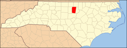
 Location of Eno in North Carolina  Eno, North Carolina (the United States) | |
| Coordinates: 36°02′29″N79°00′51″W / 36.04139°N 79.01417°W | |
| Country | United States |
| State | North Carolina |
| County | Orange |
| Elevation | 463 ft (141 m) |
| Time zone | UTC-5 (Eastern (EST)) |
| • Summer (DST) | UTC-4 (EDT) |
| Area code | 919 |
| GNIS feature ID | 1020159 [1] |
Eno is an unincorporated community in Orange County, North Carolina, United States. It is located at the intersection of Interstate 85 and U.S. Route 70.