Sciotodale, Ohio

Last updated

Sciotodale, Ohio
OHMap-doton-Sciotodale.png
Location of Sciotodale, Ohio
Coordinates: 38°45′03″N82°51′35″W / 38.75083°N 82.85972°W / 38.75083; -82.85972
Country United States
State Ohio
County Scioto
Area
[1]
  Total1.94 sq mi (5.02 km2)
  Land1.93 sq mi (5.00 km2)
  Water0.01 sq mi (0.01 km2)
Elevation
[2]
699 ft (213 m)
Population
 (2020)
  Total1,049
  Density542.96/sq mi (209.62/km2)
Time zone UTC-5 (Eastern (EST))
  Summer (DST) UTC-4 (EDT)
FIPS code 39-70912 [3]
GNIS feature ID2393226 [2]

Sciotodale is a census-designated place (CDP) in Scioto County, Ohio, United States. The population was 1,049 at the 2020 census.

Contents

Geography

According to the United States Census Bureau, the CDP has a total area of 2.0 square miles (5.2 km2), all land.

Demographics

Historical population
CensusPop.Note
2020 1,049
U.S. Decennial Census [4]

As of the census [3] of 2000, there were 982 people, 378 households, and 291 families residing in the CDP. The population density was 499.0 inhabitants per square mile (192.7/km2). There were 397 housing units at an average density of 201.7 per square mile (77.9/km2). The racial makeup of the CDP was 97.86% White, 0.20% African American, 0.51% Native American, 0.10% Asian, and 1.32% from two or more races. Hispanic or Latino of any race were 0.31% of the population.

There were 378 households, out of which 32.3% had children under the age of 18 living with them, 61.4% were married couples living together, 11.9% had a female householder with no husband present, and 23.0% were non-families. 20.6% of all households were made up of individuals, and 9.3% had someone living alone who was 65 years of age or older. The average household size was 2.60 and the average family size was 2.97.

In the CDP, the population was spread out, with 23.2% under the age of 18, 9.0% from 18 to 24, 28.4% from 25 to 44, 24.2% from 45 to 64, and 15.2% who were 65 years of age or older. The median age was 39 years. For every 100 females, there were 94.8 males. For every 100 females age 18 and over, there were 89.9 males.

The median income for a household in the CDP was $35,865, and the median income for a family was $42,250. Males had a median income of $36,979 versus $21,181 for females. The per capita income for the CDP was $20,469. About 19.6% of families and 24.2% of the population were below the poverty line, including 24.6% of those under age 18 and 21.8% of those age 65 or over.

Related Research Articles

<span class="mw-page-title-main">Rock Creek, Alabama</span> CDP in Alabama, United States

Rock Creek is a census-designated place in Jefferson County, Alabama, United States. Its location is northwest of Hueytown. At the 2020 census, the population was 1,471. This area was damaged by an F5 tornado on April 8, 1998. An EF2 tornado struck northwest from here on January 23, 2012.

<span class="mw-page-title-main">Moores Mill, Alabama</span> Census-designated place in Alabama, United States

Moores Mill is an unincorporated community and census-designated place (CDP) in Madison County, Alabama, United States, and is included in the Huntsville-Decatur Combined Statistical Area. The population was 6,729 at the 2020 census, up from 5,682 at the 2010 census.

<span class="mw-page-title-main">East Sahuarita, Arizona</span> Community in Pima County, Arizona

East Sahuarita was a census-designated place (CDP) in Pima County, Arizona, United States. The population was 1,419 at the 2000 census. The CDP comprises the unincorporated neighborhoods east of incorporated Sahuarita.

<span class="mw-page-title-main">Summit, Arizona</span> CDP in Pima County, Arizona

Summit is a census-designated place (CDP) in Pima County, Arizona, United States. The population was 3,702 at the 2000 census.

<span class="mw-page-title-main">Landmark, Arkansas</span> CDP in Arkansas, United States

Landmark is a census-designated place (CDP) in Pulaski County, Arkansas, United States. Per the 2020 census, the population was 3,585. It is part of the Little Rock–North Little Rock–Conway Metropolitan Statistical Area.

<span class="mw-page-title-main">Bayview-Montalvin, California</span> Former CDP in California, United States

Bayview-Montalvin is a former census-designated place (CDP) in Contra Costa County, California, United States. The population was 5,004 at the 2000 census.

<span class="mw-page-title-main">Dixon Lane-Meadow Creek, California</span> Census-designated place in California, United States

Dixon Lane-Meadow Creek is a census-designated place (CDP) in Inyo County, California, United States. The population was 2,645 at the 2010 census, down from 2,702 at the 2000 census.

<span class="mw-page-title-main">East Brooklyn, Connecticut</span> Census-designated place in Connecticut, United States

East Brooklyn is a census-designated place (CDP) located within the town of Brooklyn in Windham County, Connecticut. It is the portion of the Danielson urban cluster within the town of Brooklyn. The population was 2,205 at the 2020 census. US 6 runs through the town and severs the town.

Moss Bluff is a census-designated place (CDP) in Calcasieu Parish, Louisiana, United States. The population was 12,522 at the 2020 census. Located just north of the city of Lake Charles, it is considered a suburb of that city. Moss Bluff is a burgeoning community, and is one of the communities in Calcasieu Parish besides Lake Charles and Sulphur experiencing growth. Several efforts have been made to incorporate Moss Bluff, but at the present time the community is unincorporated.

<span class="mw-page-title-main">Calvert Beach-Long Beach, Maryland</span> Former Census-designated place in Maryland, United States

Calvert Beach-Long Beach was a census-designated place (CDP) in Calvert County, Maryland, United States. The population was 2,487 at the 2000 census. For the 2010 census the area was split into two CDPs: Calvert Beach and Long Beach.

<span class="mw-page-title-main">Harbor Isle, New York</span> Hamlet and census-designated place in New York, United States

Harbor Isle is a hamlet and census-designated place (CDP) in the Town of Hempstead in Nassau County, New York, United States. The population was 1,301 at the 2010 census.

<span class="mw-page-title-main">Welcome, North Carolina</span> Census-designated place in North Carolina, United States

Welcome is a census-designated place (CDP) in Davidson County, North Carolina, United States. The population was 4,162 at the 2010 census. It is nationally known as the home of Richard Childress Racing. In addition, Walker and Associates, Inc., a nationwide communication value-add distribution is headquartered here. The town motto is "Welcome to Welcome, A Friendly Place," as posted on the welcoming sign. Neighboring communities and municipalities include Midway, Arcadia, and Lexington.

<span class="mw-page-title-main">Sherwood, Hamilton County, Ohio</span> Census-designated place in Ohio, United States

Sherwood is a census-designated place (CDP) in Hamilton County, Ohio, United States. The population was 3,633 at the 2020 census.

<span class="mw-page-title-main">Turpin Hills, Ohio</span> Census-designated place in Ohio, United States

Turpin Hills is a census-designated place (CDP) in Anderson Township, Hamilton County, Ohio, United States. The population was 5,162 at the 2020 census.

<span class="mw-page-title-main">Gloverville, South Carolina</span> Census-designated place in South Carolina, United States of America

Gloverville is a census-designated place (CDP) in Aiken County, South Carolina, United States. The population was 2,831 at the 2010 census. It is part of the Augusta, Georgia metropolitan area. Gloverville is located in historic Horse Creek Valley.

<span class="mw-page-title-main">Utica, South Carolina</span> Census-designated place in South Carolina, United States

Utica is a census-designated place (CDP) in Oconee County, South Carolina, United States. The population was 1,322 at the 2000 census.

<span class="mw-page-title-main">Wiley Ford, West Virginia</span> CDP in West Virginia, United States

Wiley Ford is a census-designated place (CDP) in Mineral County, West Virginia, United States and part of the 'Cumberland, MD-WV Metropolitan Statistical Area'. The population was 1,026 at the 2010 census.

<span class="mw-page-title-main">Loveland Park, Ohio</span> Census-designated place in Ohio, United States

Loveland Park is a census-designated place (CDP) located in Symmes Township, Hamilton County and Deerfield Township, Warren County, in the southwestern part of the U.S. state of Ohio. The CDP is named after the city of Loveland. The population was 1,737 at the 2020 census.

Yorkshire is a census-designated place (CDP) in the northeastern corner of the town of Yorkshire in Cattaraugus County, New York, United States. The population of the CDP was 1,180 at the 2010 census, out of 3,913 in the town of Yorkshire as a whole.
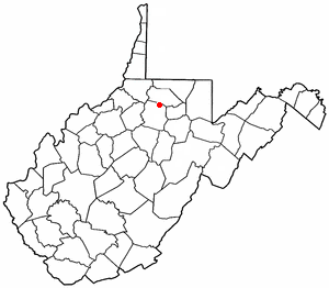
<span class="mw-page-title-main">Enterprise, West Virginia</span> Census-designated place in West Virginia, United States

Enterprise is a census-designated place (CDP) in Harrison County, West Virginia, United States, along the West Fork River. The population was 961 at the 2010 census.

References

  1. "ArcGIS REST Services Directory". United States Census Bureau. Retrieved September 20, 2022.
  2. 1 2 U.S. Geological Survey Geographic Names Information System: Sciotodale, Ohio
  3. 1 2 "U.S. Census website". United States Census Bureau . Retrieved January 31, 2008.
  4. "Census of Population and Housing". Census.gov. Retrieved June 4, 2016.