Scribner State Airport

Last updated
Scribner State Airport
Scribner Army Airfield
Scribner State Airport - Nebraska.jpg
2006 USGS Orthophoto
Summary
Airport typePublic
OwnerNebraska Dept of Aeronautics
Serves Scribner, Nebraska
Location Everett Township, Dodge County, near Scribner, Nebraska
Elevation  AMSL 1,325 ft / 404 m
Coordinates 41°36′37″N096°37′48″W / 41.61028°N 96.63000°W / 41.61028; -96.63000
Map
USA Nebraska location map.svg
Airplane silhouette.svg
KSCB
Location
Runways
Direction LengthSurface
ftm
17/354,2001,280 Concrete
12/303,199975Concrete
Statistics (2022)
Aircraft operations (year ending 8/17/2022)2,550
Based aircraft12

Scribner State Airport( IATA : SCB, ICAO : KSCB, FAA LID : SCB) is three miles southeast of Scribner, in Dodge County, Nebraska.

Contents

Facilities

Scribner State Airport covers 789 acres (319  ha ) at an elevation of 1,325 feet (404 m). It has two concrete runways: 17/35 is 4,200 by 75 feet (1,280 x 23 m) and 12/30 is 3,199 by 60 feet (975 x 18 m). [1]

In the year ending August 17, 2022, the airport had 2,550 aircraft operations, average 49 per week: 98% general aviation and 2% military. 12 aircraft were then based at the airport: 10 single-engine and 2 ultralight. [1]

History

Scribner State Airport was built in 1942 as a United States Army Air Forces training airfield. The 2,060-acre (8.3 km2) site is south of the Elkhorn River and is surrounded by low rolling hills on the east, north and west. The area is agricultural.

The first news that Scribner Army Airfield would be built came on 1 October 1942, with eviction notices given to area farmers shortly thereafter. Construction soon began, with two runways completed by 26 November 1942. 87 buildings and structures were built. The base opened on 9 December 1942. [2]

Scribner AAF was one of eleven training airfields in Nebraska, and came under the command of Second Air Force. It was initially a satellite base to Sioux City Army Air Base, Iowa, though by 1943 it became an independent base, with Ainsworth Army Airfield, Nebraska, being designated as Scribner's satellite. The 4316th Army Air Force Base Unit had host unit responsibilities at Scribner. In December 1942, the Base Commander was Major A. J. Guffanti. [3] [4]

The field's primary mission was to provide aircrew training for B-17 Flying Fortress and B-24 Liberator bomber air crews. In addition, P-47 Thunderbolt fighter pilots completed proficiency training at Scribner before reassignment to the European Theater of Operations. Crews that used Scribner Army Airfield included the following: [5] [6]

Component of: 383d Bombardment Group, assigned to Geiger Field, Washington
Provided Operational Training at Scribner.
22nd, 23rd, and 53rd Fighter Squadrons (P-47 Thunderbolt)
Deployed to Ninth Air Force in England

Scribner also became a camouflage school. By 1943 the entire airfield was camouflaged to look like a farm and small village to prove that an airfield could be hidden from the enemy. The hangar was painted red to resemble a barn, chicken wire was stuffed with green colored spun glass to resemble trees, and a mock silo beside the barn really housed the sliding hangar doors. Another building was given a steeple and painted to resemble a church, and a "school house" was built with spun-glass children. Even the runways were coated with tar and coated with wood chips and ground corncobs, and painted green or brown, depending on the season.

The USAAF training airfield closed on 31 December 1945 and the State of Nebraska acquired the Airfield property from the U.S. Government in 1946. By 1951, word came that the then surplus Scribner Air Base was being considered as the site of a proposed United States Air Force Academy. This did not happen, however, the U.S. Air Force acquired 136 acres (0.55 km2) for installation of an ionosphere sounding station. This High Frequency radio receiver site did operate and is in fact still in operation as an unmanned annex of Offutt AFB. During this same era, some of the old WW-II era temporary barracks and administrative facilities, located near the HF receiver site, was known as "Site-X"—an emergency relocation site for Headquarters, Strategic Air Command at Offutt AFB, in use until SAC's underground command post at Offutt became operational. The detachment operated until 30 April 1959, when it was discontinued. [7] [8]

The remainder of the former Airfield was rented out. Nebraska Department of Aeronautics continues to operate the airfield, leasing storage and small segments of land to local concerns. A United States Air Force communications center is also located on the site.

A few wartime buildings still are in use, along with the remains of the wartime runways.

See also

Related Research Articles

<span class="mw-page-title-main">Dobbins Air Reserve Base</span> Military base in Georgia, USA

Dobbins Air Reserve Base or Dobbins ARB is a United States Air Force reserve air base located in Marietta, Georgia, a suburb about 20 miles (32 km) northwest of Atlanta. Originally known as Dobbins Air Force Base, it was named in honor of Captain Charles M. Dobbins, a World War II C-47 pilot who died near Sicily.

<span class="mw-page-title-main">Lincoln Airport (Nebraska)</span> Public airport and military airbase serving Lincoln, Nebraska, USA

Lincoln Airport is a public/military airport five miles (8.0 km) northwest of downtown Lincoln, the state capital, in Lancaster County, Nebraska, United States. It is owned by the Lincoln Airport Authority and is the second-largest airport in Nebraska. It is included in the Federal Aviation Administration (FAA) National Plan of Integrated Airport Systems for 2023–2027 in which it is categorized as a non-hub primary commercial service facility. It has four gates with jetways, to be, as of February 2022, expanded to six.

<span class="mw-page-title-main">Rennes–Saint-Jacques Airport</span> Airport

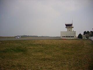
Rennes–Saint-Jacques Airport or Aéroport de Rennes–Saint-Jacques is a minor international airport about 6 kilometres (3.7 mi) southwest of Rennes, Ille-et-Vilaine, in the region of Brittany, France.

<span class="mw-page-title-main">Bruning Army Air Field</span> Former airport in Nebraska, United States

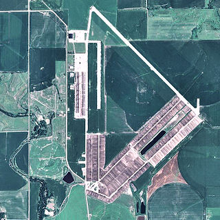
Bruning Army Air Field was a flight training installation of the United States Army Air Forces used during World War II and located in northeast Thayer County, Nebraska, at coordinates 40°20'25" North, 97°25'42" West, approximately six miles east of Bruning.

Nebraska World War II army airfields were major United States Army Air Forces (USAAF) training centers for pilots and aircrews of USAAF fighters and bombers during World War II. Nebraska was a favored because it has excellent, year-round flying conditions. The sparsely populated land made ideal locations for gunnery, bombing, and training ranges.

<span class="mw-page-title-main">Ainsworth Regional Airport</span> Airport

Ainsworth Regional Airport is seven miles northwest of Ainsworth, in Brown County, Nebraska. It is owned by the Ainsworth Airport Authority. The National Plan of Integrated Airport Systems for 2011–2015 called it a general aviation airport.

<span class="mw-page-title-main">Fairmont State Airfield</span> Airport in Madison Township, Fillmore County

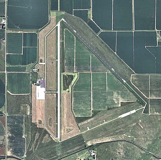
Fairmont State Airfield is three miles south of Fairmont, in Fillmore County, Nebraska. The National Plan of Integrated Airport Systems for 2011–2015 categorized it as a general aviation facility. It has no scheduled airline service.

<span class="mw-page-title-main">Larson Air Force Base</span> Former US Air Force base in Grant County, WA, US

Larson Air Force Base is a former United States Air Force base located five miles (8 km) northwest of the central business district (CBD) of Moses Lake, in Grant County, Washington. After its closure in 1966, the airport facility became Grant County International Airport.

<span class="mw-page-title-main">Waycross–Ware County Airport</span> Airport in near Waycross, Georgia

Waycross–Ware County Airport is four miles northwest of Waycross, in Ware County, Georgia. It is owned by the City of Waycross and Ware County.

<span class="mw-page-title-main">Dalhart Army Air Base</span> Airport

Dalhart Army Air Base is a former World War II military airfield complex near the city of Dalhart, Texas. It operated three training sites for the United States Army Air Forces from 1943 until 1945.

<span class="mw-page-title-main">Cross City Air Force Station</span> Former United States Air Force facility

Cross City Air Force Station is a former United States Air Force facility, located 1.6 miles (2.6 km) east of Cross City, Florida.

Telerghma Airport is a joint-use civilian/military airport in Algeria, just south of the city of Telerghma, about 300 km east of Algiers

<span class="mw-page-title-main">Saint-Simon – Clastres Air Base</span>

Saint-Simon – Clastres Air Base is an abandoned military airfield, which is located approximately 3 km (2 NM) northwest of Clastres and east of Saint-Simon, both communes in the Aisne department of the Picardy (Picardie) region in France. It is approximately 116 km (63 NM) north-northeast of Paris.

Le Mans Airfield is an abandoned World War II military airfield, which is located near the City of Le Mans in the Pays de la Loire region of northern France.

<span class="mw-page-title-main">Vannes Airport</span> Airport in Meucon, France

Vannes Airport is a regional airport in France. It supports general aviation.

<span class="mw-page-title-main">Chartres – Champhol Aerodrome</span> Airport

Chartres – Champhol Aerodrome is an airport serving Chartres and Champhol, in the Eure-et-Loir department in north-central France. The airport is located 2.5 km (1.3 NM) east-northeast of Chartres and it is southeast of Champhol. It supports general aviation with no commercial airline service scheduled.

<span class="mw-page-title-main">Brétigny-sur-Orge Air Base</span> Airport in Brétigny, France

Brétigny-sur-Orge Air Base is a former French Air Force French: Armée de l'Air (ALA) base. The base is located approximately 2 miles (3.2 km) southeast of Brétigny-sur-Orge; about 17 miles (27 km) south of Paris.

<span class="mw-page-title-main">Desert Center Airport</span> Airport in California, United States

Desert Center Airport is a private-use airport located five nautical miles northeast of the central business district of Desert Center, in Riverside County, California, United States.

<span class="mw-page-title-main">Aiken Air Force Station</span> Closed United States Air Force General Surveillance Radar station

Aiken Air Force Station is a closed United States Air Force General Surveillance Radar station. It is located 6.4 miles (10.3 km) north-northeast of Aiken, South Carolina. It was closed in 1975.

<span class="mw-page-title-main">Sioux City Air National Guard Base</span> Iowa Air National Guard base in Sioux City

Sioux City Air National Guard Base is an Iowa Air National Guard base, located at Sioux Gateway Airport It is located 7.2 miles (11.6 km) south-southeast of Sioux City, Iowa. On 25 May 2002, the airport was named "Colonel Bud Day Field" in honor of United States Air Force Colonel George Everette "Bud" Day, a Sioux City, Iowa native and is the only person ever awarded both the Medal of Honor and the Air Force Cross.

References

PD-icon.svg This article incorporates public domain material from the Air Force Historical Research Agency.

  1. 1 2 3 FAA Airport Form 5010 for SCB PDF , effective November 30, 2022.
  2. Real-McKeighan, Tammy, "Pilots once trained at Scribner Air Base", Military Times , 4 September 2011.
  3. USAFHRA Document 00177633
  4. USAFHRA Document 00177637
  5. USAFHRA Document 00169028
  6. USAFHRA Document 00079524
  7. USAFHRA Document 00489538
  8. USAFHRA Document 00489563