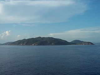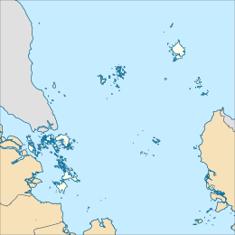
Natuna Regency is an islands regency located in the northernmost part of the Province of Riau Islands, Indonesia. It contains at least 154 islands, of which 127 of them are reported as uninhabited. This archipelago, with a land area of 1,978.49 km2 out of a total area of 264,198.37 km2 area, contains 17 administrative districts (kecamatan).

Anambas Islands Regency is a small archipelago of Indonesia, located 150 nautical miles northeast of Batam Island in the North Natuna Sea between the Malaysian mainland to the west and the island of Borneo to the east. Geographically part of the Tudjuh Archipelago, it is administratively a regency within the Riau Islands Province. It covers a land area of 590.14 square kilometres (227.85 sq mi) and had a population of 37,411 at the 2010 Census and 47,402 at the 2020 Census; the official estimate as at mid 2023 was 49,090. The administrative centre is at Tarempa on Siantan Island.

Bunguran Island or just Bunguran is the main island of the Middle Natuna Archipelago, which is part of the Riau Islands Province in Indonesia. It is also called Great Natuna Island.
Leptobrachella serasanae is a species of amphibian in the family Megophryidae. It is found in Pulau Serasan and central Sarawak, Borneo, (Malaysia). Its natural habitats are tropical moist lowland forests and rivers. It is threatened by habitat loss.

China and Indonesia established formal diplomatic relations in 1950, more commonly referred to as Sino-Indonesian relations. Prior to this, for many centuries, the two countries maintained a variety of relations mainly in informal trade. Under Sukarno’s presidency, from 1945 to 1967, relations with China deepened, as in the early 1960s Sukarno embarked on a series of aggressive foreign policies under the rubric of anti-imperialism and personally championed the Non-Aligned Movement. These developments led to increasing friction with the West and closer relations both with China and the USSR.
On 11 June 2015, eight Indonesian pirates hijacked the MT Orkim Harmony, a Malaysian tanker, in the South China Sea. The crew and the tanker were freed and recovered on 19 June near the southwest of Phú Quốc in Vietnam with the joint efforts of Royal Malaysian Navy, Royal Malaysian Air Force, Malaysian Maritime Enforcement Agency, Royal Australian Air Force, Vietnam Border Guard, Vietnam Coast Guard, Indonesian Navy and Royal Thai Navy.

Ranai Kota is the administrative capital of the Natuna Regency archipelago in the Riau Islands, Indonesia. It has one airport and can be reached by boat. It is located on Bunguran Island, in East Bunguran District, which had a population of 29,080 in mid 2023, of whom 8,735 lived in Ranai Kota.

Mendanau is an island in the Bangka Belitung province of Indonesia. Located about 6 km off the west coast of Belitung and 20 km from the town of Tanjung Pandan, it is the fourth largest island in the province after Bangka, Belitung and Lepar with an area of approximately 113 square kilometers. Administratively it forms - with about 27 satellite islands - the Selat Nasik District of Belitung Regency, and it is home to 5,674 people at the 2020 Census, mostly spread in 3 settlements.

On 6 March 2023, a series of landslides were triggered by continuous rain in Serasan Island of Serasan District, Natuna Regency, Riau Islands, Indonesia. Around 50 people were killed and four others are still missing while contact to the Serasan Island was entirely lost. An entire village was reportedly buried.

Serasan is a district in the Natuna Regency, Riau Islands, Indonesia. It is located on the western half of Serasan Island and includes 34 named islands, 4 inhabited islands and 7 villages.

Serasan is a village on Serasan Island, Serasan District, Natuna Regency, Indonesia.
Midai is a district in the Natuna Regency, Riau Islands, Indonesia. It is located on the eastern half of Midai island and shares the island with the district of Suak Midai.
Midai Island is an island in the Natuna Regency, Riau Islands, Indonesia. The island is split between the Midai District and the Suak Midai District. The island is only accessible by boat and has a port on the west side of the island, near Sabang Barat.
On March 26 2023, a landslide was caused by the heavy rainfall in Alausí, Ecuador. At least 11 people were killed, 23 were injured, and 67 were missing.

The North Natuna Sea is a shallow body of water located north of Natuna Regency. Named by the Indonesian government in July 2017, Indonesia changed the northern part of its Exclusive Economic Zone in the South China Sea to the North Natuna Sea, bordering the southern part of Vietnam's Exclusive Economic Zone. The North Natuna Sea lies between the Natuna Islands and the Natuna Sea and Cape Cà Mau south of the Mekong Delta in Vietnam.
The 2024 Sulawesi landslide was a mass casualty event that occurred at an unauthorized gold mine in the Bone Bolango regency located in Gorontalo province on the island of Sulawesi, Indonesia, on 6 July 2024. The disaster occurred as a result of heavy rainfall causing a landslide that struck over 100 villagers digging for gold at the site of the gold mine, killing at least twelve people and leaving about 48 more missing.


