Serra dos Ancares

Last updated
Serra dos Ancares
Sierra de los Ancares
Ancares 059.jpg
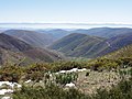
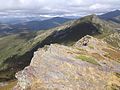
General view of the range
Highest point
Peak Cuiña
Elevation 1,987 m (6,519 ft)
Coordinates 42°46′05″N6°53′53″W / 42.76806°N 6.89806°W / 42.76806; -6.89806 Coordinates: 42°46′05″N6°53′53″W / 42.76806°N 6.89806°W / 42.76806; -6.89806
Dimensions
Length95 km (59 mi)NE/SW
Width32 km (20 mi)NW/SE
Geography
Relief Map of Spain.png
Red triangle with thick white border.svg
Serra dos Ancares
Location in Spain
Location Lugo Province, Galicia
León Province, Castile and León
Country Spain
Parent range Galician Massif
Geology
Orogeny Variscan orogeny
Age of rock Ordovician
Type of rock Slate, limestone, sandstone, quartzite

The Serra dos Ancares (Spanish: Sierra de los Ancares, also known as Sierra de Ancares) is a mountain range of the Galician Massif in north-west Spain, extending in a south-westerly direction from the western end of the Cantabrian Mountains in Asturias.

Contents

Geography

The range forms the boundary between the autonomous communities of Galicia and Castile and León. The highest point of the range is the Cuiña Peak at 1,987 metres (6,519 ft). Other notable peaks are Mustallar (1,935 m) and Miravalles (1,969 m). The smaller Serra do Courel lies south of this range, stretching parallel to it.

The main trees in the range are willow and European alder close to water courses, as well as chestnut, ash, common hazel, oak and common holly. Above 1,600 metres (5,200 ft) there is brushland with tree heath and juniper. [1]

This area of Spain contains many isolated rural communities that were largely cut off from the outside world until roads were built in the mid 20th century. The most significant element of the whole architecture of the area is the palloza or casa teito , stone buildings of ancient origin, with a circular or elliptical plan.

Ecology

Sierra de los Ancares is the name of a Site of Community Importance in the province of León. [2]

Os Ancares Lucenses y Montes de Cervantes, Navia y Becerrea was declared a UNESCO Biosphere Reserve in 2006. [3] [4] Los Ancares Leoneses is also a biosphere reserve.

See also

Related Research Articles

Sierra Madre Oriental

The Sierra Madre Oriental is a mountain range in northeastern Mexico. The Sierra Madre Oriental is part of the American Cordillera, a chain of mountain ranges (cordillera) that consists of an almost continuous sequence of mountain ranges that form the western "backbone" of North America, Central America, South America and Antarctica.

Sierra Nevada de Santa Marta Mountain range in northern Colombia

The Sierra Nevada de Santa Marta is an isolated mountain range in northern Colombia, separate from the Andes range that runs through the centre of the country. Reaching an altitude of 5,700 m (18,700 ft) just 42 km (26 mi) from the Caribbean coast, the Sierra Nevada is the highest coastal range in the tropics, and one of the highest coastal ranges in the world, being 250 metres (820 ft) shorter than the Saint Elias Mountains in Canada. The Sierra Nevada encompasses about 17,000 km2 (6,600 sq mi) and serves as the source of 36 rivers. The range is in the Departments of Magdalena, Cesar and La Guajira.

Sierra de la Laguna

The Sierra de la Laguna is a mountain range at the southern end of the Baja California Peninsula in Mexico, and is the southernmost range of the Peninsular Ranges System.

California Coast Ranges Mountain range

The Coast Ranges of California span 400 miles (644 km) from Del Norte or Humboldt County, California, south to Santa Barbara County. The other three coastal California mountain ranges are the Transverse Ranges, Peninsular Ranges and the Klamath Mountains.

Minho (river)

The Minho or Miño is the longest river in Galicia, sharing the border with Portugal, with a length of 340 kilometres (210 mi). By discharge, it is the fourth river of the Iberian peninsula, after the Douro, Ebro and Tagus.

Sierra Gorda

The Sierra Gorda is an ecological region centered on the northern third of the Mexican state of Querétaro and extending into the neighboring states of Guanajuato, Hidalgo and San Luis Potosí. Within Querétaro, the ecosystem extends from the center of the state starting in parts of San Joaquín and Cadereyta de Montes municipalities and covering all of the municipalities of Peñamiller, Pinal de Amoles, Jalpan de Serra, Landa de Matamoros and Arroyo Seco, for a total of 250 km2 of territory. The area is extremely rugged with high steep mountains and deep canyons. As part of the Huasteca Karst, it also contains many formations due to erosion of limestone, especially pit caves known locally as sótanos. The area is valued for its very wide diversity of plant and animal life, which is due to the various microenvironments created by the ruggedness of the terrain and wide variation in rainfall. This is due to the mountains’ blocking of moisture coming in from the Gulf of Mexico, which generally makes the east side fairly moist and the west semiarid scrub brush. Most of the region has been protected in two biosphere reserves, with the one centered in Querétaro established in 1997 and the one centered in Guanajuato established in 2007. The Sierra Gorda is considered to be the far west of the La Huasteca region culturally and it is home to the Franciscan Missions in the Sierra Gorda World Heritage Site.

Sierra de Guadarrama

The Sierra de Guadarrama is a mountain range forming the main eastern section of the Sistema Central, the system of mountain ranges along the centre of the Iberian Peninsula. It is located between the systems Sierra de Gredos in the province of Ávila, and Sierra de Ayllón in the province of Guadalajara.

Cervantes, Lugo

Cervantes is a municipality in the comarca of Os Ancares, in the province of Lugo, Galicia (Spain).

Os Ancares Comarca in Galicia, Spain

Os Ancares is a comarca in the Galician Province of Lugo. The overall population of this local region is 13,888 (2005). It is formed by the municipality of Candín with two slopes, Sil and Navia, and separated by the Ancares pass.

Los Ancares

Los Ancares is a district in northern Spain, which is noted for its unspoilt landscapes and ecological importance. The area takes its identity from the Sierra de los Ancares mountains which form a political and linguistic boundary between the autonomous communities of Galicia and Castile and León. The Spanish term Los Ancares Leoneses is sometimes used to refer to the zone on the Castile and León side of the sierra, which is in the basin of the river Sil. Os Ancares Lucenses is the corresponding term for the Galician side of the sierra: in Spanish, the name is Los Ancares.

Picos de Europa National Park

The Picos de Europa National Park is a National Park in the Picos de Europa mountain range, in northern Spain. It is within the boundaries of three autonomous communities, Asturias, Cantabria and Castile and León, which are represented on the body which runs the park. The park is also a popular destination for hikers and trekkers.

A Pontenova

A Pontenova is a municipality in the Spanish province of Lugo. It has a population of 3199 and an area of 136 km².

Taramundi Municipality in Asturias, Spain

Taramundi is a municipality in the Principality of Asturias, Spain. It neighbors on the north side with San Tirso de Abres and Vegadeo, on the east side with Villanueva de Oscos and Vegadeo, on the south side with Santa Eulalia de Oscos and A Pontenova (Lugo), and on the west side with Lugo.

Sistema Ibérico Major system of mountain ranges in Spain

The Iberian System, is one of the major systems of mountain ranges in Spain. It consists of a vast and complex area of mostly relatively high and rugged mountain chains and massifs located in the central region of the Iberian Peninsula, but reaching almost the Mediterranean coast in the Valencian Community in the east.

Under UNESCO’s Man and the Biosphere Programme, there are 302 biosphere reserves recognized as part of the World Network of Biosphere Reserves in Europe and North America. These are distributed across 36 countries in the region.

Sierra de la Culebra

The Sierra de la Culebra, Portuguese: Serra da Coroa, is a mountain range in Castile and León, northwest Spain, and northeastern Portugal. It lies 7 km south of Puebla de Sanabria in the comarcas of Aliste, Sanabria and La Carballeda, as well as Vinhais and Bragança municipalities in the District of Bragança. Its highest point is 1,243 metres (4,078 ft) high Peña Mira, located near Flechas, within Figueruela de Arriba municipal term; other important peaks are Miño Cuevo 1,211 metres (3,973 ft) and La Pedrizona 1,054 metres (3,458 ft).

Sierras de Cazorla, Segura y Las Villas Natural Park

Sierras de Cazorla, Segura y Las Villas Natural Park is a natural park in the eastern and northeastern part of the province of Jaén, Spain, established in 1986. With an area of 2,099.2 square kilometres (810.5 sq mi), it is the largest protected area in Spain and the second largest in Europe. It was declared a biosphere reserve by UNESCO in 1983 and also a Special Protection Area for migratory birds in 1988.

Geography of Galicia

The geography of Galicia (Spain) is characterized by the contrast between the low altitude coastal relief and, further inland, by the higher altitude of the Galician Massif which itself offers contrasts between the morphology of the high northern plains and the southern mountains and valleys.

Galician Massif

The Galician Massif, Spanish: Macizo Galaico, also known as Macizo Galaico-Leonés, is a system of mountain ranges in the northwestern corner of the Iberian Peninsula. It is located in Galicia with its southeastern end reaching into the provinces of Zamora and León of Castile and León. Its highest point is Pena Trevinca at 2,127 metres (6,978 ft). Another important peak is Cabeza de Manzaneda.

Intercontinental Biosphere Reserve of the Mediterranean

The Intercontinental Biosphere Reserve of the Mediterranean is the first of its type to be designated by the Man and the Biosphere Programme. It combines the Tingitane Peninsula in Morocco and the southern Iberian Peninsula of Andalusia. Both countries are located in a biogeographic region of deciduous forests and evergreen sclerophyllous scrub within the Mediterranean bioclimatic zone. The maritime area of the biosphere reserve is dominated by the Strait of Gibraltar, which links the two peninsulas. The reserve also encompasses natural and human communication routes between Africa and Europe.

References

  1. González Arias, Alejandro,Guía e rutas dos Ancares, Vigo: Editorial Galaxia, 1995, pp 13-14
  2. Sierra de los Ancares Archived 2011-09-06 at the Wayback Machine , Urugallo cantábrico website. According to this source, the SCI covers the same area as a regional hunting reserve.
  3. "Os Ancares..." UNESCO. Retrieved 19 July 2016.
  4. Os Ancares UNESCO-MAB Biosphere Reserve