Shady Grove, Tennessee | |
---|---|
Unincorporated community | |
Coordinates: 36°22′06″N86°08′15″W / 36.36833°N 86.13750°W Coordinates: 36°22′06″N86°08′15″W / 36.36833°N 86.13750°W | |
Country | United States |
State | Tennessee |
County | Trousdale |
Elevation | 499 ft (152 m) |
Time zone | Central (CST) (UTC-6) |
• Summer (DST) | CDT (UTC-5) |
Area code(s) | 615 |
GNIS feature ID | 1301157 [1] |
Shady Grove is an unincorporated community in Trousdale County, Tennessee, United States. Shady Grove is 2.2 miles (3.5 km) southeast of downtown Hartsville. [2] As Hartsville and Trousdale County form a consolidated city-county government, Shady Grove is under the jurisdiction of Hartsville.
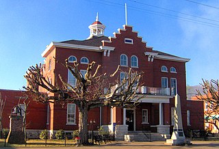
Trousdale County, also known as Hartsville/Trousdale County, As of the 2010 census, the population was 7,870. Its county seat is Hartsville, with which it shares a uniquely formed consolidated city-county government. With an area of just 117 square miles (300 km2), it is Tennessee's smallest county.
Tennessee is a state located in the southeastern region of the United States. Tennessee is the 36th largest and the 16th most populous of the 50 United States. Tennessee is bordered by Kentucky to the north, Virginia to the northeast, North Carolina to the east, Georgia, Alabama, and Mississippi to the south, Arkansas to the west, and Missouri to the northwest. The Appalachian Mountains dominate the eastern part of the state, and the Mississippi River forms the state's western border. Nashville is the state's capital and largest city, with a 2017 population of 667,560. Tennessee's second largest city is Memphis, which had a population of 652,236 in 2017.
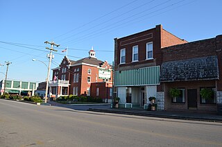
Hartsville is a town in Trousdale County, Tennessee, United States. It is the county seat of Trousdale County, with which it shares a consolidated city-county government. The population of Hartsville was 2,369 as of 2010.
John Martin was an American lawyer and politician from Hartsville, Tennessee. He represented Kansas in the United States Senate from 1893 until 1895.
Dixon Springs is an unincorporated community in Smith County, Tennessee, United States. The zip code is: 37057.
Shady Grove is an unincorporated community in Hickman County, Tennessee, United States. Shady Grove is located along Tennessee State Route 50 and the Duck River 11.25 miles (18.11 km) east-southeast of Centerville.
Shady Grove, Tennessee may refer to the following places in Tennessee:
Shady Grove is an unincorporated community in Putnam County, Tennessee, United States. Shady Grove is 10.2 miles (16.4 km) east-northeast of Cookeville.
Shady Grove is an unincorporated community in Hamilton County, Tennessee, United States. Shady Grove is located on the west bank of the Tennessee River 3.2 miles (5.1 km) north-northeast of Lakesite.
Shady Grove is an unincorporated community in Hardin County, Tennessee, United States. Shady Grove is located along Tennessee State Route 104 2.6 miles (4.2 km) west-northwest of Saltillo.
Shady Grove is an unincorporated community in White County, Tennessee, United States. Shady Grove is located along Tennessee State Route 136 6.4 miles (10.3 km) west-southwest of Sparta.
Shady Grove is an unincorporated community in Lincoln County, Tennessee, United States. Shady Grove is located on Tennessee State Route 121 13.7 miles (22.0 km) east-southeast of Fayetteville.
Shady Grove is an unincorporated community in Franklin County, Tennessee, United States. Shady Grove is located near the Elk River 10.7 miles (17.2 km) northeast of Winchester.
Shady Grove is an unincorporated community in Jackson County, Tennessee, United States. Shady Grove is located on Tennessee State Route 290 7.3 miles (11.7 km) south of Gainesboro.
Shady Grove is an unincorporated community in Sevier County, Tennessee, United States. Shady Grove is located along Tennessee State Route 454 5.2 miles (8.4 km) east of Pigeon Forge.
Shady Grove is an unincorporated community in Jefferson County, Tennessee, United States. Shady Grove is located along the French Broad River and Tennessee State Route 139 4.6 miles (7.4 km) southwest of Dandridge.
Shady Grove is an unincorporated community in Montgomery County, Tennessee, United States. Shady Grove is 10.7 miles (17.2 km) east-southeast of downtown Clarksville.
Shady Grove is an unincorporated community in Knox County, Tennessee, United States. Shady Grove is located near the Loudon County line in far southern Knox County, 3.9 miles (6.3 km) south of Farragut.
Shady Grove is a ghost town in Lawrence County, Tennessee, United States. Shady Grove was 8.2 miles (13.2 km) south-southeast of Lawrenceburg. It appeared on USGS maps as late as 1936.
State Route 260 (SR 260) is an east–west secondary highway that is located entirely in Trousdale County in Middle Tennessee. Its western terminus is located at a junction with US 231 near the Sumner County line, it and ends at SR 141 just north of Hartsville.
This Trousdale County, Tennessee geography–related article is a stub. You can help Wikipedia by expanding it. |