Shafter Lake, Texas

Last updated
Shafter Lake
Shafter Lake Andrews County Texas.jpg
Shafter Lake
Relief map of Texas.png
Red pog.svg
Shafter Lake
Location of Shafter Lake in Texas
Usa edcp relief location map.png
Red pog.svg
Shafter Lake
Shafter Lake (the United States)
Coordinates: 32°24′16″N102°39′58″W / 32.40444°N 102.66611°W / 32.40444; -102.66611 [1]
CountryFlag of the United States.svg  United States
StateFlag of Texas.svg  Texas
County Andrews
Region Llano Estacado
Established1907
Founded byJ.F. Bustin
Elevation
[1]
3,166 ft (965 m)
Time zone UTC-6 (CST)

Shafter Lake is a ghost town in Andrews County, Texas, United States, located four miles west of U.S. Route 385 on the shores of a large salt playa named Shafter Lake. It became a ghost town after the town lost an election for county seat of Andrews County.

Contents

History

Located in north central Andrews County, the town developed as part of the early 20th-century land boom in West Texas. A local businessman, J.F. Bustin, convinced the firm Pierce and Powers to found a town on the north shore of a shallow alkali playa lake lying fifty feet below the elevation of the surrounding land. The town's original name was Salt Lake. Later it and the lake were renamed after the army officer who had discovered the lake in 1875, William R. Shafter. Shafter Lake was platted in August 1907 and by early September had become a busy village. [2]

The early years of the town were its most successful. Through 1910, the village continued to grow and prosper. One of the most ardent supporters of Shafter Lake was the editor of the local paper, the Shafter Lake Herald. James T. Cumley's editorials were sprinkled with nothing but praise for the upstart community. His edits boasted of the area's rich soil and the recreation potential of Shafter Lake. He also published some of the favorable feedback that visitors to Shafter Lake had uttered. Cumley distributed thousands of copies of the Herald across America and especially throughout the Midwest. [2]

Scarcely a month after the town was platted, wagon trains of freight could be observed leaving for Lubbock. Still others could be seen hauling in lumber from Midland for new home construction in Shafter Lake. Other wagon trains and their requisite wagoneers would stop and rest in the village before resuming their journey. Within two months, the town had over 50 new homes and a school was preparing to open. The year of the town's founding saw the opening of the Shafter Lake post office; its first postmaster was Bert M. Irwin. Rumors abounded during 1907 of the proposed Llano Estacado, Mexico and Gulf Railroad between Dalhart and Chihuahua City, Mexico with headquarters in Shafter Lake. [3] Surveyors did arrive in Shafter Lake and construction was scheduled to begin in 1909, but only one mile was ever graded. [2]

Shafter Lake reached its zenith when its population reached 500 in 1910, but it began to decline soon afterward. It had a bank, three churches, a school, a general store, a blacksmith and two hotels. [2]

Decline

An intertown feud developed between Shafter Lake and nearby Andrews for the title of county seat. In June, a controversial election was held. Some of the controversy stemmed from both towns' efforts to acquire eligible voters. The election went off regardless, and Shafter Lake lost to Andrews by a narrow margin. After the loss, the town declined rapidly. By 1912, most of Shafter Lake's residents had moved to Andrews. In 1980, only a dilapidated cemetery remained. Its twelve graves and one original building are all that remain of a once bustling West Texas boom town. Today, at the site one can find a ranch operation run by the descendants of the town's first postmaster. [2]

See also

Related Research Articles

<span class="mw-page-title-main">Morton, Texas</span> City in Texas, United States

Morton is a city in and the county seat of Cochran County, Texas, United States. As of the 2020 census, the city population was 1,690. This represented a 15.8% population decline since the 2010 Census.

<span class="mw-page-title-main">Levelland, Texas</span> City in Texas, United States

Levelland is a city and the county seat of Hockley County, Texas, United States. As of the 2020 census, the city population was 12,652, down from 13,542 at the 2010 census. It is located on the Llano Estacado, 30 miles (48 km) west of Lubbock. Major industries include cotton farming and petroleum production. It is the home of South Plains College. Levelland is the principal city of the Levelland micropolitan statistical area, which includes all of Hockley County and part of the larger Lubbock–Levelland combined statistical area. Levelland was so named on account of the flat land at the town site.

<span class="mw-page-title-main">Smyer, Texas</span> Town in Texas, United States

Smyer is a town in Hockley County, Texas, United States. It is located near the Old Spade Ranch House where the current ranch headquarters is. The population was 474 at the 2010 census. in 2023, the population declined to 433.

New Deal is a U.S. town in Lubbock County, Texas. The population was 794 at the 2010 census. It is part of the Lubbock Metropolitan Statistical Area and the Llano Estacado region.

<span class="mw-page-title-main">Llano Estacado</span> Southwestern United States in New Mexico and Texas

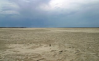
The Llano Estacado, sometimes translated into English as the Staked Plains, is a region in the Southwestern United States that encompasses parts of eastern New Mexico and northwestern Texas. One of the largest mesas or tablelands on the North American continent, the elevation rises from 3,000 feet (900 m) in the southeast to over 5,000 feet (1,500 m) in the northwest, sloping almost uniformly at about 10 feet per mile (2 m/km).

<span class="mw-page-title-main">Grulla National Wildlife Refuge</span> National Wildlife Refuge near Portales, New Mexico

Grulla National Wildlife Refuge is located primarily in eastern New Mexico in Roosevelt County, southwest of the intersection of State Highway 88 and the Texas - New Mexico border about 25 miles southeast of Portales, New Mexico and southeast of the tiny community of Arch. A very small part of the refuge extends eastward into western Bailey County, Texas.

<span class="mw-page-title-main">West Texas</span> Region in Texas, United States

West Texas is a loosely defined region in the U.S. state of Texas, generally encompassing the arid and semiarid lands west of a line drawn between the cities of Wichita Falls, Abilene, and Del Rio.

<span class="mw-page-title-main">South Plains</span> Region in Texas, United States

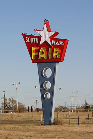
The South Plains is a region in northwest Texas, consisting of 24 counties. The main crop is cotton.

<span class="mw-page-title-main">Caprock Escarpment</span> Geographical transition in Texas and New Mexico

The Caprock Escarpment is a term used in West Texas and Eastern New Mexico to describe the geographical transition point between the level High Plains of the Llano Estacado and the surrounding rolling terrain.

<span class="mw-page-title-main">Geography of Texas</span> Geographical features of Texas

The geography of Texas is diverse and large. Occupying about 7% of the total water and land area of the U.S., it is the second largest state after Alaska, and is the southernmost part of the Great Plains, which end in the south against the folded Sierra Madre Oriental of Mexico. Texas is in the South Central United States of America, and is considered to form part of the U.S. South and also part of the U.S. Southwest.

Justiceburg is an unincorporated community in Garza County, Texas, United States. It is located along the Double Mountain Fork Brazos River, 15 miles (24 km) southeast of the county seat, Post.

<span class="mw-page-title-main">Rath City, Texas</span> Ghost Town in Texas, United States

Rath City was a frontier town that existed for fewer than five years, and is now a ghost town. The town was located on the Double Mountain Fork Brazos River, 14 miles northwest of Hamlin in southern Stonewall County, Texas, United States.

<span class="mw-page-title-main">Southland, Texas</span> Unincorporated community in Texas, United States

Southland is an unincorporated community in Garza County, Texas, United States. It lies along the eastern edge of the Llano Estacado on U.S. Route 84, twenty miles northwest of Post.

<span class="mw-page-title-main">Yellow House Draw</span> River in the United States of America

Yellow House Draw is an ephemeral watercourse about 236 km (147 mi) long, heading about 20 km (12 mi) southwest of Melrose, New Mexico, and tending generally east-southeastward across the Llano Estacado to the city of Lubbock, where it joins Blackwater Draw to form Yellow House Canyon at the head of the North Fork Double Mountain Fork Brazos River. It stretches across Roosevelt, Curry, Bailey, Cochran, Hockley, and Lubbock Counties of eastern New Mexico and West Texas, and drains an area of 9,790 km2 (3,780 sq mi).

<span class="mw-page-title-main">Bula, Texas</span> Unincorporated community in Texas, United States

Bula is an unincorporated community in Bailey County, Texas, United States. According to the Handbook of Texas, the community had a population of 35 in 2000.

<span class="mw-page-title-main">North Fork Double Mountain Fork Brazos River</span> River in Texas, United States

The North Fork Double Mountain Fork Brazos River is an intermittent stream about 75 mi (121 km) long, heading at the junction of Blackwater Draw and Yellow House Draw in the city of Lubbock, flowing generally southeastward to its mouth on the Double Mountain Fork Brazos River in western Kent County. It crosses portions of Lubbock, Crosby, Garza, and Kent counties in West Texas.

<span class="mw-page-title-main">Estacado, Texas</span> Ghost town in Texas, United States

Estacado is a ghost town in Crosby and Lubbock Counties in the U.S. state of Texas. Located along Farm to Market Road 1527, it was established in 1879 as a Religious Society of Friends (Quaker) colony by Paris Cox and originally named Maryetta after his wife. In 1886, it became the first government seat of Crosby County. In 1936, Recorded Texas Historic Landmark number 4779 was designated to commemorate the founding of Estacado.

<span class="mw-page-title-main">Becton, Texas</span> Unincorporated community in Texas, United States

Becton is an unincorporated community in northeastern Lubbock County, Texas, United States, approximately 18 mi (29 km) northeast of Lubbock. This small rural community lies on the high plains of the Llano Estacado in West Texas.

<span class="mw-page-title-main">Salt Fork Brazos River</span> River

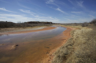
The Salt Fork Brazos River is a braided, highly intermittent stream about 150 mi (240 km) long, heading along the edge of the Llano Estacado about 26 mi (42 km) east-southeast of Lubbock, Texas. From its source, it flows generally east-southeastward to join the Double Mountain Fork to form the Brazos River about 18 mi (29 km) west-northwest of Haskell, Texas. The Salt Fork stretches across portions of Crosby, Garza, Kent, and Stonewall counties of West Texas.

<span class="mw-page-title-main">Needmore, Terry County, Texas</span> Unincorporated community in Texas, United States

Needmore is a small unincorporated community in north central Terry County, Texas, United States.

References

  1. 1 2 "Shafter Lake". Geographic Names Information System . United States Geological Survey, United States Department of the Interior.
  2. 1 2 3 4 5 Carlson, Paul H. Shafter Lake, Texas, Handbook of Texas Online, University of North Texas at Denton.
  3. Carlson, Paul (September 10, 2016). "Caprock Chronicles: Llano Estacado, Mexico and Gulf Railroad just a pipedream". Lubbock Avalanche-Journal . Lubbock, Texas . Retrieved March 17, 2024.