Muktainagar is a town in Jalgaon district, Maharashtra, India. It is the administrative headquarter of its eponymous taluka. It is located in North Maharashtra region.
Nilanga is a town with a municipal council in Latur District in the Indian state of Maharashtra. It is also the headquarters for Nilanga Taluka. It is the Taluka Headquarter.

Chaukori is a hill station in the Pithoragarh district set among the lofty peaks of the western Himalayan Range in the Kumaon Division of Uttarakhand, India. To its north is Tibet and to its south is Terai. The Mahakali River, running along its eastern boundary, forms the Indo-Nepal international border. This place has become a prominent tourist place and from here a wide and picturesque view of Himalayan range can be viewed. The golden yellow colour of sun rays falling on the Himalayan range in the morning time is really worth seeing. There are cottages available here where one can stay and enjoy the serene surroundings. Tourists coming to this place generally also visit the nearby tourist places like Patal Bhuvaneshwar, Kausani, Bageshwar and Almora.
Peth or Peint is the smallest tehsil of Nashik subdivision of Nashik district in Maharashtra, India. It belongs to Northern Maharashtra region. It belongs to Nashik Division. Peth is a Taluka headquarter. It is located 54 km to the West of Nashik District headquarters. It is also called as Peint. Pin code of Peth is 422208 and postal head office is Peth.
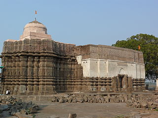
Kavathe-Mahankal is a tehsil in Miraj subdivision of Sangli district in the Indian state of Maharashtra. This is famous for Mahankali Devi temple and Mallikarjun temple. There is also a sugar factory, named after the same Goddess Mahankali sugar factory.
Mullipallam is a panchayat village in Vadipatti Taluka of Madurai district, Tamil Nadu, India, with a total of 2173 families residing.
Gothe village is located in Jamakhandi taluka of Bagalkot district in Karnataka, India. It is situated 37 km away from sub-district headquarter Jamakhandi and 117 km away from district headquarter Bagalkot. Vijayapura is the nearest city to Gothe which is approximately 36 km away.
Solapur South Taluka is one of the 11 tehsils of Solapur District in the Indian state of Maharashtra. This tehsil is located in the southeastern side of district and is bordered by Osmanabad District to the northeast, North Solapur and Mohol Taluka to the north, Akkalkot Taluka to the southeast, Karnataka's Kalaburagi district to the south, and Mangalvedhe Taluka to the west. The tehsil headquarters is located at Solapur, which is also the district headquarters and its largest city. Mandrup, Kumbhari, Valasang, Musti and Boramani are the biggest villages in south Solapur.
Madlur is a village in the Belgaum district of Karnataka State, India. The village is famous for its history and its also called Siddhabhoomi. The place was once ruled by the Chalukyas. The ancient village is rich with the architecture of the Chalukyas. The Historical name of the place is Shreerangapur. Shree Shiddeshwar temple and Koranar Bhavi are the major attractions. Other major attractions are Marakumb Kola and lake Maagani.

Barshi Taluka is one of the 11 talukas of Solapur District in the Indian state of Maharashtra. This tehsil occupies the Northeast corner of the district and is bordered by Osmanabad District to the north and east, Madha Taluka to the west, Mohol Taluka to the southwest and North Solapur Taluka to the south. The tehsil headquarters is located at Barshi, which is also the largest city in the tehsil.
Manakawad is a village in Dharwad district of Karnataka, India.
Betawad is a village in Sindkheda Taluka, Dhule District of Maharashtra State, India. It belongs to the Khandesh, the Northern Maharashtra regional and Nashik Division.
Khadaura is a village located near to the deosar town, and 45 km away from the district headquarter.
Dadegaon is a village in Ashti tahsil of Beed District in Marathwada region of Maharashtra state, India.
Manwath Road is a village in Manwath taluka of Parbhani district of Indian state of Maharashtra. Village is mainly known for being a major railway station on Nanded-Aurangabad rail route. Station code of Manwath road is MVO. It is 8 km away from taluka headquarter Manwath.
Wanegaon is a village in Nanded taluka of Nanded district of the Indian state of Maharashtra. It is also a railway station on the Nanded-Aurangabad route. The village is 3 kilometres (1.9 mi) away from Nanded Airport.

Laul, also known as Sant Shri Kurmadas Maharaj Village, is a village located in Madha Taluka of Solapur District in the State of Maharashtra, in India. It belongs to the Pune Division. It is located 81 km towards west from District headquarter Solapur. It is situated from Kurduvadi Junction(6 km). The village is located at about 380 km from the state capital, Mumbai. Kurdu (5 km), Ghatane (6 km), Ujani Madha (6 km), Padsali (7 km), Ambad (Te) (7 km) are the nearby Villages to Laul. Laul is surrounded by Paranda Taluka towards North, Mohol Taluka towards East, Barshi Taluka towards East, Indapur Taluka towards west. Pandharpur, Kurduvadi, Solapur, Osmanabad are the nearby Cities to Laul. The village follows the Panchayati raj system. Also has a railway track, which used to travel by few people.
Aremallapur is a village in the southern state of Karnataka, India. It is located in the Ranebennur taluk of Haveri district in Karnataka.
Subhanpur village is located in Kashi Chak Tehsil of Nawada district in Bihar, India. It is situated 6 km away from sub-district headquarter Kashi Chak and 40 km away from the district headquarter Nawada. As per 2009 stats, Subhanpur village is itself a gram panchayat. According to 2011 census information the location code or village code of Subhanpur village is 257666.

Mokar is a Village located in Sasaram tehsil of Rohtas district in Bihar, India. It is situated 5 km away from Sasaram, which is both district & sub-district headquarter of Mokar village. As per 2009 stats, Mokar village is also a gram panchayat.

