Shirdi is a city and pilgrimage site in the Indian state of Maharashtra. Shirdi is home to 19th century Indian satguru Sai Baba's samadhi mandir. It is located in the Rahata taluka of Ahmednagar District. It is accessible via the Ahmednagar–Malegaon State Highway No.10, approximately 83 km (52 mi) from Ahmednagar and 15 km (9.3 mi) from Kopargaon. It is located 185 km (115 mi) east of the Ahmednagar–Manmad road. Shri Saibaba Sansthan Trust is located in Shirdi.
Puntamba is a market town situated on the banks of the Godavari River in Rahata taluka, Ahmednagar District in the state of Maharashtra in India. The village contains the 14th and the final resting place of the sage Changdev. The town is known for old temples and traditional schools that specialize in study of the Hindu scriptures or the Vedas.
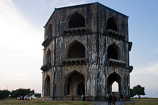
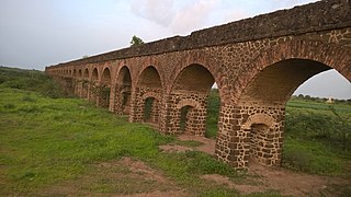
Ahmednagar district is the largest district of Maharashtra state in western India. The historical Ahmednagar city is the headquarters of the district. Ahmednagar and Sangamner are the largest cities in the district. It was the seat of the Ahmednagar Sultanate of late medieval period. This district is known for the towns of Shirdi associated with Sai Baba, Meherabad associated with Meher Baba, Shani Shinganapur with Shanidev, and Devgad with Lord Dattatreya. Ahmednagar district is part of Nashik Division. The district is bordered by Aurangabad district to the northeast, Nashik district to the northwest, Thane and Pune districts to the southwest, Solapur district to the south and Beed district to the southeast.
State Highway 10, commonly referred to as MH SH 10, is a normal state highway that runs south through Pune, Ahmednagar, Nashik and Dhule districts in the state of Maharashtra, India. This state highway touches the cities of Dondaicha, Shevade, Mehergaon, Kusumbe, Malegaon, Manmad, Yeola, Kopargaon, Shirdi Rahata, Rahuri, Ahmednagar, Kashti, and Daund.
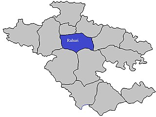
Rahuri taluka, is a taluka in the Shrirampur subdivision of the Ahmednagar district in Maharashtra, western India.
Pimpalwadi is a village in Rahata taluka of Ahmednagar district in state of Maharashtra, This village famous for so many Brisk factories. Pimpalwadi village has two schools, Z.P. Govt. Primary School and CSMV Senior Secondary school. For upper education students have to go Shirdi, Kopargaon, Rahata or loni. Out of Maharashtra Largest brisk supplier live in this village. Yearly turn over is near about 5-6 Cr rupis.
Sawali Vihir Budruk is a village in Rahata taluka of Ahmednagar district in state of Maharashtra of India.
Wakadi is a village in Rahata taluka of Ahmednagar district in Indian state of Maharashtra. It has a temple dedicated to the Hindu deity Khandoba.It has a higher secondary school named 'shri Laxmi Narayan vidyalay' located in mid of town.
Chitali, is a village in Rahata taluka of Ahmednagar district in Indian state of Maharashtra.
Jalgaon is a village in Rahata taluka of Ahmednagar district in Indian state of Maharashtra.
Khadkewake is a village in Rahata taluka of Ahmednagar district in the Indian state of Maharashtra.
Bhagwatipur is a village in Rahata taluka of Ahmednagar district in the Indian state of Maharashtra.
Korhale is a village in Rahata taluka of Ahmednagar district in the Indian state of Maharashtra. It is located in the north-west region of Rahata taluka.
Tisgaon is a village in Rahata taluka of Ahmednagar district in the Indian state of Maharashtra.
Pimpri Nirmal is a village in Rahata taluka of Ahmednagar district in the Indian state of Maharashtra. Literacy rate is almost 100 percent.
Pimpri Lokai is a village in Rahata taluka of Ahmednagar district in the Indian state of Maharashtra.
Pimplas is a village in Rahata taluka of Ahmednagar district in the Indian state of Maharashtra. It is located close to Rahata.
Pathare Budruk is a village in Rahata taluka of Ahmednagar district in the Indian state of Maharashtra. It is located on banks of Pravara River.
Dahigaon Korhale is a village in Rahata taluka of Ahmednagar district in the Indian state of Maharashtra. It is located near Rahata city.