
Sumay-ye Beradust District is a district (bakhsh) in Urmia County, West Azerbaijan Province, Iran. It is west of Lake Urmia, between the city of Urmia and the border with Turkey. Its administrative seat is the town of Serow. At the 2006 census, its population was 39,802, in 6,760 families. The District has one city: Serow. The District has three rural districts (dehestan): Beradust Rural District, Sumay-ye Jonubi Rural District, and Sumay-ye Shomali Rural District.
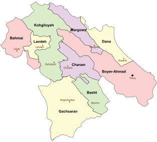
Bahmai County is a county in Kohgiluyeh and Boyer-Ahmad Province in Iran. The capital of the county is Likak. At the 2006 census, the county's population was 35,067, in 6,583 families. The county was subdivided into two districts: the Central District and Bahmai-ye Garmsiri District. The district has one city: Likak.
Sarfaryab District is a district (bakhsh) in Charam County, Kohgiluyeh and Boyer-Ahmad Province, Iran. At the 2006 census, its population was 11,249, in 2,331 families. The District has one city Sarfaryab. The District has two rural districts (dehestan): Poshteh-ye Zilayi Rural District and Sarfaryab Rural District.
Simmineh District is a district (bakhsh) in Bukan County, West Azerbaijan Province, Iran. At the 2006 census, its population was 25,401, in 4,788 families. The District has one city: Simmineh. The District has three rural districts (dehestan): Akhtachi-ye Mahali Rural District, Akhtachi-ye Sharqi Rural District, and Behi Dehbokri Rural District.

Shalah Kosh is a village in Ghaleh Rural District, in the Zagros District of Chardavol County, Ilam Province, Iran. At the 2006 census, its population was 965, in 172 families. The village is the capital of Ghaleh Rural District, established on June 30, 2013.
Sholeh-ye Zardu is a village in Sardasht Rural District, Zeydun District, Behbahan County, Khuzestan Province, Iran. At the 2006 census, its population was 274, in 59 families.
Azadi is a village in Howmeh-ye Gharbi Rural District, in the Central District of Dasht-e Azadegan County, Khuzestan Province, Iran. At the 2006 census, its population was 45, in 6 families.
Sar Qaleh-ye Khalijan is a village in Holayjan Rural District, in the Central District of Izeh County, Khuzestan Province, Iran. At the 2006 census, its population was 416, in 74 families.
Salami is a village in Howmeh-ye Sharqi Rural District, in the Central District of Ramhormoz County, Khuzestan Province, Iran. At the 2006 census, its population was 78, in 12 families.
Ahsham-e Ahmad is a village in Howmeh Rural District, in the Central District of Deyr County, Bushehr Province, Iran. At the 2006 census, its population was 59, in 11 families.
Berkeh-ye Soflin is a village in Howmeh Rural District, in the Central District of Bandar Lengeh County, Hormozgan Province, Iran. At the 2006 census, its population was 429, in 93 families.
Jamalvi-ye Jadid is a village in Zayandeh Rud-e Jonubi Rural District, Ben County, Chaharmahal and Bakhtiari Province, Iran. At the 2006 census, its population was 57, in 13 families.
Zarrik is a village in Qareh Poshtelu-e Bala Rural District, Qareh Poshtelu District, Zanjan County, Zanjan Province, Iran. At the 2006 census, its population was 19, in 5 families.
Sholeh Boran is a village in Bozkosh Rural District, in the Central District of Ahar County, East Azerbaijan Province, Iran. At the 2006 census, its population was 583, in 103 families.
Abbas Kola is a village in Firuzjah Rural District, Bandpey-ye Sharqi District, Babol County, Mazandaran Province, Iran. At the 2006 census, its population was 44, in 11 families.
Boneh Zemin is a village in Sajjadrud Rural District, Bandpey-ye Sharqi District, Babol County, Mazandaran Province, Iran. At the 2006 census, its existence was noted, but its population was not reported.
Mazraeh-ye Siah Daneh is a village in Alamarvdasht Rural District, Alamarvdasht District, Lamerd County, Fars Province, Iran. At the 2006 census, its existence was noted, but its population was not reported.
Mazraeh-ye Seyf ol Din is a village in Alamarvdasht Rural District, Alamarvdasht District, Lamerd County, Fars Province, Iran. At the 2006 census, its population was 19, in 5 families.
Hormud is a village in Sahray-ye Bagh Rural District, Sahray-ye Bagh District, Larestan County, Fars Province, Iran. At the 2006 census, its population was 563, in 121 families.

