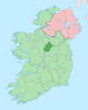
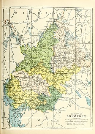
County Longford is a county in Ireland. It is in the province of Leinster. It is named after the town of Longford. Longford County Council is the local authority for the county. The population of the county was 46,634 at the 2022 census. The county is based on the historic Gaelic territory of Annaly (Anghaile), formerly known as Teffia (Teathbha).

Longford is the county town of County Longford in Ireland. It had a population of 10,952 at the 2022 census. It is the biggest town in the county and about one third of the county's population lives there. Longford lies at the meeting of Ireland's N4 and N5 National Primary Route roads, which means that traffic travelling between Dublin and County Mayo, or north County Roscommon passes around the town. Longford railway station, on the Dublin-Sligo line, is used heavily by commuters.
South Longford was a parliamentary constituency in Ireland, which returned one Member of Parliament (MP) to the House of Commons of the Parliament of the United Kingdom.
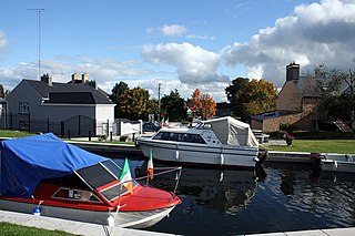
Abbeyshrule is a village in south-east County Longford, Ireland, on the River Inny and the Royal Canal. The village is in a civil parish of the same name.

Moydow is a village on the outskirts of Longford town in County Longford, Ireland.

The Diocese of Ardagh and Clonmacnoise is a Latin Church diocese of the Catholic Church in Ireland.

The River Inny is a river within the Shannon River Basin in Ireland. It is 88.5 kilometres (55.0 mi) in length, and has a number of lakes along its course.

The R399 road is a short regional road in Ireland linking the N55 to the R393; all in County Longford.

Abbeyshrule Aerodrome is a small private airfield located in south-east County Longford, Ireland, near the village of Abbeyshrule, 12 NM west north-west of Mullingar and beside the River Inny and the Royal Canal.

Moygoish is a barony in north County Westmeath, in Ireland, formed by 1672. It is bordered by County Longford to the west and four other Westmeath baronies: Corkaree, Fore, Moyashel and Magheradernon and Rathconrath to the south–west.

Farbill is a barony in east County Westmeath, in Ireland. It was formed by 1672. It is bordered by County Meath to the south and east and three other baronies: Fartullagh, Moyashel and Magheradernon and Delvin. The largest centre of population in the barony is the town of Kinnegad.
Kilmacnevan is a civil parish in County Westmeath, Ireland. It is located about 15.81 kilometres (10 mi) west–north–west of Mullingar.
Moydow is a barony in County Longford, Ireland.
Rathcline is a barony in County Longford, Ireland.
Noughaval is a civil parish which spans the counties of Longford and Westmeath in Ireland. It is located about 30.02 kilometres (19 mi) west of Mullingar and 21.61 kilometres (13 mi) south of Longford.
Kilkenny West is a civil parish in County Westmeath, Ireland. It is located about 33.81 kilometres (21 mi) west of Mullingar.
Piercetown is a civil parish in County Westmeath, Ireland. It is located about 18.69 kilometres (12 mi) west–north–west of Mullingar. It was formerly often spelled Pierstown.
The Conmaicne Cúile or Conmaicne Cuile Tolad were an early people of Ireland. Their tuath comprised, at minimum, most of the barony of Kilmaine, in County Mayo.
Cath Sruthair was an aggression by the Ui Briuin against a branch of the Conmaicne in 766 AD. The battle site was probably Shrule in County Mayo.