Ohio County is a county located in the Northern Panhandle of the U.S. state of West Virginia. As of the 2010 census, the population was 44,443. Its county seat is Wheeling. The county was formed in 1776 from the District of West Augusta, Virginia. It was named for the Ohio River, which forms its western boundary. West Liberty was designated as the county seat in 1777, serving to 1797.
Hancock County is a county in the U.S. state of West Virginia. As of the 2010 census, the population was 30,676. Its county seat is New Cumberland. The county was created from Brooke County in 1848 and named for John Hancock, first signer of the Declaration of Independence. Hancock County is the northernmost point in both West Virginia and, by some definitions, the Southern United States; being at the tip of the state's Northern Panhandle.

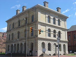
Brooke County is a county in the Northern Panhandle of the U.S. state of West Virginia. As of the 2010 census, the population was 24,069. Its county seat is Wellsburg. The county was created in 1797 from part of Ohio County and named in honor of Robert Brooke, Governor of Virginia from 1794 to 1796.

In the history of the United States, a slave state was a U.S. state in which the practice of slavery was legal, and a free state was one in which slavery was prohibited or being legally phased out. Historically, in the 17th century, slavery was established in a number of English overseas possessions. In the 18th century, it existed in all the British colonies of North America. In the Thirteen Colonies, the distinction between slave and free states began during the American Revolutionary War (1775–1783). Slavery became a divisive issue and was the primary cause of the American Civil War. The Thirteenth Amendment to the United States Constitution, ratified in 1865, abolished slavery throughout the United States, and the distinction between free and slave states ended.

Bethany College is a private, liberal arts college in Bethany, West Virginia, United States. Founded in 1840 by Alexander Campbell of the Restoration Movement, who gained support by the Virginia legislature, Bethany College was the first institution of higher education in what is now West Virginia.

These are tables of congressional delegations from West Virginia to the United States House of Representatives and the United States Senate.

Bluefield State College (BSC) is a historically black college located in Bluefield, West Virginia, United States. It is a part of West Virginia's public education system and offers baccalaureate and associate degrees. It is the only non-residential four-year college in the state system. Bluefield State College is a member school of the Thurgood Marshall College Fund.

Thomas Sim Lee was an American planter and statesman of Frederick County, Maryland. Although not a signatory to the Declaration of Independence, the Articles of Confederation or the US Constitution, he was an important participant in the process of their creation. Thomas Sim Lee was the second State Governor of Maryland, serving twice, from 1779 to 1783 and again from 1792 to 1794. Thomas Sim Lee also served as a delegate of Maryland in the Congress of the Confederation in 1783 and was a member of the House of Delegates in 1787. He worked closely with many of the Founding fathers and played himself an important part in the birth of his state and the nation.
USS Sims (DE-154/APD-50), a Buckley-class destroyer escort of the United States Navy, was named in honor of Admiral William Sowden Sims (1858–1936), who pushed for modernization of the navy. She is the second ship in the United States Navy to be named USS Sims.
Alexander Dromgoole Sims was a U.S. Representative from South Carolina.

The Devonian Hamilton Group is a mapped bedrock unit in the United States. The unit is present in New York, Pennsylvania, Maryland, Ohio and West Virginia. In Virginia, it is known as the laterally equivalent Millboro Shale. The group is named for the village of Hamilton, New York. Details of stratigraphic nomenclature for this unit as used by the U.S. Geological Survey are available on-line from the National Geologic Map Database. These rocks are the oldest strata of the Devonian gas shale sequence.
The Devonian Mahantango Formation is a mapped bedrock unit in Pennsylvania, West Virginia, and Maryland. It is named for the North branch of the Mahantango Creek in Perry and Juniata counties in Pennsylvania. It is a member of the Hamilton Group, along with the underlying the Marcellus Formation Shale. South of Tuscarora Mountain in south central Pennsylvania, the lower members of this unit were also mapped as the Montebello Formation. Details of the type section and of stratigraphic nomenclature for this unit as used by the U.S. Geological Survey are available on-line at the National Geologic Map Database.

State governments of the United States are institutional units in the United States exercising some of the functions of government at a level below that of the federal government. Each state's government holds fiscal, legislative and executive authority over a defined geographic territory. The United States comprises 50 states: 13 that were already part of the United States at the time the present Constitution took effect in 1789, plus 37 that have been admitted since by Congress as authorized under Article IV, Section 3 of the Constitution.

In the United States, a state is a constituent political entity, of which there are currently 50. Bound together in a political union, each state holds governmental jurisdiction over a separate and defined geographic territory and shares its sovereignty with the federal government. Due to this shared sovereignty, Americans are citizens both of the federal republic and of the state in which they reside. State citizenship and residency are flexible, and no government approval is required to move between states, except for persons restricted by certain types of court orders. Four states use the term commonwealth rather than state in their full official names.

Stella Bloomberg Hackel Sims was Director of the United States Mint from 1977 to 1981.


