
Bharathidasan University (BDU) is a university in the city of Tiruchirapalli, Tamil Nadu, India. It is located on Tiruchirappalli-Pudukkottai National Highway 336. It has affiliated colleges in the districts of Karur, Nagapattinam, Perambalur, Pudukkottai, district, Tiruvarur and Tiruchirapalli. It is a recognised university, supported by the University Grants Commission of India. All major faculties of science and arts are represented

Tiruchirapalli District is located along the Kaveri River in Tamil Nadu, India. The main town in Tiruchirappalli District is the city of Tiruchirappalli, also known as Trichy. During the British Raj, Tiruchirappalli was known as Trichinopoly, and was a district of the Madras Presidency; it was renamed upon India's declaration of independence in 1947. As of 2011, the district had a population of 2,722,290 with 1,013 females for every 1,000 males.

Anna University Tiruchirappalli otherwise Anna University Chennai – Regional Office,BIT CAMPUS, Tiruchirappalli (AUC-ROT), erstwhile Anna University of Technology, Tiruchirappalli, is a technical university department of Anna University, It is located on Tiruchirappalli–Pudukkottai National Highway 336, Tamil Nadu, India. It was established on 1999 as a part of Bharathidasan University with five departments viz., Bio-Technology, Petrochemical Technology, Information Technology and Pharmaceutical Technology. In 2007, due to management constrains Anna University was split into six universities, namely: Anna University, Chennai; Anna University, Chennai – Taramani Campus; Anna University Chennai - Regional Office, Coimbatore; Anna University Chennai - Regional Office, Madurai; Anna University Chennai – Regional Office, Tiruchirappalli; Anna University Chennai - Regional Office, Tirunelveli. Government acquired this campus from Bharathidasan University and renamed it as Anna University Tiruchirappalli in 2007.The university is an accredited university with powers to grant affiliations to colleges and universities conducting graduate and post graduate studies, as well as diploma courses, and is so recognized by the UGC.
Tiruchirappalli is a Lok Sabha constituency in Tamil Nadu.

Tiruchirappalli Junction railway station(TPJ) is a junction station in Tiruchirappalli, Tamil Nadu. It serves as the headquarters for Tiruchirappalli railway division of the Southern Railway Zone. The station code is TPJ, used for official purposes. Daily approximately 60,000 passengers are using this Tiruchchirappalli Junction. TPJ is the only railway station in southern railway to host Diesel-electric Multiple Unit (DEMU) shed.

The Tiruchirappalli City Municipal Corporation is the municipal corporation which looks after the city administration of Tiruchirappalli in Tamil Nadu, India. It consists of a legislative and an executive body. The legislative body is headed by the city mayor while the executive body is headed by a Chief Commissioner.
Ariyamangalam is one of the four zones of the Tiruchirappalli Municipal Corporation. One of SIDCO's two Tiruchirappalli-based industrial estates is located in Ariyamangalam. The estate extends over an area of 17.64 acres (71,400 m2).
K. K. Nagar or Kalaignar Karunanidhi Nagar is a residential part of Tiruchirappalli City in Tamil Nadu, India. The K.K. Nagar neighbourhood is near the Tiruchirappalli International Airport, and is the most densely populated ward in the city and also the most populous ward in the city of Tiruchirapalli. It is a part of T.C.C since 1994.
The Tiruchirappalli Cantonment is a residential neighbourhood in the city of Tiruchirappalli. It originated as a cantonment of the Madras Regiment in the 18th century. Most of the hotels and restaurants and the main tourist office and post office of Tiruchirappalli are located here. The Tiruchirappalli Junction is also located in the cantonment area.

Tiruchirappalli is believed to be of great antiquity and has been ruled by the Early Cholas,Mutharaiyars Early Pandyas, Pallavas, Medieval Cholas, Later Cholas, Later Pandyas, Delhi Sultanate, Ma'bar Sultanate, Vijayanagar Empire, Nayak Dynasty, the Carnatic state and the British at different times. The archaeologically important town of Uraiyur which served as the capital of the Early Cholas is a suburb of Tiruchirapalli. Even today, Mutharajas community is the most populated community in this Early Chola Capital.

The Indian Institute of Management Tiruchirappalli is a public graduate business school located on Tiruchirappalli-Pudukkottai National Highway 336, Tamil Nadu, India. Founded in 2011, it is one of the seven Indian Institutes of Management the Indian government had set up during the Eleventh Five-Year Plan and was mentored by IIM Bangalore. It was the 11th IIM to be set up in India. Classes for the first batch began on 15 June 2011.

Tiruchirappalli has a well-developed transport infrastructure. Being located almost at the geographic centre of the state Tamil Nadu India, Trichy is well connected by Road, Rail and Air with most cities.
Refer Tiruchirappalli – I for previous elections held in this constituency.
Refer Tiruchirappalli – II for previous elections held in this constituency.
Pirattiyur is a part of the city of Tiruchirappalli and located in Tiruchirappalli West taluk in Tiruchirappalli district in Tamil Nadu, India. Early Pirattiyur is a Town Panchayat which covers Full Edamalaipatti Pudur.
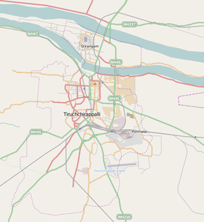
Tiruchirappalli is the fourth largest city in the Indian state of Tamil Nadu, situated 322 kilometres south of Chennai and is almost situated at the geographic centre of the state. The city houses the Trichy railway division, and is served by several railway stations, of which the most prominent one being the Tiruchirappalli Junction, which is connected by 5 different branches towards Thanjavur, Pudukottai, Dindigul, Karur and Virudhachalam. Tiruchirappalli has rail connectivity with most important cities and towns in India.

Indian Institute of Information Technology Tiruchirappalli (IIITT) is a higher education academic and research institute located in Tiruchirappalli, Tamil Nadu, India. It is one of the Indian Institutes of Information Technology (IIITs) established under the non-profit Public-Private Partnership and is an funded by the Government of India, Government of Tamil Nadu and the Indian industry partners in the ratio of 50:35:15. Industry partners include Tata Consultancy Services (TCS), Cognizant Technology Solutions (CTS), Infosys, Ramco Systems, ELCOT, and Navitas. Together with the other IIITs, it has been granted the status of Institute of National importance in 2017.
Panjapur is an area of Tiruchirappalli suburbs of Edamalaipatti Pudur of Trichy in Tamil Nadu, India. It comes under the city limit with Tiruchirappalli city corporation and Tiruchirappalli West taluk. Ward 39 of Trichy corporation covers panjapur.
Kalpalayam is a village located in the Manachanallur taluk of the Tiruchirappalli district of the Indian state Tamil Nadu. It is situated 3 km away from taluk headquarter Manachanallur and 15 km away from district headquarter Tiruchirappalli.


