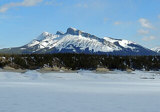
Solitude Range

Last updated
Solitude Range
Canada British Columbia relief location map.jpg
Red triangle with thick white border.svg
Solitude Range
General Extent of the Solitude Range
Highest point
Peak Mount Stephenson
Elevation 2,037 m (6,683 ft) [1]
Prominence 855 m (2,805 ft) [1] [2]
Listing Mountains of British Columbia
Coordinates 55°24′53″N122°17′55″W / 55.41472°N 122.29861°W / 55.41472; -122.29861 [3]
Dimensions
Area766 km2 (296 sq mi)
Geography
Country Canada
Province British Columbia
Parent range Hart Ranges

Solitude Range is a subdivision range of the Hart Ranges, of the Northern Rockies in British Columbia, Canada. The boundaries of the Solitude Range generally lie between the Murray Range and Mountain Creek to the west, Le Moray Creek to the east, the Pine River to the north and Mount Merrick to the south. [4]

Several mountains in the range are named after local area Canadian soldiers killed in action during World War II.

Prominent Peaks

Official Mountains of the Solitude Range [5]
Rank Mountain Peak Coordinates Elevation (m/ft) Prom. (m/ft) Isolation Nearest Higher Neighbor
1 Mount Stephenson 55°24′53″N122°17′55″W / 55.41472°N 122.29861°W / 55.41472; -122.29861 6,683
style="text-align:right;" data-sort-value="7002855000000000000"|855
2,805 22.0 km S Grant Peak
2 Howling Wolves Peak 55°19′49″N 122°7′48″W6,542
style="text-align:right;" data-sort-value="7002557000000000000"|557
1,827 14.2 km WNW Mount Stephenson
3 Mount Gilliland 55°21′20″N122°11′55″W / 55.35556°N 122.19861°W / 55.35556; -122.19861 6,360
style="text-align:right;" data-sort-value="7002516000000000000"|516
1,693 5.2 km ESEHowling Wolves Peak
4 Watson Peak 55°13′41″N122°5′22″W / 55.22806°N 122.08944°W / 55.22806; -122.08944 6,309
style="text-align:right;" data-sort-value="7002611000000000000"|611
2,005 8.5 km WUnnamed Peak
5 Goodrich Peak 55°20′53″N 122°4′52″W6,194
style="text-align:right;" data-sort-value="7002233000000000000"|233
764 3.7 km WSWHowling Wolves Peak
6 Brazion Peak 55°19′33″N 122°9′41″W5,948
style="text-align:right;" data-sort-value="7002264000000000000"|264
866 1.4 ENEHowling Wolves Peak
7 Mount Merrick 55°10′58″N121°55′38″W / 55.18278°N 121.92722°W / 55.18278; -121.92722 5,738
style="text-align:right;" data-sort-value="7002294000000000000"|294
965 9.4 km WMount Jilg
8 Mount Le Moray 55°27′8″N 122°28′39″W5,669
style="text-align:right;" data-sort-value="7002348000000000000"|348
1,142 12.0 km ESEUnnamed Peak
9 Pyramis Peak 55°30′60″N 122°26′28″W5,653
style="text-align:right;" data-sort-value="7002216000000000000"|216
709 7.5 km SSWMount Le Moray
10 Solitude Mountain 55°29′22″N 122°36′24″W5,164
style="text-align:right;" data-sort-value="7002564000000000000"|564
1,850 5.9 km SSWUnnamed Peak
Map this section's coordinates using: OpenStreetMap

Related Research Articles

<span class="mw-page-title-main">Mount Waddington</span> Mountain in British Columbia, Canada

Mount Waddington, once known as Mystery Mountain, is the highest peak in the Coast Mountains of British Columbia, Canada. Although it is lower than Mount Fairweather and Mount Quincy Adams, which straddle the United States border between Alaska and British Columbia, Mount Waddington is the highest peak that lies entirely within British Columbia. It and the subrange which surround it, known as the Waddington Range, stand at the heart of the Pacific Ranges, a remote and extremely rugged set of mountains and river valleys.

<span class="mw-page-title-main">Canadian Rockies</span> Mountain range in Canada

The Canadian Rockies or Canadian Rocky Mountains, comprising both the Alberta Rockies and the British Columbian Rockies, is the Canadian segment of the North American Rocky Mountains. It is the easternmost part of the Canadian Cordillera, which is the northern segment of the North American Cordillera, the expansive system of interconnected mountain ranges between the Interior Plains and the Pacific Coast that runs northwest–southeast from central Alaska to the Isthmus of Tehuantepec in Mexico.

<span class="mw-page-title-main">Mount Garibaldi</span> Stratovolcano in British Columbia, Canada

Mount Garibaldi is a dormant stratovolcano in the Garibaldi Ranges of the Pacific Ranges in southwestern British Columbia, Canada. It has a maximum elevation of 2,678 metres and rises above the surrounding landscape on the east side of the Cheakamus River in New Westminster Land District. In addition to the main peak, Mount Garibaldi has two named sub-peaks. Atwell Peak is a sharp, conical peak slightly higher than the more rounded peak of Dalton Dome. Both were volcanically active at different times throughout Mount Garibaldi's eruptive history. The northern and eastern flanks of Mount Garibaldi are obscured by the Garibaldi Névé, a large snowfield containing several radiating glaciers. Flowing from the steep western face of Mount Garibaldi is the Cheekye River, a tributary of the Cheakamus River. Opal Cone on the southeastern flank is a small volcanic cone from which a lengthy lava flow descends. The western face is a landslide feature that formed in a series of collapses between 12,800 and 11,500 years ago. These collapses resulted in the formation of a large debris flow deposit that fans out into the Squamish Valley.

<span class="mw-page-title-main">Beaverfoot Range</span> Mountain range in British Columbia, Canada

The Beaverfoot Range is a mountain range of the Canadian Rockies, located in southeastern British Columbia. The range extends from Cedared Creek near Spillimacheen north to the Kicking Horse River.

<span class="mw-page-title-main">Purcell Mountains</span> Mountain range in British Columbia, Canada

The Purcell Mountains are a mountain range in southeastern British Columbia, Canada. They are a subrange of the Columbia Mountains, which includes the Selkirk, Monashee, and Cariboo Mountains. They are located on the west side of the Rocky Mountain Trench in the area of the Columbia Valley, and on the east side of the valley of Kootenay Lake and the Duncan River. The only large settlements in the mountains are the Panorama Ski Resort and Kicking Horse Resort, adjacent to the Columbia Valley towns of Invermere and Golden, though there are small settlements, such as Yahk and Moyie along the Crowsnest Highway, and residential rural areas dependent on the cities of Creston, Kimberley and Cranbrook, which are located adjacent to the range.

<span class="mw-page-title-main">Lillooet Ranges</span> Mountain range in the country of Canada

The Lillooet Ranges are the southeasternmost subdivision of the Pacific Ranges of the Coast Mountains of British Columbia. They are located between the drainage of the Lillooet River and Harrison Lake on the west and the canyon of the Fraser River on the east, and by the lowland coastal valley of that river on the south.

<span class="mw-page-title-main">Kakwa Provincial Park and Protected Area</span> Provincial park in British Columbia, Canada

Kakwa Provincial Park and Protected Area is a 170,890 ha provincial park in northeastern British Columbia, Canada. The park preserves the southernmost portion of the Hart Ranges and the northernmost portion of the Continental Ranges. The park also preserves significant marine fossil deposits located in the region.

<span class="mw-page-title-main">Mount Meager massif</span> Group of volcanoes in British Columbia, Canada

The Mount Meager massif is a group of volcanic peaks in the Pacific Ranges of the Coast Mountains in southwestern British Columbia, Canada. Part of the Cascade Volcanic Arc of western North America, it is located 150 km (93 mi) north of Vancouver at the northern end of the Pemberton Valley and reaches a maximum elevation of 2,680 m (8,790 ft). The massif is capped by several eroded volcanic edifices, including lava domes, volcanic plugs and overlapping piles of lava flows; these form at least six major summits including Mount Meager which is the second highest of the massif.

<span class="mw-page-title-main">Hart Ranges</span> Subrange of the Northern Canadian Rockies in British Columbia, Canada

The Hart Ranges are a major subrange of the Canadian Rockies located in northeastern British Columbia and western Alberta. The mountains constitute the southernmost portion of the Northern Rocky Mountains.

<span class="mw-page-title-main">Ranges of the Canadian Rockies</span>

The Canadian Rockies are a segment of the North American Rocky Mountains found in the Canadian provinces of Alberta and British Columbia.

<span class="mw-page-title-main">South Jasper Ranges</span> Mountain ranges in Alberta and British Columbia

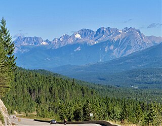
The South Jasper Ranges are mountain ranges of the Rocky Mountains in Alberta and British Columbia, Canada.

The Northern Rocky Mountains, usually referred to as the Northern Rockies, are a subdivision of the Canadian Rockies comprising the northern half of the Canadian segment of the Rocky Mountains. While their northward limit is easily defined as the Liard River, which is the northward terminus of the whole Rockies, the southward limit is debatable, although the area of Mount Ovington and Monkman Pass is mentioned in some sources, as south from there are the Continental Ranges, which are the main spine of the Rockies forming the boundary between British Columbia and Alberta. Some use the term to mean only the area north of the Peace Arm of the Williston Reservoir, and in reference to Northern Rocky Mountains Provincial Park, while others consider the term to extend all the way south, beyond the limit of the Hart Ranges at Mount Ovington, to include the McBride area, the Sir Alexander Group and Mount Robson.

A mountain formerly known as Mount Pétain, but with no current official name, is located on the border of the Canadian provinces of Alberta and British Columbia (BC) on the Continental Divide.

<span class="mw-page-title-main">Foster Peak</span>

Foster Peak is a 3,204-metre (10,512-foot) mountain summit located on the western border of Kootenay National Park. It is the highest point in the Vermilion Range, a sub-range of the Canadian Rockies of British Columbia, Canada. Its nearest higher peak is Mount Ball, 14.96 km (9.30 mi) to the northeast. The mountain is part of what is known as The Rockwall. Floe Lake, southeast of the peak, is one of the beauty spots of Kootenay National Park. The area is accessible via the Floe Lake Trail and Rockwall Trail. The Rockwall Trail is a scenic 55 kilometre traverse of alpine passes, subalpine meadows, hanging glaciers, and limestone cliffs, in some places in excess of 900 metres above the trail.

<span class="mw-page-title-main">Murray Range</span> Mountain Range in British Columbia

Murray Range is a subdivision range of the Hart Ranges, of the Northern Rockies in British Columbia, Canada. The majority of the range lies within the Pine-Lemoray Provincial Park and is noted for its snowmobiling, hiking and ski touring opportunities. The boundaries of the Murray Range generally lie between the Misinchinka River to the west and Mountain Creek to the east; the Pine River to the north and Mount Reynolds to the south.

<span class="mw-page-title-main">Misinchinka Ranges</span> Mountain range in British Columbia, Canada

Misinchinka Ranges, is the largest subdivision range of the Hart Ranges, of the Northern Rockies in British Columbia, Canada. The boundaries of the Misinchinka Ranges generally lie between the Rocky Mountain Trench to the west, Clearwater Creek and the Sukunka River to the east, the Peace Arm of Williston Reservoir to the north and Monkman Provincial Park to the south.

Mount Stephenson, is a 2,037-metre (6,683 ft) mountain in the Solitude Range of the Hart Ranges in Northern British Columbia.

Mount Gilliland, is a 1,940-metre (6,365 ft) mountain in the Solitude Range of the Hart Ranges in Northern British Columbia.

Watson Peak, is a 1,923-metre (6,309 ft) mountain in the Solitude Range of the Hart Ranges in Northern British Columbia.

Mount Merrick, is a 1,749-metre (5,738 ft) mountain on the northern side of upper Sukunka River in the Solitude Range of the Hart Ranges in Northern British Columbia, Canada.

References

  1. 1 2 "Mount Stephenson". peakvisor.com. Retrieved 2023-07-13.
  2. "Mount Stephenson". Bivouac.com. Retrieved 2023-07-13.
  3. "Mount Stephenson". BC Geographical Names . Retrieved 2023-07-13.
  4. Holland, Stuart S. (1976). Bulletin 48: Landforms of British Columbia--A Physiographic Outline (PDF). K.M MacDonald, Province of British Columbia. Archived from the original (PDF) on 2016-03-04.
  5. "Hart Ranges". PeakVisor. Retrieved 2020-05-07.