
The Winston Churchill Range is a mountain range in the central section of the Park Ranges of the Canadian Rockies located in Jasper National Park. The range was named after Sir Winston Churchill, former British prime minister.

The Fairholme Range is a mountain range east of the Bow River valley in the Canadian Rockies. The range is bounded on the west side by the Trans-Canada Highway as it passes through the towns of Exshaw and Canmore, while the northern section of the range extends into Banff National Park to the southern shores of Lake Minnewanka. John Palliser named the range in 1859 after his sister Grace Fairholme, who had married William Fairholme.

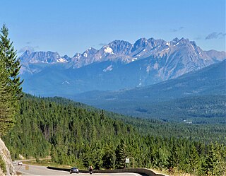
The Rainbow Range is a small subrange of the Park Ranges subdivisions of the Northern Continental Ranges of the Rocky Mountains on the border between Alberta and British Columbia in Mount Robson Provincial Park.

The Premier Range is a group of mountains within the Cariboo Mountains of east-central British Columbia, Canada. The range is bounded by the Raush River and Kiwa Creek to the north, the North Thompson River on the south and west and the Fraser River and its tributaries to the east.

The Hart Ranges are a major subrange of the Canadian Rockies located in northeastern British Columbia and western Alberta. The mountains constitute the southernmost portion of the Northern Rocky Mountains.

The Bow Range is a mountain range of the Park Ranges in Alberta and British Columbia, Canada. The range is named in association with the Bow River and was officially adopted on March 31, 1917 by the Geographic Board of Canada.
The Tower of London Range is a sub-range of the Northern Rocky Mountains in northern British Columbia, Canada, located northwest of the Tuchodi Lakes at the northwest end of the Northern Rocky Mountains Provincial Park to the southwest of Fort Nelson.

The Albion Mountains are a mountain range in the U.S. states of Idaho (~99%) and Utah (~1%), spanning Cassia County, Idaho and barely reaching into Box Elder County, Utah. The highest point in the range is Cache Peak at 10,339 feet (3,151 m), and the range is a part of the Basin and Range Province. Most of the mountains are part of the Albion Division of the Minidoka Ranger District of Sawtooth National Forest.

The Black Pine Mountains are a mountain range in the U.S. states of Idaho (~65%) and Utah (~35%), spanning Cassia County, Idaho and reaching into Box Elder County, Utah. The highest point in the range is known as Black Pine Mountains High Point, sometimes referred to as Black Peak, at 9,395 feet (2,864 m), and the range is a part of the Great Basin Divide and the Basin and Range Province. In Idaho, the mountains are part of the Black Pine Division of the Minidoka Ranger District of Sawtooth National Forest.

Azu Mountain, is a 1,629-metre (5,344 ft) mountain in the Hart Ranges of the Northern Rockies of British Columbia. The mountain is situated approximately 27 kilometres southwest of Mackenzie, British Columbia. The name is an abbreviation of the nearby Azouzetta Lake and was officially adopted on March 26, 1985. The Azu Bowl is a popular local ski touring area and is easily accessible from the adjacent Powder King Mountain Resort.

Mount Murray, is a 1,802-metre (5,912-feet) in the Murray Range of Hart Ranges of Northern British Columbia. The mountain is within the Pine-Lemoray Provincial Park.

Mount Hunter, is a 2,032-metre (6,667 ft) mountain in the Murray Range of the Hart Ranges in Northern British Columbia. The mountain is within the Pine-Lemoray Provincial Park.
Grant Peak is a 2,094-metre (6,870 ft) mountain in the Murray Range of the Hart Ranges in Northern British Columbia.
Mount Reynolds, is a 2,004-metre (6,575 ft) mountain in the Murray Range of the Hart Ranges in Northern British Columbia.
Milburn Peak, is a 2,019-metre (6,624 ft) mountain in the Murray Range of the Hart Ranges in Northern British Columbia.
Misinchinka Ranges, is the largest subdivision range of the Hart Ranges, of the Northern Rockies in British Columbia, Canada. The boundaries of the Misinchinka Ranges generally lie between the Rocky Mountain Trench to the west, Clearwater Creek and the Sukunka River to the east, the Peace Arm of Williston Reservoir to the north and Monkman Provincial Park to the south.
Solitude Range is a subdivision range of the Misinchinka Ranges of the Hart Ranges of the Northern Rockies in British Columbia, Canada. The boundaries of the Solitude Range generally lie between the Murray Range and Mountain Creek to the west, Le Moray Creek to the east, the Pine River to the north and Mount Merrick to the south.
The Pioneer Range is a small subdivision range of the Misinchinka Ranges of the Hart Ranges of the Northern Rockies in British Columbia, Canada. The boundaries of the Pioneer Range are generally the Murray River to the east, Monkman Glacier to the west, Imperial Creek to the north and the Limestone Lakes to the south. The majority of the Pioneer Range lies within Monkman Provincial Park.
The Vermilion Range is a mountain range of the Canadian Rockies, in British Columbia, Canada. The range is west of the Vermilion River and east of the headwaters of the Kootenay River.

The Flathead Range is a mountain range of the Canadian Rockies in Alberta and British Columbia, Canada. It is located on the Continental Divide, east of Fernie, in the Kootenay Land District. It stretches 27 km (17 mi) lengthwise north–south from Crowsnest Pass to North Kootenay Pass. The range's toponym was officially adopted on 30 June 1912 by the Geographic Board of Canada, and was named in association with the Flathead River.


