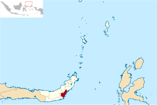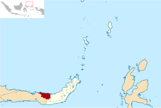
Pesisir Selatan Regency is a regency (kabupaten) of West Sumatra, Indonesia. It has an area of 6,049.33 km² and a population of 429,246 at the 2010 Census and 504,418 at the 2020 Census; the official estimate as at mid-2022 was 516,518. The regency seat is at the town of Painan, in IV Jurai District.

Gorontalo is a regency of Gorontalo Province, Indonesia, on the island of Sulawesi. It was established in 1959 under Law Number 29/1959, but has subsequently been reduced in area as additional regencies have been cut out of it. It now has an area of 2,189.08 km2 and had a population of 355,988 at the 2010 Census and 393,107 at the 2020 Census; the official estimate as at mid 2023 was 418,244. The administrative headquarters of the regency is in the town of Limboto.

Rokan Hilir is a regency (kabupaten) of Riau Province, on Sumatra island, Indonesia. It was formed on 4 October 1999 from districts which had previously been the northwestern part of Bengkalis Regency. It occupies the lower part of the catchment area of the Rokan River, and has an area of 8,851.59 km2. It had a population of 553,216 at the 2010 census and 637,161 at the 2020 census; the official estimate as at mid 2022 was 638,407. The administrative centre of the Rokan Hilir Regency is located at the town of Bagansiapiapi.

North Bengkulu is a regency of Bengkulu Province, Indonesia, on the island of Sumatra. It originally covered much of the northern part of Bengkulu Province, but on 25 February 2003 the most northwesterly districts were split off to form a separate Mukomuko Regency, and on 24 June 2008 the most southeastern districts were likewise split off to create a new Central Bengkulu Regency. The residual regency now covers an area of 4,424.59 km2, and it had a population of 257,675 at the 2010 Census and 296,523 at the 2020 Census; the official estimate as at mid 2022 was 302,833. The administrative centre is at the town of Arga Makmur.

Bone Bolango is a regency of Gorontalo Province, Indonesia, on the island of Sulawesi. It was established in 2003 under Law Number 6/2003from the former eastern districts of Gorontalo Regency. It has an area of 1,915.44 km2 and had a population of 141,915 at the 2010 Census and 162,778 at the 2020 Census; the official estimate as at mid 2023 was 172,301. The administrative centre of the regency is the town of Suwawa.

Sarmi Regency is one of the regencies (kabupaten) in Papua Province of Indonesia. It was formed from the western districts which had until then been part of Jayapura Regency with effect from 12 November 2002. It covers an area of 18,034.0 km2, and had a population of 32,971 at the 2010 Census and 41,515 at the 2020 Census; the official estimate as at mid 2022 was 42,233. The regency's administrative centre is at the town of Sarmi.

Musi Banyuasin Regency is a regency of South Sumatra province, in Indonesia. Originally much larger, it was reduced by about 45% of its former area on 10 April 2002 by the splitting off of most of its eastern and northeastern districts to form the new Banyuasin Regency. It now has a total area of 14,265.96 km2 (5,508 sq mi) and a population of 561,458 at the 2010 Census and 622,206 at the 2020 Census; the official estimate as at mid 2022 was 633,124.
Central Halmahera Regency is a regency of North Maluku Province, Indonesia. The regency was originally formed on 15 August 1990 from part of the former North Maluku Regency, but on 25 February 2003 parts of the new regency were split off to form a separate East Halmahera Regency and the city of Kota Tidore Kepulauan. It now comprises just the southern half of the southeastern peninsula of Halmahera Island, together with part of the southern peninsula of that island.

Takalar Regency is a regency of South Sulawesi Province, Indonesia. It covers an area of 566.51 km2 and had a population of 269,603 at the 2010 census and 300,853 at the 2020 census; the official estimate for mid 2023 was 326,044. The entire regency lies within the official metropolitan area of the city of Makassar. The principal towns are at Galesong and Takalar, but the administrative centre is at Pattallassang.

Kolaka Regency is a regency of Southeast Sulawesi Province, Indonesia. It covers an area of 2,960.73 km2 (1,143.14 sq mi) and had a population of 208,817 at the 2010 Census, rising to 237,587 at the 2020 Census; the official estimate as at mid 2023 was 247,680. The principal town lies at Kolaka.

South Konawe Regency is a regency of Southeast Sulawesi Province, Indonesia. The regency was created on 25 February 2003 from what had been the southern districts of Konawe Regency. It covers an area of 4,237.74 km2 and had a population of 264,587 at the 2010 Census and of 308,524 at the 2020 Census; the official estimate as at mid 2023 was 322,946 - comprising 165,487 males and 157,459 females.< The administrative centre is in the town of Andoolo.

Parigi Moutong Regency is a regency of Central Sulawesi Province of Indonesia. The regency was created on 10 April 2002 by splitting off the eastern districts previously part of Donggala Regency. It covers an area of 5,877.47 km2 and had a population of 413,588 at the 2010 Census and 440,015 at the 2020 Census; the official estimate as at mid 2023 was 457,031. The principal town lies at Parigi in the south of the regency.

Tojo Una-Una Regency is a regency of Central Sulawesi, Indonesia. The administrative centre is at Ampana town, on the Sulawesi 'mainland'. While the Regency includes a considerable area on the eastern peninsula of Sulawesi, it also includes the Togian Islands in the Gulf of Tomini. The total area covers 5,721.51 km2 and the population was 134,945 at the 2010 Census and 163,829 at the 2020 Census; the official estimate as at mid 2023 was 169,002.

Bolaang Mongondow Regency is a regency of North Sulawesi Province, Indonesia, situated on the island of Sulawesi. The principal town lies at Kotamobagu, which since 2007 has been administratively separated from the regency, the administrative centre of which is now at the town of Lolak. The Regency covers a land area of 2,933.6 km2, and had a population of 213,484 at the 2010 Census and 248,751 at the 2020 Census; the official estimate as at mid 2023 was 254,945.

East Bolaang Mongondow Regency is a regency of North Sulawesi Province of Indonesia. It was created on 24 June 2008 by splitting off districts which were previously the eastern part of Bolaang Mongondow Regency. It covers a land area of 866.37 sq km and had a population of 63,654 at the 2010 Census, rising to 87,241 at the 2020 Census; the official estimate as at mid 2023 was 90,787. The principal town lies at Tutuyan.

North Bolaang Mongondow Regency is a regency of North Sulawesi Province of Indonesia. It was created on 2 January 2007 by splitting off districts which had previously been the western part of Bolaang Mongondow Regency. The regency covers an area of 1,672.61 km2 and had a population of 70,693 at the 2010 Census and 83,112 at the 2020 Census; the official estimate as at mid 2023 was 86,111. Bitauna is the only official town (kelurahan) in the regency, but the administrative centre is at Boroko.

Buru Regency is a regency of Maluku province, Indonesia. When it was first created on 4 October 1999, the regency encompassed the entire island ; but on 24 June 2008 the southern 40% of the island was split off to form a separate Buru Selatan Regency. The residual Buru Regency comprises the northern 60% of the island of Buru and covers an area of 7,595.58 km2. The population at the 2010 census was 108,445 and at the 2020 census this had increased to 135,238; the official estimate as at mid 2023 was 139,408. The principal town lies at Namlea.

Southwest Maluku Regency is a regency of Maluku Province, Indonesia. Geographically it forms the most eastern portion of the Lesser Sunda Islands, although it has never been administratively included with them, and politically has always comprised a part of the Maluku Province. It comprises a number of islands and island groups in the south of the province, including Lirang Island, Wetar Island, Kisar Island, Romang Island, the Letti Islands, the Damer Islands, the Sermata Islands and the Babar Islands. The total land area is 4,581.06 km2, and the population was 70,714 at the 2010 Census and 81,928 at the 2020 Census; the official estimate as at mid 2023 was 93,766.

Manokwari Regency is a regency in West Papua, Indonesia. Following the splitting away of twenty of its former districts in 2013, it now covers an area of 3,168.28 km2 and had a population of 192,663 at the 2020 Census; the official estimate as at mid 2022 was 200,785. The administrative centre is presently at the town of Manokwari, which is also the capital of the province, but under proposals currently under consideration by the Indonesian Parliament, the town is intended to be split off from the regency to form a separate independent city.

Kotamobagu is a city in North Sulawesi, Indonesia. Having previously been a town within the Bolaang Mongondow Regency, Kotamobagu was separated from that regency on 2 January 2007 to become an autonomous city. It is the principal centre of the southern part of the province, the Bolaang Mongondow region, which has been under consideration by the Indonesian government to be separated from the rest of North Sulawesi and formed into a separate province. The city covers an area of 108.89 km2, and had a population of 107,459 at the 2010 Census, rising to 123,722 at the 2020 Census; the official estimate as at mid 2023 was 123,918.


