North Carolina is a state in the Southeastern region of the United States. The state is the 28th largest and 9th-most populous of the United States. It is bordered by Virginia to the north, the Atlantic Ocean to the east, Georgia and South Carolina to the south, and Tennessee to the west. In the 2020 census, the state had a population of 10,439,388. Raleigh is the state's capital and Charlotte is its largest city. The Charlotte metropolitan area, with a population of 2,595,027 in 2020, is the most-populous metropolitan area in North Carolina, the 21st-most populous in the United States, and the largest banking center in the nation after New York City. The Raleigh-Durham-Cary combined statistical area is the second-largest metropolitan area in the state and 32nd-most populous in the United States, with a population of 2,043,867 in 2020, and is home to the largest research park in the United States, Research Triangle Park.

Interstate 73 (I-73) is a north–south Interstate Highway, located within the US state of North Carolina. Currently, there is one continuous section of I-73, totaling 93.5 miles (150.5 km), first traversing the U.S. Route 220 (US 220) freeway 70 miles (110 km) from Ellerbe, North Carolina, to I-85 in Greensboro, North Carolina, then along the southwestern segment of the Greensboro Outer Loop 12 miles (19 km) from US 220 to Bryan Boulevard, then 9.5 miles (15.3 km) along a freeway from Bryan Boulevard west then north to US 220 near Summerfield, North Carolina.
A Pure Michigan Byway is the designation for a segment of the State Trunkline Highway System in the US state of Michigan that is a "scenic, recreational, or historic route that is representative of Michigan's natural and cultural heritage." The designation was created with the name Michigan Heritage Route by the state legislature on June 22, 1993, and since then six historic, seven recreational and seven scenic byways have been designated by the Michigan Department of Transportation (MDOT), and another two have been proposed. These byways have been designated in both the Upper and Lower peninsulas of the state. The current name was adopted on December 30, 2014, and it references the Pure Michigan tourism marketing campaign.

The Gullah are an African American ethnic group who predominantly live in the Lowcountry region of the U.S. states of Georgia, Florida, South Carolina, and North Carolina, within the coastal plain and the Sea Islands. Their language and culture have preserved a significant influence of Africanisms as a result of their historical geographic isolation and the community's relation to their shared history and identity.

U.S. Route 25 is a north–south United States Highway that runs for 750 miles (1,210 km) in the southern and midwestern US. Its southern terminus is in Brunswick, Georgia, from where it proceeds mostly due north, passing through the cities of Augusta, Georgia, Greenville, South Carolina, and Asheville, North Carolina, before dividing into two branches, known as U.S. Route 25W and U.S. Route 25E between Newport, Tennessee, and North Corbin, Kentucky. After passing through Richmond and Lexington, Kentucky, it reaches its northern terminus at Ohio state line in Covington, Kentucky. The route is an important crossing of the Appalachian Mountains, and it is covered by three of the corridors of the Appalachian Development Highway System. When the highway was originally established in 1926, the route extended from North Augusta, South Carolina to Port Huron, Michigan. The southern end was extended to its current terminus in 1936, while the northern end was truncated in 1974.

The Lowcountry is a geographic and cultural region along South Carolina's coast, including the Sea Islands. The region includes significant salt marshes and other coastal waterways, making it an important source of biodiversity in South Carolina.

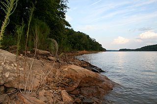
The Tugaloo River is a 45.9-mile-long (73.9 km) river that forms part of the border between the U.S. states of Georgia and South Carolina. It was named for the historic Cherokee town of Tugaloo at the mouth of Toccoa Creek, south of present-day Toccoa, Georgia and Travelers Rest State Historic Site in Stephens County, Georgia.

The Charles Pinckney National Historic Site is a unit of the United States National Park Service, preserving a portion of Charles Pinckney's Snee Farm plantation and country retreat. The site is located at 1254 Long Point Road, Mount Pleasant, South Carolina. Pinckney (1757-1824) was a member of a prominent political family in South Carolina. He fought in the American Revolutionary War, was held for a period as prisoner in the North, and returned to the state in 1783. Pinckney, a Founding Father of the United States, served as a delegate to the constitutional convention where he contributed to drafting the United States Constitution.

Tugaloo was a Cherokee town located on the Tugaloo River, at the mouth of Toccoa Creek. It was south of Toccoa and Travelers Rest State Historic Site in present-day Stephens County, Georgia. Cultures of ancient indigenous peoples had occupied this area, and those of the South Appalachian Mississippian culture built a platform mound and village here. It was an administrative and ceremonial center for them.

McLeod Plantation is a former slave plantation located on James Island, South Carolina, near the intersection of Folly and Maybank roads at Wappoo Creek, which flows into the Ashley River. The plantation is considered an important Gullah heritage site, preserved in recognition of its cultural and historical significance to African-American and European-American cultures.

The Delaware & Lehigh Canal National and State Heritage Corridor (D&L) is a 165-mile (266 km) National Heritage Area in eastern Pennsylvania in the United States. It stretches from north to south, across five counties and over one hundred municipalities. It follows the historic routes of the Lehigh and Susquehanna Railroad, Lehigh Valley Railroad, the Lehigh Navigation, Lehigh Canal, and the Delaware Canal, from Bristol to Wilkes-Barre in the northeastern part of the state. The backbone of the Corridor is the 165-mile (266 km) D&L Trail. The Corridor's mission is to preserve heritage and conserve green space for public use in Bucks, Northampton, Lehigh, Carbon, and Luzerne counties in Pennsylvania. It also operates Hugh Moore Historical Park & Museums, which includes the National Canal Museum.

U.S. Route 70 (US 70) is a part of the United States Numbered Highway System that runs from Globe, Arizona, to the Crystal Coast of the US state of North Carolina. In North Carolina, it is a major 488-mile-long (785 km) east–west highway that runs from the Tennessee border to the Atlantic Ocean. From the Tennessee state line near Paint Rock to Asheville it follows the historic Dixie Highway, running concurrently with US 25. The highway connects several major cities including Asheville, High Point, Greensboro, Durham, Raleigh, Goldsboro, and New Bern. From Beaufort on east, US 70 shares part of the Outer Banks Scenic Byway, a National Scenic Byway, before ending in the community of Atlantic, located along Core Sound.

U.S. Highway 1 (US 1) is a north–south United States Numbered Highway which runs along the East Coast of the U.S. between Key West, Florida, and the U.S.–Canada border near Fort Kent, Maine. In North Carolina, US 1 runs for 174.1 miles (280.2 km) across the central region of the state. The highway enters North Carolina from South Carolina, southwest of Rockingham. US 1 runs northeast, passing through or closely bypassing Southern Pines and Sanford in the Sandhills region. It next passes through Cary, the state capital of Raleigh, and Wake Forest. The highway continues north to Henderson, before leaving the state at the Virginia state line, near Wise. The route is mostly a multilane divided arterial road, with several freeway segments. It serves as a strategic highway, connecting the North Carolina Sandhills and Research Triangle regions northward to the Southside region.

BarbadianAmericans are Americans of Barbados heritage or ancestry. The 2000 Census recorded 53,785 US residents born on the Caribbean island 52,170 of whom were born to non-American parents and 54,509 people who described their ethnicity as Barbadian. The 2010 US Census estimation report stated more than 62,000 Barbadian Americans are resident in the United States, most of whom are in the area of New York City extending from Rhode Island to Delaware. In past years, some also moved to the areas of Chicago, Illinois, and Boston, Massachusetts.

Interstate 73 (I-73) is a proposed Interstate Highway in the US state of South Carolina. When completed, it will connect the Grand Strand area with the state's Interstate system.
The Journey Through Hallowed Ground National Heritage Area is a federally designated National Heritage Area in portions of Pennsylvania, West Virginia, Maryland and Virginia.

The Gullah-Geechee Cultural Heritage Corridor is a federal National Heritage Area in the United States, representing the significant story of the Gullah-Geechee people for maintaining their cultural traditions, and for being a reflection of the values of ingenuity, pride, and perseverance. The intent of the designation is to help us to preserve and interpret the traditional cultural practices, sites, and resources associated with Gullah-Geechee people. Gullah-Geechee Cultural Heritage Corridor, and the federal Gullah-Geechee Cultural Heritage Corridor Commission established to oversee it, were designated by an act of Congress on October 12, 2006 through the National Heritage Areas Act of 2006.

Kenai Mountains – Turnagain Arm National Heritage Area is a federally designated National Heritage Area in the U.S. state of Alaska. The heritage area extends across the northern part of the Kenai Peninsula, immediately to the north and east of Kenai Fjords National Park. The designation recognizes the area's unique cultural, scenic and historical features and provides a unified organization for promotion of the area's attractions.
Tennessee Civil War National Heritage Area is a federally designated National Heritage Area that encompasses the entire U.S. state of Tennessee. The heritage area concentrates on eight major corridors: the Mississippi River, Cumberland River, Tennessee River, Louisville and Nashville Railroad, Nashville and Chattanooga Railroad, East Tennessee Georgia and Virginia Railroad, Memphis and Charleston Railroad and the Nashville and Northwestern Railroad corridors.


