Related Research Articles

Interstate 90 (I-90) is an east–west transcontinental freeway and the longest Interstate Highway in the United States at 3,021 miles (4,862 km). It begins in Seattle, Washington, and travels through the Pacific Northwest, Mountain West, Great Plains, Midwest, and the Northeast, ending in Boston, Massachusetts. The highway serves 13 states and has 15 auxiliary routes, primarily in major cities such as Chicago, Cleveland, Buffalo, and Rochester.

North Bend is a city in King County, Washington, United States, on the outskirts of the Seattle metropolitan area. The population was 7,461 at the 2020 census.

Riverbend is an unincorporated community and census-designated place (CDP) in King County, Washington, United States. The population was 2,123 at the 2020 census.

Snoqualmie is a city next to Snoqualmie Falls in King County, Washington, United States. It is 28 miles (45 km) east of Seattle. Snoqualmie city is home to the Northwest Railway Museum. The population was 14,121 at the 2020 census.

Easton is an unincorporated community and census-designated place (CDP) in Kittitas County, Washington, United States. The population was 478 at the 2010 census. Easton is the annual site of the start/finish line for the Cascade Crest 100-mile ultra-running race.

Snoqualmie Pass is a census-designated place (CDP) in Kittitas County, Washington, United States. It includes the unincorporated community of Hyak. The population was 311 at the 2010 census.

Thorp is an unincorporated community and census-designated place (CDP) in Kittitas County, Washington, United States. In 2020, the population was 232.

Mount Si is a mountain in the northwest United States, east of Seattle, Washington. It lies on the western margin of the Cascade Range just above the coastal plains around Puget Sound, and towers over the nearby town of North Bend. Mount Si and neighboring mountain Little Si were named after local homesteader Josiah "Uncle Si" Merritt. The mountain became nationally familiar in the early 1990s with the television series Twin Peaks, which was filmed in North Bend.

Asahel Curtis (1874–1941) was an American photographer based in the Pacific Northwest region of the United States. His career included documentation of the Klondike Gold Rush period in Seattle, natural landscapes in the Northwest, and infrastructure projects in Seattle.

Alpental, named after the German word for alpine valley, is both a valley in eastern King County, Washington, United States, and part of a ski area in the valley. The valley is about 50 miles (80 km) east of Seattle, Washington and is north of Snoqualmie Pass, in the Washington Cascades. It is a popular outdoor recreation destination in summer and winter. The ski area is one of four areas that make up The Summit at Snoqualmie.
Harvey Manning was a noted author of hiking guides and climbing textbooks, and a tireless hiking advocate. Manning lived on Cougar Mountain, within the city limits of Bellevue, Washington, calling his home the "200-meter hut". His book Walking the Beach to Bellingham is an autobiography and manifesto fleshing out his journal of a hike along the shore of Puget Sound over a two-year span.
Rattlesnake Ridge, known as daʔšədabš to the Snoqualmie people, is the ridge of Rattlesnake Mountain located south of North Bend, Washington, United States. The western end is near the intersection of State Route 18 and I-90 in Snoqualmie, Washington, and runs southeast about 7 miles (11 km) or 11 miles (18 km) by trail. It is the highest and easternmost of the Issaquah Alps. A maze of abandoned logging roads and constructed trails have been strung together to provide a 10.5-mile (16.9 km) footpath from the Snoqualmie Point trailhead at Exit 27 on I-90 all the way to the Rattlesnake Lake trailhead near Exit 32.

Tiger Mountain is a mountain in the U.S. state of Washington. It is at the center of the Issaquah Alps, a small range in the Eastside region of King County, Washington southeast of Seattle. The mountain is part of a designated protected area, the Tiger Mountain State Forest, and has several recreational areas used for hiking, mountain biking, and paragliding.

The Summit at Snoqualmie is a recreation area in the northwest United States, located on Snoqualmie Pass, Washington. It provides alpine skiing and snowboarding, Nordic skiing, mountain biking, winter tubing, and scenic lift rides. Owned and managed by Boyne Resorts, it is 52 miles (80 km) east of downtown Seattle on Interstate 90.

The Palouse to Cascades State Park Trail, formerly known as the John Wayne Pioneer Trail and the Iron Horse Trail, is a rail trail that spans most of the U.S. state of Washington. It follows the former railway roadbed of the Chicago, Milwaukee, St. Paul & Pacific Railroad for 300 miles (480 km) across two-thirds of the state, from the western slopes of the Cascade Mountains to the Idaho border.

Olallie State Park is a public recreation area featuring multiple waterfalls located five miles (8.0 km) southeast of North Bend, Washington. The state park spans a 3.5-mile (5.6 km) stretch along the South Fork of the Snoqualmie River. The most prominent feature of the park is 135-foot-high (41 m) Twin Falls.

Franklin Falls is a waterfall on the South fork of the Snoqualmie River, the first of three major waterfalls on the South Fork Snoqualmie River. The falls are located near Snoqualmie Pass in King County, Washington, United States, between the north and south lanes of Interstate 90, just east of exit 47. The falls actually consist of three tiers, totaling about 135 feet (41 m). The first drop is a very scenic 15-foot (4.6 m) block-shaped fall. The second drop is a 25-foot (7.6 m) fanning cascade. The final drop begins as a 25-foot slide, which bends to the right, then plunges over the final 70-foot (21 m) drop seen from the base of the falls. The falls are popular canyoneering destination. The upper two drops are north of the freeway.

The Raging River is a tributary of the Snoqualmie River in western Washington state in the United States. It is located in the western foothills of the Cascade Mountains in east central King County, Washington. It gets its name from the large amount of water it sometimes carries. The record discharge at the gaging station is over 4,000 cubic feet (110 m3) per second. The Raging is a salmon-bearing river and supports one-fifth of the Snoqualmie River's chinook runs.
Interstate 90 (I-90), designated as the American Veterans Memorial Highway, is a transcontinental Interstate Highway that runs from Seattle, Washington, to Boston, Massachusetts. It crosses Washington state from west to east, traveling 298 miles (480 km) from Seattle across the Cascade Mountains and into Eastern Washington, reaching the Idaho state line east of Spokane. I-90 intersects several of the state's other major highways, including I-5 in Seattle, I-82 and U.S. Route 97 (US 97) near Ellensburg, and US 395 and US 2 in Spokane.

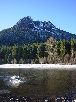
Snoqualmie Pass is a mountain pass that carries Interstate 90 (I-90) through the Cascade Range in the U.S. state of Washington. The pass summit is at an elevation of 3,015 feet (919 m), on the county line between Kittitas County and King County.
References
- ↑ Gutman, David (March 12, 2019). "Federal lands bill creates National Heritage Area from Seattle to Ellensburg". The Seattle Times. Retrieved March 13, 2019.
- ↑ Metzger, Katie (April 10, 2019). "Mountains to Sound Greenway designated as a National Heritage Area". Enumclaw Courier-Herald. Retrieved April 11, 2019.
- ↑ Paulson, Michael (June 10, 1998). "Stretch of Rainier road joins scenic elite". Seattle Post-Intelligencer . p. B1.
- ↑ Carlton Harrell, Debera (June 7, 2003). "Greenway trailblazers on mountain high". Seattle Post-Intelligencer. p. A1. Retrieved October 6, 2021.
- ↑ Fefer, Mark D. (April 27, 2000). "Big green money machine". Seattle Weekly . Archived from the original on October 30, 2002. Retrieved September 28, 2021.