Southgate, Spokane

Last updated
Southgate
Hamblen Park Spring.png
Hamblen Park in spring
Southgatecropped.png
Location within the city of Spokane
Coordinates: 47°36′48.7″N117°22′06.3″W / 47.613528°N 117.368417°W / 47.613528; -117.368417
CountryUnited States
StateWashington
County Spokane
CitySpokane
Population
 (2017 [1] )
  Total9,700
Time zone UTC-8 (PST)
  Summer (DST) UTC-7 (PDT)
ZIP Codes
99203, 99223
Area code 509

Southgate is a neighborhood in Spokane, Washington. It is located in the southwestern corner of the City of Spokane and part of the broader area known locally as the South Hill. [2] Southgate is one of the newer neighborhoods in the city, with development first taking hold in the post-World War II housing boom and continuing into the present day. It is a mix of single-family residential, multi-family residential and commercial districts. The neighborhood has grown as Spokane has expanded southward, with multiple annexations expanding Southgate and the city since 2000 and as recently as 2016. [3]

Contents

History

What is now Southgate has been inhabited by the Spokane people for centuries. [4] The area was historically the site of a travel route from the Spokane River in the north to Latah Creek in the south. [5]

European-American settlers first made their presence known in the Southgate area when the Mullan Road was constructed between 1859 and 1860, passing through Southgate near present-day Havana Street. The Mullan Road was the first wagon road to cross the Rocky Mountains into the Pacific Northwest and connected what is now Montana with present-day Spokane and beyond to Fort Walla Walla. Homesteading began in the area when Joe Jackson, from Missouri, moved in and established a supply stop for prospectors and trappers passing through. Jackson sold his land in 1870 to the Joseph Morin, a French-Canadian rancher. Morin's land was subsequently obtained after his death in 1889 by John J. Browne. The Moran Prairie, which occupies the southeastern portion of the neighborhood, and Browne's Mountain, immediately to the southeast, bear the names of these early settlers. [5]

The Spokane and Inland Empire Railroad, an electrified interurban railway reached Browne's farm on the border of present-day Southgate and Glenrose in 1908. It served the neighborhood via the Pine Grove Station at 37th Avenue and Havana Street on the northern edge of the neighborhood. The railroad connected Southgate with more established parts of Spokane to the north as well as the broader Palouse and North Idaho region. The railroad served the community until 1939. [5]

An early commercial district where farmers from the Moran Prairie, Glenrose and Southgate areas sold fruit from their orchards was established at Regal Street and Palouse Highway, which to this day remains a commercial district in the neighborhood. In the 1930s, 1940s and 1950s the original orchards were replaced by greenhouses and chicken farms. Which subsequently gave way to residential and commercial development which continues to this day. [5]

Gated community in Southgate Southgate Private Residential Development.png
Gated community in Southgate

The northern tier of the neighborhood, from 44th Avenue north to 37th, was incorporated into the city of Spokane in 1907. Subsequent annexations brought the areas from 44th to 50th Avenues into the city between 1958 and 1979. Piecemeal annexations continued to the south and east throughout the 1980s and continuing to as recently as 2016, expanding the neighborhood into its current size. [3] Development has outpaced annexation, and the Southgate area transitions almost imperceptibly into unincorporated Spokane County to the south and east, with only arterials featuring signs delineating the city limits.

Southgate has seen continued infill growth into the 21st century, along with the growth beyond its boundaries, such as in 2013 when ground was broken on a Target store at Palouse Highway and Regal and nearby multi-story apartment complexes. [6]

Geography

Southgate is, as the name suggests, situated along the southern edge of the city of Spokane. Its southern and eastern boundaries also serve as the city limits. 37th Avenue makes up the entire northern border, separating it from Lincoln Heights. Perry Street serves as the entire western border, across which lies the Comstock neighborhood. 53rd Avenue constitutes most of the southern border, though from Freya it zig-zags to the northeast until reaching 37th Avenue. Beyond 53rd and the zig-zag boundary lie unincorporated areas of Spokane County including Glenrose. [5]

Though it is located in the broader South Hill area of Spokane, Southgate itself is relatively flat. The South Hill takes its name from the steep relief of the hill as it climbs up from the Spokane Valley floor at Downtown Spokane in the north. Southgate, like the Comstock neighborhood to its west, are located beyond the crest of the hill. Here, the land is at the same relative elevation as the broader, surrounding Columbia Plateau. [2] [7] [8] Elevations rise rapidly to the east and southeast, however, as Southgate and the South Hill give way to Krell Hill, the southernmost peak of the Selkirk Mountains, which begins to rise dramatically within a mile distance from the neighborhood. [7]

Southeast Sports Complex Southeast Sports Complex Spokane.png
Southeast Sports Complex

As with the rest of Spokane, the neighborhood is dominated by towering ponderosa pine trees. There are also numerous wetlands, ponds and ephemeral streams in Southgate, which drain into the Glenrose basin and ultimately the Spokane River. [9]

In terms of built geography, the neighborhood is mostly single-family residential, with some multi-family residential along the central southern area of Southgate. There are also commercial districts along Regal Street, from around 44th Avenue in the north through the southern end of the neighborhood at 53rd. Also located there is the public Southside Sports Complex with many soccer fields, a baseball diamond and playground. [10]

The neighborhood is home to three parks. The undeveloped Hamblen Park in the northwest, the sports facilities at the Southside Sports Complex in the neighborhood's center, and the landscaped Ben Burr Park in the east. [5]

A sizable chunk of the north-central portion of the neighborhood is taken up by the campus of Joel E. Ferris High School which is located between Regal and Freya Streets along 37th Avenue, and extends four blocks south to Thurston Avenue. [5]

Transportation

City Streets

Freya Street, which passes north–south through Southgate, is the neighborhood's only principal arterial as defined by the city of Spokane, and it only holds this distinction south of 43rd Avenue. Minor arterials include Regal Street, which traverses north–south through the center of the neighborhood, 37th Avenue, which serves as the northern boundary, Havana Street in the east and Palouse Highway on the south. Collector roads include Thurston Avenue, Perry Street, Crestline Street and a stretch of 44th Avenue from Freya to Regal. [11]

Bike Lanes follow 37th Avenue across the northern edge of Southgate from Regal east to the city limits. Freya and Havana Streets also have bike lanes extending south from 37th. A shared use path follows 44th Avenue east of Regal. [12]

Public Transit

The Spokane Transit Authority, the region's public transportation provider, serves Southgate with two fixed schedule bus lines. [13]

RouteTerminiService operation and notesStreets traveled
4
Moran Prairie
Downtown Spokane
STA Plaza
Glenrose
Moran Station Park and Ride
High-frequency routeRegal, 57th
43
Lincoln/37th
Downtown Spokane
STA Plaza
Lincoln Heights
South Hill Park & Ride
Basic-frequency route37th

Demographics

As of 2017, Southgate was home to 9,700 residents across 4,140 households. 39% of households were rented, compared to 45.3% citywide. The median household income was $69,572, compared to $44,768 citywide. 38.6% of students qualified for free or reduced lunch, compared to 54.5% citywide. 52.6% of residents had a bachelor's degree or above and 13.7% had a high school diploma or below. Persons of color made up 14.9% of the population, compared to 15.1% citywide. [1]

92.6% of residents were born in the United States or its territories. Of the residents not born in the United States, 9.7% were from Vietnam, 7.6% from the United Kingdom, 7.3% from Germany and 6.9% from Canada. [1]

Education

The northwestern portion of Southgate is served by Hamblen Elementary, which is located at Thurston Avenue and Crestline. The northeastern portion is part of the Adams Elementary district, located at 37th Avenue and Regal Street just north of Southgate in Lincoln Heights. The eastern portion is part of the Moran Prairie Elementary district, which is located just southeast of Southgate. Hamblen and Adams feed into Carla Peperzak Middle School, currently under construction to the south as of 2022, [14] while Moran Prairie feeds into the existing Chase Middle School on 37th in Lincoln Heights. [15] All three elementary schools serving Southgate feed into Joel E. Ferris High School, located in the north-central portion of the neighborhood at 37th and Regal Street. [16]

Related Research Articles

<span class="mw-page-title-main">Hillyard, Spokane</span> Neighborhood of Spokane in Spokane County, Washington, United States

Hillyard is a neighborhood in Spokane, Washington which existed as a separate town between 1892 and 1924.

<span class="mw-page-title-main">Glenrose, Washington</span> Unincorporated community in Washington, United States

Glenrose is an unincorporated community in Spokane County, Washington, United States. It is a rural and suburban community split between sections of farmland with many canola fields and new construction of single-family homes. The community is bounded by mountains on two sides and the Spokane urban area on the other two.

<span class="mw-page-title-main">Bemiss, Spokane</span> Neighborhood in Spokane, Washington, United States

Bemiss is a neighborhood in Spokane, Washington. It is located within City Council District 1, which covers the northeastern section of the city. The neighborhood is bounded by Wellesley Avenue to the north, Market Street to the east, Illinois Avenue and the Spokane River to the south, and Perry Street and Napa Street to the west. It is located to the southeast of the Hillyard neighborhood and is often grouped into greater Hillyard.

<span class="mw-page-title-main">Chief Garry Park, Spokane</span> Spokane Neighborhood in Washington, United States

Chief Garry Park is a neighborhood in Spokane, Washington. It is located immediately south of the Spokane River. It is named for Spokane Garry and a park that has taken his name. The neighborhood was first established in 1912 but it wasn't until 1932 that it was officially named for Chief Garry.

<span class="mw-page-title-main">East Central, Spokane</span> Spokane Neighborhood in Washington, United States

East Central is a neighborhood in Spokane, Washington. As the name suggests, it is on the east side of Spokane and centrally located. The official neighborhood is expansive and covers multiple areas considered by locals to be independent neighborhoods, such as the Sprague Union District on East Sprague Avenue, the South Perry District, the Underhill Park area and the University District on the eastern fringe of Downtown Spokane.

<span class="mw-page-title-main">Rockwood, Spokane</span> Spokane Neighborhood in Washington, United States

Rockwood is a neighborhood in Spokane, Washington. It is located on the south side of the city to the southeast of Downtown Spokane and expanding southeasterly from close to the city center. Its proximity to downtown makes it one of Spokane's older neighborhoods, with mature trees lining most of its streets. Due to its location on the hill leading up from the Spokane River Valley, the street grid breaks down in many places around Rockwood. The most notable of these is along the winding Rockwood Boulevard, which bends its way from the northwesternmost corner of the neighborhood through the center and across to the eastern border.

<span class="mw-page-title-main">Manito/Cannon Hill, Spokane</span> Neighborhood in Spokane, Washington, United States

Manito/Cannon Hill is a neighborhood on the South Hill of Spokane, Washington. It is named after the two public parks that dominate its setting: Manito Park and Cannon Hill Park. Manito/Cannon Hill is a predominantly residential neighborhood made up mostly by single-family homes and city park land.

<span class="mw-page-title-main">Latah/Hangman, Spokane</span> Spokane Neighborhood in Washington, United States

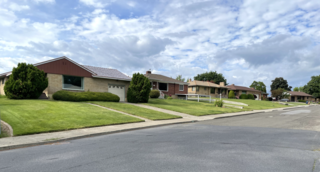
Latah/Hangman is a neighborhood in Spokane, Washington.

<span class="mw-page-title-main">Emerson/Garfield, Spokane</span> Spokane Neighborhood in Washington, United States

Emerson/Garfield is a neighborhood in Spokane, Washington. It is located immediately north of Downtown Spokane's North Bank and extends out into the inner northwestern portion of the city. Emerson/Garfield is a diverse neighborhood with residential, commercial and civic zones all bordering one another, with density ranging from single-family homes to multi-use buildings. Due to its location in the central area of Spokane, Emerson/Garfield is criss-crossed by numerous arterials and thoroughfares. Along those main roads are numerous commercial and retail districts of importance to both the neighborhood and city as a whole.

<span class="mw-page-title-main">Lincoln Heights, Spokane</span> Spokane Neighborhood in Washington, United States

Lincoln Heights is a neighborhood in Spokane, Washington. It is located in the southeastern portion of the city in a broader area commonly known as the South Hill. As the name suggests, Lincoln Heights lies on the slopes and atop the crest of the South Hill area. Lincoln Heights is home to a mix of single-family residential, multi-family residential, and commercial areas and a significant amount of park land. The Lincoln Heights Shopping Center and surrounding area is one of the largest and most important commercial and retail districts on the entire south side of Spokane.

<span class="mw-page-title-main">Comstock, Spokane</span> Spokane Neighborhood in Washington, United States

Comstock is a neighborhood in Spokane, Washington. It is located on the south side of the city in a broader area commonly known as the South Hill. The neighborhood is primarily single-family residential, and a mix of homes built during the streetcar era and then built during the post-World War II housing boom. The neighborhood is also home to a few commercial districts, including the regionally important Manito Shopping Center, two schools, the eponymous Comstock Park, sports fields and a golf course.

<span class="mw-page-title-main">Grandview/Thorpe, Spokane</span> Spokane Neighborhood in Washington, United States

Grandview/Thorpe is a neighborhood in Spokane, Washington. Located in southwestern Spokane, the neighborhood takes its name from two roads that pass through. Grandview Boulevard, so named because of its location at the top of a ridge from which large swaths of Spokane, the Spokane Valley and surrounding mountains to the north and east such as Mount Spokane, can be seen, is located in the northern part of the neighborhood. Thorpe Road traverses a gully in the central and southern portion of the neighborhood.

<span class="mw-page-title-main">North Hill, Spokane</span> Spokane Neighborhood in Washington, United States

North Hill is a neighborhood in Spokane, Washington. As the name suggests, it is atop a hill on the north side of Spokane, within which it is centrally located and crossed by numerous major thoroughfares. It is home to parks, commercial districts and single family residential areas. The historic Garland Theater is located in North Hill, and the city's main north–south arterial, Division Street, is home to a major commercial district along the eastern edge of the neighborhood.

<span class="mw-page-title-main">West Hills, Spokane</span> Spokane Neighborhood in Washington, United States

West Hills is a neighborhood in Spokane, Washington. As the name suggests, the neighborhood is located on hillsides to the west of downtown Spokane. The neighborhood also extends far to the west along the West Plains to incorporate the Spokane International Airport and surrounding land. As the city has grown over the decades, the West Hills neighborhood has expanded uphill and onto the plains to the west. That history of incremental growth, combined with the hilly topography of the area cut by numerous watercourses, has broken up the neighborhood into multiple, distinct areas with swaths of undeveloped land mixed in between.

<span class="mw-page-title-main">North Indian Trail, Spokane</span> Spokane neighborhood in Washington, United States

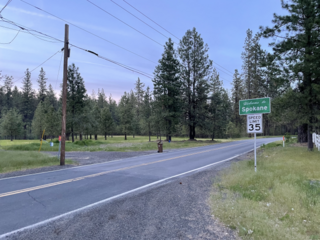
North Indian Trail is a neighborhood in the northwesternmost corner of Spokane, Washington. It extends to the northwest of the rest of Spokane along a tableland east of the Spokane River, west of the Five Mile Prairie. Its terrain isolates the neighborhood somewhat, and it was only extensively developed starting in the second half of the 20th century.

<span class="mw-page-title-main">Balboa/South Indian Trail, Spokane</span> Spokane Neighborhood in Washington, United States

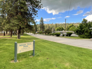
Balboa/South Indian Trail is a neighborhood in Spokane, Washington located on the northwestern side of the city. The neighborhood is largely composed of single-family residential areas that were developed after being annexed into the city in the 1950s. The neighborhood is situated on tableland above a steep bluff rising from the Spokane River to the west, that then rises up a more developed bluff towards Five Mile Prairie which is located above the neighborhood to the north and east.

<span class="mw-page-title-main">Nevada Heights, Spokane</span> Spokane Neighborhood in Washington, United States

Nevada Heights is a neighborhood in Spokane, Washington, located on the north side of the city. Its southern border is atop a bluff that runs east–west across the north side of the city, which gives the neighborhood its name. Nevada Street, a major north–south arterial, runs through the neighborhood. The neighborhood is largely residential, but also home to large retail districts, medical facilities, schools and parks. Being surrounded by the city of Spokane on all sides, the neighborhood is well integrated into urban area.

<span class="mw-page-title-main">Shiloh Hills, Spokane</span> Spokane Neighborhood in Washington, United States

Shiloh Hills is a neighborhood in Spokane, Washington, located on the far northeastern side of the city. It is one of the newer areas of the city, initially annexed in the late 1960s with growth continuing into the 21st century. The neighborhood is home to residential, commercial and industrial districts as well as multiple regionally important transportation corridors such as the Division Street "Y".

<span class="mw-page-title-main">Northwest, Spokane</span> Spokane Neighborhood in Washington, United States

Northwest is a neighborhood in Spokane, Washington, located in the northwestern portion of the city. Largely single-family residential, Northwest is also home to Spokane's VA Medical Center, the Dwight Merkel Sports complex, a large public sports facility, and portions of Riverside State Park along the Spokane River. The neighborhood contains developments that span from the post-World War II housing boom in the east to more contemporary, suburban-style developments in the west. It was also home to Joe Albi Stadium from 1950 until 2022, which served as the Spokane region's main high school sports stadium over its seven decades of use.

<span class="mw-page-title-main">Whitman, Spokane</span> Spokane Neighborhood in Washington, United States

Whitman is a neighborhood located on the northeast side of Spokane, Washington. It is named for pioneer missionaries Marcus and Narcissa Whitman.

References

  1. 1 2 3 "Comstock Neighborhood Snapshot" (PDF). spokanecity.org. City of Spokane. Retrieved 23 May 2022.
  2. 1 2 "South Hill Coalition". spokanecity.org. City of Spokane. Retrieved 24 May 2022.
  3. 1 2 "Annexation History | City of Spokane". data-spokane.opendata.arcgis.com. City of Spokane. Retrieved 24 May 2022.
  4. "History - Spokane Tribe of Indians". spokanetribe.com. Spokane Tribe of Indians. Retrieved 24 May 2022.
  5. 1 2 3 4 5 6 7 "Southgate Neighborhood Profile" (PDF). spokanecity.org. City of Spokane. Retrieved 24 May 2022.
  6. Sowa, Tom (28 June 2013). "Target will build South Hill store". The Spokesman-Review. Retrieved 24 May 2022.
  7. 1 2 "Spokane SE Quadrangle". usgs.gov. U.S. Geological Survey. Retrieved 24 May 2022.
  8. "Spokane SW Quadrangle". usgs.gov. U.S. Geological Survey. Retrieved 24 May 2022.
  9. "Glenrose Watershed Glenrose Virtual Tour". spokanecounty.org. Spokane County. Retrieved 24 May 2022.
  10. Hammer, Hawk (13 April 2019). "Construction underway at Southeast Sports Complex, new playground being added". KXLY-TV. Retrieved 24 May 2022.
  11. "Official Arterial Street Map" (PDF). spokanecity.org. City of Spokane. Retrieved 24 May 2022.
  12. "Spokane Regional Bike Map". srtc.maps.arcgis.com. Spokane Regional Transportation Council. Retrieved 24 May 2022.
  13. "STA System Map" (PDF). spokanetransit.com. Spokane Transit Authority. Retrieved 19 June 2022.
  14. Nelson, Madeline (1 June 2021). "Denny Yashuara, Pauline Flett and Carla Peperzak: SPS chooses names for 3 new middle schools". KREM-TV. Retrieved 24 May 2022.
  15. "Elementary Schools Boundary Map" (PDF). spokaneschools.org. Spokane Public Schools. Retrieved 24 May 2022.
  16. "High School Boundary Map" (PDF). spokaneschools.org. Spokane Public Schools. Retrieved 24 May 2022.