Southwest Wyoming Regional Airport(IATA: RKS, ICAO: KRKS, FAALID: RKS) is eight miles east of Rock Springs, in Sweetwater County, Wyoming, United States. It is operated by the Rock Springs-Sweetwater County Joint Powers Airport Board,[1] with a total of five members, two appointed by the City of Rock Springs and three appointed by Sweetwater County. The airport has twice-daily United Express flights to Denver International Airport.
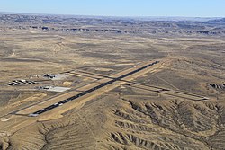
The airport covers 1,242 acres (503 ha) at an elevation of 6,765 feet (2,062 m). It has two asphalt runways: 9/27 is 10,000 by 150 feet (3,048 x 46 m) and 3/21 is 5,228 by 75 feet (1,593 x 23 m).[1] RWY 27 has an ILS and RNAV GPS approach while RWY 9 has a RNAV GPS approach.
The airport's commercial terminal opened in 1978; plans are underway to expand and renovate it.[when?]
RKS has over 7 acres of aircraft apron space and offers Aircraft Rescue Fire Fighting services up to Index C.
It has over 130,000 ft2 of hangar space including community hangar space large enough to support multiple large cabin corporate aircraft. All facilities are owned by the City of Rock Springs and operated by the Airport Board.
In December 2017, it became the first airport in Wyoming to use a renewable energy power source for part of its electrical demand. The 25 KW solar farm installed by Creative Energies offsets a portion of the electrical demand for the General Aviation Complex operated by Sweetwater Aviation.
Operations & passenger statistics
In 2018 the airport had 16,674 aircraft operations, average 46 per day: 72.2% general aviation, 27.3% air taxi, and <1% military. 41 aircraft were then based at this airport: 85% single-engine, 12% multi-engine, and 2% helicopter, plus 3 ultralight aircraft.
Order 2000-5-14 (May 11, 2000): tentatively reselecting Great Lakes Aviation to provide essential air service at Laramie, Rock Springs and Worland, Wyoming, for the two-year period from May 1, 2000 – April 30, 2002, at an annual subsidies of $297,633, for Laramie, $465,023, for Rock Springs, and $353,345 for Worland.
Order 2002-7-20 (July 11, 2002): extends the interim subsidy rates of Great Lakes Aviation, Ltd. at each of the communities listed (Page, AZ; Alamosa, CO; Pueblo, CO; Ironwood, MI/Ashland, WI; McCook, NE; Laramie, WY; Rock Springs, WY; Worland, WY; Moab, UT; Vernal, UT).
Order 2004-7-16 (July 20, 2004): selects Great Lakes Aviation, Ltd., to provide essential air service with 19-passenger B1900Ds at Laramie, Riverton, Rock Springs, and Worland, Wyoming, for two years for annual subsidy rates of $397,400, $394,046, $390,488, and $797,844, respectively.
Order 2006-9-9 (September 11, 2006): re-selecting Great Lakes Aviation, Ltd., operating as both a United Airlines and Frontier code-share partner, to provide subsidized essential air service (EAS) at Laramie and Worland, Wyoming, at an annual subsidy rate of $487,516 for Laramie and $972,757 for Worland, for the two-year period of October 1, 2006, through September 30, 2008. On June 14, 2006, Great Lakes notified the Department that it will continue its existing service at Rock Springs but subsidy-free as of October 1, 2006, the beginning of the new rate-term. On July 24, 2006 Great Lakes notified the Department that it will continue its existing service at Riverton subsidy-free beginning October 1, 2006.
This page is based on this Wikipedia article Text is available under the CC BY-SA 4.0 license; additional terms may apply. Images, videos and audio are available under their respective licenses.