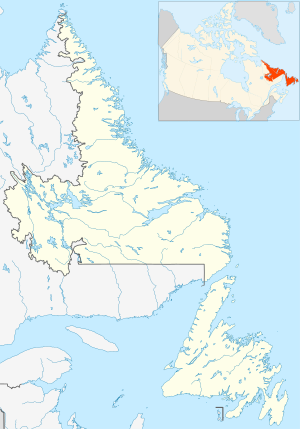
Cape Spear is a headland located on the Avalon Peninsula of Newfoundland near St. John's in the Canadian province of Newfoundland and Labrador. At a longitude of 52°37' W, it is the easternmost point in Canada and North America, excluding Greenland.

Canadian Forces Station Barrington, also referred to as CFS Barrington, was a Canadian Forces Station located in the unincorporated community of Baccaro, Nova Scotia at Baccaro Point near the southwesternmost point of the province.
Pepperrell Air Force Base, previously known as Fort Pepperrell, is a decommissioned United States military base located in St. John's, Newfoundland, Canada which operated from 1941 to 1961.

The 64th Air Division is an inactive United States Air Force organization. Its last assignment was with Air Defense Command, being stationed at Stewart Air Force Base, New York. It was inactivated on 1 July 1963.

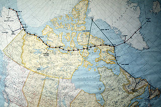
The Northeast Air Command (NEAC) was a short-lived organization in the United States Air Force tasked with the operation and defense of air bases in Greenland, Labrador and Newfoundland. It was formed in 1950 from the facilities of the United States established during World War II in Northeast Canada, Newfoundland and Greenland. It was discontinued in 1957.

Cross City Air Force Station is a former United States Air Force facility, located 1.6 miles (2.6 km) east of Cross City, Florida.

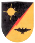
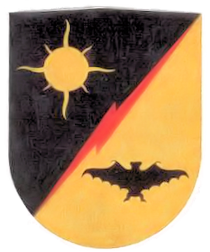
The 4732nd Air Defense Group is a discontinued United States Air Force organization. Its last assignment was with the 64th Air Division of Air Defense Command at Goose Air Force Base, Newfoundland, Canada, where it was discontinued in 1960. The group was formed in 1957 when ADC assumed responsibility for air defense of Newfoundland and Northern Canada from Northeast Air Command and controlled a fighter-interceptor squadron at Harmon and seven squadrons operating radars at dispersed locations. It was discontinued when Goose Air Defense Sector assumed responsibility for air defense of Newfoundland and Northern Canada.
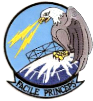
The 4731st Air Defense Group is a discontinued United States Air Force organization. Its last assignment was with the 64th Air Division of Air Defense Command (ADC) at Ernest Harmon Air Force Base, Newfoundland, Canada, where it was inactivated in 1960. The group was formed in 1957 when ADC assumed responsibility for air defense of Newfoundland from Northeast Air Command and controlled a fighter-interceptor squadron at Harmon and two squadron operating radars at dispersed locations. It was discontinued when Goose Air Defense Sector assumed responsibility for air defense of Newfoundland.
The 4733d Air Defense Group is a discontinued United States Air Force organization. Its last assignment was with the 64th Air Division at Frobisher Bay, Baffin Island, Northwest Territories, Canada, where it was discontinued in 1958. The group was formed in 1957 when ADC assumed responsibility for air defense of Northern Canada from Northeast Air Command, including support for remote Distant Early Warning Line radar sites. It also controlled two squadrons operating radars at dispersed locations. It was discontinued in 1958 and its DEW Line support mission transferred to the 4601st Support Group and its radar squadrons to the 4732d Air Defense Group in Newfoundland.
The 685th Aircraft Control and Warning Squadron is an inactive United States Air Force unit. It was last assigned to the Oklahoma City Air Defense Sector, Aerospace Defense Command, stationed at Las Cruces Air Force Station, New Mexico. It was inactivated on 1 August 1963.

Aiken Air Force Station is a closed United States Air Force General Surveillance Radar station. It is located 6.4 miles (10.3 km) north-northeast of Aiken, South Carolina. It was closed in 1975.
Red Cliff Air Station was a General Surveillance Radar station. The remains of which are located 5.8 miles (9.3 km) north-northeast of St. John's, Newfoundland and Labrador, Canada. It was closed in 1961.

Saint Anthony Air Station is a closed General Surveillance Radar station. It is located 292.5 miles (470.7 km) north-northwest of St. John's, Newfoundland and Labrador, Canada. It was closed in 1968.

Canadian Forces Station Beaverlodge is a closed General Surveillance Radar station. It is located 4.9 miles (7.9 km) east-northeast of Beaverlodge, Alberta. It was closed in 1988.
Elliston Ridge Air Station was a General Surveillance Gap Filler Radar station in the Canadian province of Newfoundland and Labrador, It was located 74 miles (119 km) north-northwest of St. John's. It was closed in 1961.
La Scie Air Station was a General Surveillance Gap Filler Radar station in the Canadian province of Newfoundland and Labrador, It was located 210 miles (340 km) east-northeast of St.John's, Near La Scie. It was closed in 1961.

Fox Harbour Air Station was a General Surveillance Gap Filler Radar station in St. Lewis in the Canadian province of Newfoundland and Labrador, It was located 210 miles (340 km) southeast of CFB Goose Bay. It was closed in 1961.
Fogo Island Radar Station (Quad) was a United States Army General Surveillance Ground Radar Early Warning Station in the Dominion of Newfoundland. It was built during World War II and responsible for monitoring air traffic from Gander to Goose Bay and into the Atlantic Ocean. It was located in Sandy Cove, Fogo Island 260 kilometres (160 mi) north-northwest of St. John's. It was closed in 1945.
Allan's Island Radar Station (Cinco) was a United States Army General Surveillance Ground Radar Early Warning Station in the Dominion of Newfoundland. It was built during World War II and responsible for monitoring air traffic from Naval Station Argentia to Gander and into the Gulf of St. Lawrence. It was located on Allan’s Island 250 kilometres (160 mi) southwest of St. John's. It was closed in 1945.