La Scie Air Station

Last updated

La Scie Air Station
USAF - Aerospace Defense Command.png
Part of Pinetree Line
Newfoundland, Canada
921st Aircraft Control and Warning Squadron - Emblem.png
Emblem of the 921st Aircraft Control and Warning Squadron
Coordinates 49°58′50″N055°31′48″W / 49.98056°N 55.53000°W / 49.98056; -55.53000 (La Scie AS N-26B)
TypeRadar Station
CodeN-26B
Site information
Controlled by Aerospace Defense Command
Site history
Built1957
Built by United States Air Force
In use1957-1961
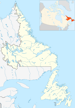
Canada Newfoundland and Labrador location map 2.svg
Red pog.svg
La Scie AS
Location of La Scie AS

La Scie Air Station (ADC ID: N-26B) was a General Surveillance Gap Filler Radar station in the Canadian province of Newfoundland and Labrador, It was located 210 miles (340 km) east-northeast of St.John's, Near La Scie. [1] It was closed in 1961.[ citation needed ]

Contents

History

The site was established in 1957 as a manned Gap Filler radar station, built by the United States Air Force, under operational control of Saint Anthony Air Station and part of Pinetree Line of Ground-Control Intercept (GCI) radar sites.[ citation needed ]

The station was assigned to Aerospace Defense Command in 1957, and was given designation "N-26B" (later C-26B). Aerospace Defense Command stationed the 642d Aircraft Control and Warning Squadron at the station in 1957. It operated an AN/FPS-14 manned Gap Filler search radar.[ citation needed ]

As a manned Gap Filler base, the 921st's role was to guide interceptor aircraft toward unidentified intruders picked up on the unit's radar scopes. These interceptors were assigned to the 64th Air Division at Goose AFB, Labrador. [2]

USAF units and assignments

Units:

Assigned to Air Defense Command, 1 April 1957
Discontinued 1961

Assignments:

See also

Related Research Articles

<span class="mw-page-title-main">CFS Saglek</span> Canadian Forces Air Command radar base

Canadian Forces Station Saglek is a Royal Canadian Air Force radar base in the former Pinetree Line and currently part of the North Warning System, located near Saglek Bay in Newfoundland and Labrador, 367.7 miles (591.8 km) north-northwest of CFB Goose Bay.

Dickinson Air Force Station is a closed United States Air Force General Surveillance Radar station. It is located 3.8 miles (6.1 km) northeast of Dickinson, North Dakota. It was closed in 1965.

<span class="mw-page-title-main">Brunswick Air Force Station</span> Closed United States Air Force station in Brunswick, Maine

Brunswick Air Force Station is a closed United States Air Force General Surveillance Radar station. It is located 2.5 miles (4.0 km) east-southeast of Brunswick, Maine. It was closed in 1965.

Killeen Air Force Station is a closed United States Air Force General Surveillance Radar station. It is located 9.2 miles (14.8 km) west-southwest of Killeen, Texas. It was closed in 1961.

<span class="mw-page-title-main">Rockport Air Force Station</span> Closed United States Air Force General Surveillance Radar station

Rockport Air Force Station is a closed United States Air Force General Surveillance Radar station. It is located 4.1 miles (6.6 km) southwest of Lamar, Texas. It was closed in 1963.

<span class="mw-page-title-main">Two Creeks Air Force Station</span> United States Air Force Radar station

Two Creeks Air Force Station is a closed United States Air Force General Surveillance Radar station. It is located 0.7 miles (1.1 km) north-northwest of Two Creeks, Wisconsin. It was closed in 1957.

Zapata Air Force Station is a closed United States Air Force General Surveillance Radar station. It is located 3.2 miles (5.1 km) north of Zapata, Texas. It was closed in 1961.

Lake Charles Air Force Station is a closed United States Air Force General Surveillance Radar station. It is located 3.8 miles (6.1 km) southeast of Lake Charles, Louisiana. It was closed in 1995 by the Air Force, and turned over to the Federal Aviation Administration (FAA).

<span class="mw-page-title-main">Cartwright Air Station</span> Former Canadian General Surveillance Radar station

Cartwright Air Station is a closed General Surveillance Radar station. It is located 233.7 km (145.2 mi) east-northeast of CFB Goose Bay, Newfoundland and Labrador. It was closed in 1968.

<span class="mw-page-title-main">Melville Air Station</span> Radar station in Newfoundland and Labrador, Canada 1953–1988

Melville Air Station was a General Surveillance Radar station. It was located on the summit of Dome Mountain, 5.4 miles (8.7 km) west of CFB Goose Bay, Newfoundland and Labrador. It was closed in 1988.

<span class="mw-page-title-main">Hopedale Air Station</span> General Surveillance Radar station

Hopedale Air Station is a General Surveillance Radar station that the USAF closed in 1968. It is located north of the community of Hopedale, Newfoundland and Labrador 147.8 miles (237.9 km) west-northwest of CFB Goose Bay, Newfoundland and Labrador, Canada.

<span class="mw-page-title-main">Red Cliff Air Station</span> General Surveillance Radar station

Red Cliff Air Station was a General Surveillance Radar station. The remains of which are located 5.8 miles (9.3 km) north-northeast of St. John's, Newfoundland and Labrador, Canada. It was closed in 1961.

<span class="mw-page-title-main">Saint Anthony Air Station</span> Closed Canadian radar station

Saint Anthony Air Station is a closed General Surveillance Radar station. It is located 292.5 miles (470.7 km) north-northwest of St. John's, Newfoundland and Labrador, Canada. It was closed in 1968.

<span class="mw-page-title-main">CFS Beaverlodge</span> Radar station in Alberta, Canada 1953–1988

Canadian Forces Station Beaverlodge is a closed General Surveillance Radar station. It is located 4.9 miles (7.9 km) east-northeast of Beaverlodge, Alberta. It was closed in 1988.

Elliston Ridge Air Station was a General Surveillance Gap Filler Radar station in the Canadian province of Newfoundland and Labrador, It was located 74 miles (119 km) north-northwest of St. John's. It was closed in 1961.

<span class="mw-page-title-main">Cape Makkovik Air Station</span> General Surveillance Gap Filler Radar station

Cape Makkovik Air Station was a General Surveillance Gap Filler Radar station in the Canadian province of Newfoundland and Labrador, It was located 140 miles (230 km) north-northeast of CFB Goose Bay. It was closed in 1961.

<span class="mw-page-title-main">Cut Throat Island Air Station</span> Former US Air Force radar station in Canada

Cut Throat Island Air Station was a General Surveillance Gap Filler Radar station in the Canadian province of Newfoundland and Labrador, It was located 160 miles (260 km) east-northeast of CFB Goose Bay. It was closed in 1961.

<span class="mw-page-title-main">Spotted Island Air Station</span> General Surveillance Gap Filler Radar station

Spotted Island Air Station was a General Surveillance Gap Filler Radar station in the Canadian province of Newfoundland and Labrador, It was located 195 miles (314 km) east of CFB Goose Bay. It was closed in 1961.

<span class="mw-page-title-main">Fox Harbour Air Station</span> Canadian radar station

Fox Harbour Air Station was a General Surveillance Gap Filler Radar station in St. Lewis in the Canadian province of Newfoundland and Labrador, It was located 210 miles (340 km) southeast of CFB Goose Bay. It was closed in 1961.

<span class="mw-page-title-main">Stephenville Air Station</span> Closed General Surveillance Radar station

Stephenville Air Station is a closed General Surveillance Radar station. It is located 9.5 kilometres (5.9 mi) north-northwest of Stephenville, Newfoundland and Labrador, Canada. It was closed in 1971.

References

PD-icon.svg This article incorporates public domain material from the Air Force Historical Research Agency

  1. "The CADIN Pinetree Line Locations".
  2. Information for La Scie AS, NL