Empire Air Force Station

Last updated

Empire Air Force Station
Air Defense Command.svg
Part of Air Defense Command (ADC)
USA Michigan location map.svg
Red pog.svg
Empire AFS
Location of Empire AFS, Michigan
Coordinates 44°48′09″N086°03′11″W / 44.80250°N 86.05306°W / 44.80250; -86.05306 (Empire AFS P-34)
TypeAir Force Station
CodeADC ID: P-34, NORAD ID: Z-34
Current JSS ID: J-58
Site information
Controlled byFlag of the United States Air Force.svg  United States Air Force
ConditionJSS/NEADS site
Site history
Built1950
In use1950-1978
Garrison information
Garrison752d Radar Squadron

Empire Air Force Station is a former United States Air Force Aerospace Defense Command (ADC) long range radar site located 0.7 miles (1.1 km) south-southeast of Empire, Michigan, in Empire Township. It was closed in 1978 by the Air Force, and turned over to the Federal Aviation Administration (FAA).

Contents

Today the site is part of the Joint Surveillance System (JSS), designated by NORAD as Northeast Air Defense Sector (NEADS) Ground Equipment Facility.

History

The radar site was operated by the 752d Aircraft Control and Warning (AC&W) squadron, starting in late 1950. The unit operated and maintained an AN/CPS-6B radar at this site, and initially the station functioned as a Ground-Control Intercept (GCI) and warning station. As a GCI station, the squadron's role was to guide interceptor aircraft toward unidentified intruders picked up on the unit's radar scopes. In 1958 this radar was replaced by an AN/FPS-6. A second height-finder radar arrived a year later.

During 1960 Empire AFS joined the Semi Automatic Ground Environment (SAGE) system, initially feeding data to DC-14 at K. I. Sawyer AFB, Michigan. After joining, the squadron was re-designated as the 752d Radar Squadron (SAGE) on 15 July 1960. In 1963, Empire AFS was switched to the SAGE Data Center DC-06 at Custer AFS, Michigan. The radar squadron provided information 24/7 the SAGE Direction Center where it was analyzed to determine range, direction altitude speed and whether or not aircraft were friendly or hostile.

Also during 1960 Empire site began operating an AN/FPS-7 radar, and one of the AN/FPS-6 height-finder radars was supplanted by an AN/FPS-26A in 1963.

The Empire AFS site ID was changed to Z-34 when all SAGE radar squadron designations received the NORAD "Z" prefix on 31 July 1963. [1]

In 1964 Empire site became an ADC/FAA (Federal Aviation Administration) Joint Surveillance System (JSS) site.

In addition to the main facility, Empire operated two AN/FPS-18 gap-filler sites:

Control of two more gap-fillers was transferred to the 752d from the 781st Radar Squadron (SAGE) at Custer AFS on 27 January 1965 as the 781st was being inactivated. [2]

Of the four gap-filler radars once under the control of Empire AFS, only the Saugatuck annex still stands basically as it did while in operation. In fact, of all of the radars in the SAGE system, gap-filler or long-range, the Saugatuck annex appears to be the last site in public hands that is nearly completely intact with all of the Cold War era electronic equipment still in place in both the building and tower.

Over the years, the equipment at Empire AFS was upgraded or modified to improve the efficiency and accuracy of the information gathered by the radars. The 752d Radar Squadron (SAGE) was inactivated in April 1978, and the AN/FPS-26A height-finder was decommissioned in this time frame.

The FAA assumed control of the radar operations area except for the AN/FPS-6 height-finder radar (now modified to the AN/FPS-116 variant). The National Park Service assumed control of the rest of the property, which is now part of Sleeping Bear Dunes National Lakeshore. Circa 1980 or 1981, the AN/FPS-7 search radar was replaced by an FAA model ARSR-3 search radar. The AN/FPS-116 height-finder radar was removed c. 1988. The ARSR-3 was replaced by an ARSR-4 in the late 1990s.

Many of the veterans of this site still reside in the area and in Traverse City, Michigan, approximately 26 miles (42 km) east of Empire. The museum in Empire has a full history of the air station, including a historical marker and the original rock marker for the Dining Hall on display. Reunions are held annually for the veterans of Empire AFS.

Air Force units and assignments

Emblem of the 752d Aircraft Control and Warning Squadron 752nd Aircraft Control & Warning Squadron emblem.png
Emblem of the 752d Aircraft Control and Warning Squadron

Units

Activated on 27 November 1950
Redesignated as the 752d Radar Squadron (SAGE) on 15 July 1960
Redesignated as the 752d Radar Squadron on 1 February 1974
Inactivated on 1 April 1978

Assignments

See also

Related Research Articles

Point Arena Air Force Station is a closed United States Air Force General Surveillance Radar station. It is located 3.7 miles (6.0 km) east of Point Arena, California. It was closed in 1998 by the Air Force, and turned over to the Federal Aviation Administration (FAA).

<span class="mw-page-title-main">Ground Equipment Facility J-33</span> Federal Aviation Administration (FAA) radar station

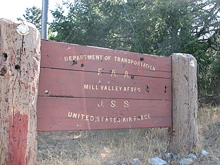
Ground Equipment Facility J-33 is a Federal Aviation Administration (FAA) radar station of the Joint Surveillance System's Western Air Defense Sector (WADS) with an Air Route Surveillance Radar (ARSR-4). The facility was previously a USAF general surveillance radar station during the Cold War.

Minot Air Force Station [Permanent Installation Number (PIN): 1445; Installation Location Code (ILC): QJVM]) is a closed United States Air Force General Surveillance Radar station. It is located 16.2 miles (26.1 km) south of Minot, North Dakota; on the west side of US Highway 83. It was closed in 1979. A portion of the property was reopened in 1984 as the Minot Communications Site and served until 1997.

<span class="mw-page-title-main">Finley Air Force Station</span> Former US Air Force radar station

Finley Air Force Station is a closed United States Air Force General Surveillance Radar station. It is located 1.5 miles (2.4 km) west-northwest of Finley, North Dakota. It was closed in 1979 by the Air Force, and turned over to the Federal Aviation Administration (FAA).

Dickinson Air Force Station is a closed United States Air Force General Surveillance Radar station. It is located 3.8 miles (6.1 km) northeast of Dickinson, North Dakota. It was closed in 1965.

North Charleston Air Force Station is a closed United States Air Force General Surveillance Radar station. It is located in the City of North Charleston, South Carolina. It was closed in 1980.

Oakdale Air Force Station is a United States Air Force General Surveillance Radar station. It is located 1.3 miles (2.1 km) east of the Pittsburgh suburb of Oakdale, Pennsylvania. It was closed in 1969.

<span class="mw-page-title-main">Kirksville Air Force Station</span> Former US Air Force radar station in Missouri

Kirksville Air Force Station is a closed United States Air Force General Surveillance Radar station. It is located 7.1 miles (11.4 km) north of Kirksville, Missouri. It was closed by the Air Force in 1968. Today the radar site is used by the Federal Aviation Administration (FAA) as a Joint Surveillance System (JSS) site.

<span class="mw-page-title-main">Custer Air Force Station</span> Radar station in Michigan, US 1952–1965

Custer Air Force Station is a closed United States Air Force General Surveillance Radar and Direction Center station. It is located 5.3 miles (8.5 km) west-northwest of Battle Creek, Michigan. It was closed in 1969.

Omaha Air Force Station is a closed United States Air Force General Surveillance Radar station. It is located 7.5 miles (12.1 km) north of Omaha, Nebraska. It was closed in 1968.

<span class="mw-page-title-main">Ajo Air Force Station</span> Closed USAF surveillance radar site

Ajo Air Force Station is a closed United States Air Force General Surveillance Radar station. It is located 6.4 miles (10.3 km) northwest of Ajo, Arizona. It was closed in 1969 by the Air Force, and the radar site turned over to the Federal Aviation Administration (FAA).

<span class="mw-page-title-main">Mount Laguna Air Force Station</span> Radar station in California, US 1952–1981

Mount Laguna Air Force Station is a closed United States Air Force General Surveillance Radar station. It is located 24.3 miles (39.1 km) north-northeast of Tecate, California. It was closed in 1981 by the Air Force, and turned over to the Federal Aviation Administration (FAA).

<span class="mw-page-title-main">Klamath Air Force Station</span> Closed United States Air Force General Surveillance Radar station

Klamath Air Force Station is a closed United States Air Force General Surveillance Radar station. It is 3.4 miles (5.5 km) northwest of Klamath, California, and was closed in 1981.

<span class="mw-page-title-main">Ground Equipment Facility J-82</span> Radar station in Oregon, US 1957–1979

Keno Air Force Station is a closed United States Air Force General Surveillance Radar station. It is located 4.6 miles (7.4 km) south-southwest of Keno, Oregon. It was closed in 1979 by the Air Force, and turned over to the Federal Aviation Administration (FAA).

Lake Charles Air Force Station is a closed United States Air Force General Surveillance Radar station. It is located 3.8 miles (6.1 km) southeast of Lake Charles, Louisiana. It was closed in 1995 by the Air Force, and turned over to the Federal Aviation Administration (FAA).

Mica Peak Air Force Station is a closed United States Air Force General Surveillance Radar station. It is located atop Mica Peak, 6.3 miles (10.1 km) east-northeast of Mica, Washington. It was closed in 1975 by the Air Force, and turned over to the Federal Aviation Administration (FAA).

<span class="mw-page-title-main">Kalispell Air Force Station</span>

Kalispell Air Force Station is a closed United States Air Force General Surveillance Radar station. It is located 13.3 miles (21.4 km) south of Kalispell, Montana near the community of Lakeside.

Makah Air Force Station is a closed United States Air Force General Surveillance Radar station. It is located 2.4 miles (3.9 km) south of Neah Bay, Washington. It was closed in 1988 by the Air Force, and turned over to the Federal Aviation Administration (FAA).

<span class="mw-page-title-main">Fort Lawton Air Force Station</span>

Fort Lawton Air Force Station is a closed United States Air Force General Surveillance Radar station. It is located on Fort Lawton in the Magnolia neighborhood of northwest Seattle, Washington. The Air Force inactivated its unit in 1963; while the site remained under Army control until 1974. Today the Federal Aviation Administration (FAA) operates the site as part of the Joint Surveillance System (JSS).

<span class="mw-page-title-main">Saugatuck Gap Filler Radar Annex</span> Last cold War radar installation

The Saugatuck Gap Filler Annex is a decommissioned air defense radar installation previously of the United States Air Force. It served in the vast Cold War era Semi-Automatic Ground Environment (SAGE) air defense system. Of the hundreds of SAGE radars, Saugatuck's is one of, perhaps, two that remain nearly completely intact.

References

PD-icon.svg This article incorporates public domain material from the Air Force Historical Research Agency

  1. Winkler, David, et al. (1997). Searching the Skies - The Legacy of the United States Cold War Defense Radar Program. United States Air Force Air Combat Command. p. 93.
  2. Easton, Read (1965). "Historical Record of the 781st Radar Squadron (SAGE), Custer AFS, Battle Creek, Michigan for the period ending 31 March 1965". Air Force Historical Research Agency. Microfilm Reel # K0606: 975.