Fort Lee Air Force Station

Last updated • 2 min readFrom Wikipedia, The Free Encyclopedia
Fort Lee Air Force Station
Air Defense Command.svg
Part of Air Defense Command (ADC)
USA Virginia location map.svg
Red pog.svg
Fort Lee AFS
Location of Fort Lee AFS, Virginia
Coordinates 37°15′08″N77°19′21″W / 37.25222°N 77.32250°W / 37.25222; -77.32250 (Fort Lee AFS DC-04) Coordinates: 37°15′08″N77°19′21″W / 37.25222°N 77.32250°W / 37.25222; -77.32250 (Fort Lee AFS DC-04)
TypeAir Force Station
Site information
Controlled byFlag of the United States Air Force.svg  United States Air Force
Site history
Built1956
In use1956-1983
Garrison information
Garrison Washington Air Defense Sector
33d Air Division
20th Air Division
Washington Air Defense Sector - Emblem.png
Emblem of the Washington Air Defense Sector
USAF 33d Air Division Crest.jpg
Emblem of the 33d Air Division
USAF 20th Air Division Crest.jpg
Emblem of the 20th Air Division

Fort Lee Air Force Station is a former United States Air Force station. It is located 2.9 miles (4.7 km) northwest of Prince George, Virginia. It was closed in 1983 due to budget cuts.

Contents

History

Fort Lee Air Force Station, located on the United States Army Fort Lee installation, was selected in 1956 for a Semi Automatic Ground Environment (SAGE) system direction center (DC) site, designated DC-04. The SAGE system was a network linking Air Force (and later FAA) General Surveillance Radar stations into a centralized center for Air Defense, intended to provide early warning and response for a Soviet nuclear attack. This automated control system was used by NORAD for tracking and intercepting enemy bomber aircraft. In the later versions the system could automatically direct aircraft to an interception by sending instructions directly to the aircraft's autopilot.

The 4625th Air Defense Wing was activated at the site under the 85th Air Division on 1 December 1956 to supervise the construction of the SAGE blockhouses and the installation and testing of the SAGE electronic and data processing equipment. The 4625th ADW was re-designated as the Washington Air Defense Sector (WaADS) on 8 January 1957 upon DC-04's activation, remaining under the 85th AD.

The operation of the Semi Automatic Ground Environment (SAGE) direction center (DC-04) was the mission the WaADS. The Sector was disestablished on 1 April 1966, the SAGE operations were reassigned to the 33d Air Division, being moved to Fort Lee AFS from Richards-Gebaur AFB, Missouri. The 33d AD was inactivated on 19 November 1969, its assets being assumed by the newly reactivated 20th Air Division at Fort Lee AFS

The DC-04 and the 20th Air Division were inactivated on 1 March 1983 by Air Defense, Tactical Air Command (ADTAC). With its inactivation, Fort Lee Air Force Station was closed. After its closure, the site was taken over by other Federal Government agencies, and is now houses several such offices. Only the orderly room, mess hall and one barracks building still stand of the Air Force station.

The SAGE blockhouse also stands, now named Von Steuben Hall, it contains the U.S. Army Communications-Electronics Command (CECOM) Software Engineering Center - Lee (SEC-Lee).

Known ADCOM units assigned

Transferred to ADTAC as 20th NORAD Region, 1 October 1979-1 March 1983
Re-designated: 20th Air Defense Squadron (SAGE), 1 January 1975-1 March 1983

See also

Related Research Articles

<span class="mw-page-title-main">Fort Fisher Air Force Station</span> United States Air Force installation

Fort Fisher Air Force Station was a United States Air Force installation located on the Atlantic coast 0.8 miles (1.3 km) southwest of Kure Beach, North Carolina. Its primary mission was as a radar complex. It was closed on 30 June 1988 by the Air Force, and turned over to the Federal Aviation Administration (FAA).

<span class="mw-page-title-main">21st Air Division</span> Military unit

The 21st Air Division is an inactive United States Air Force organization. Its last assignment was with Tactical Air Command, being stationed at Griffiss Air Force Base, New York. It was inactivated on 23 September 1983.

<span class="mw-page-title-main">26th Air Division</span> Military unit

The 26th Air Division is an inactive United States Air Force organization. Its last assignment was with Air Defense Tactical Air Command, assigned to First Air Force, being stationed at March Air Force Base, California. It was inactivated on 30 September 1990.

<span class="mw-page-title-main">Finley Air Force Station</span> Former US Air Force radar station

Finley Air Force Station is a closed United States Air Force General Surveillance Radar station. It is located 1.5 miles (2.4 km) west-northwest of Finley, North Dakota. It was closed in 1979 by the Air Force, and turned over to the Federal Aviation Administration (FAA).

Thomasville Air Force Station is a closed United States Air Force General Surveillance Radar station. It is located 1.9 miles (3.1 km) north-northwest of Thomasville, Alabama. It was closed in 1969.

<span class="mw-page-title-main">Washington Air Defense Sector</span> Military unit

The Washington Air Defense Sector (WaADS) is an inactive United States Air Force organization. Its last assignment was with the Air Defense Command (ADC) 26th Air Division, being stationed at Fort Lee Air Force Station (AFS), Virginia. It was inactivated on 1 April 1966.

<span class="mw-page-title-main">Calumet Air Force Station</span> Abandoned Aircraft Control and Warning System located near Calumet, Michigan

Calumet Air Force Station is a closed United States Air Force General Surveillance Radar station. It is located 5.2 miles (8.4 km) east-northeast of Phoenix, Michigan. It was closed in 1988 by the Air Force, and turned over to the Federal Aviation Administration (FAA).

Bedford Air Force Station is a closed United States Air Force General Surveillance Radar station. It is located 12.7 miles (20.4 km) north of Bedford, Virginia. It was closed in 1975.

North Charleston Air Force Station is a closed United States Air Force General Surveillance Radar station. It is located in the City of North Charleston, South Carolina. It was closed in 1980.

<span class="mw-page-title-main">Winston-Salem Air Force Station</span> Closed United States Air Force General Surveillance Radar station in North Carolina

Winston-Salem Air Force Station is a closed United States Air Force General Surveillance Radar station. It is located 1 mile (1.6 km) southeast of Winston-Salem, North Carolina. It was closed in 1970.

<span class="mw-page-title-main">Caswell Air Force Station</span> Former Air Force radar station

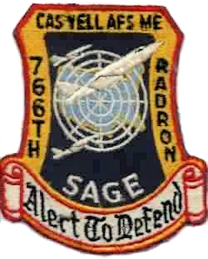
Caswell Air Force Station is a closed United States Air Force General Surveillance Radar station. It is located 4.3 miles (6.9 km) north of Limestone, Maine. It was closed in 1980.

Snow Mountain Air Force Station is a closed United States Air Force General Surveillance Radar station. It is located 1.9 miles (3.1 km) west-southwest of Godman Army Airfield, Kentucky. It was closed in 1968.

<span class="mw-page-title-main">Custer Air Force Station</span> Closed United States Air Force General Surveillance Radar and Direction Center station

Custer Air Force Station is a closed United States Air Force General Surveillance Radar and Direction Center station. It is located 5.3 miles (8.5 km) west-northwest of Battle Creek, Michigan. It was closed in 1969.

Port Austin Air Force Station is a closed United States Air Force General Surveillance Radar station. It is located 1.2 miles (1.9 km) south-southwest Port Austin, Michigan. It was closed in 1988 by the Air Force.

Omaha Air Force Station is a closed United States Air Force General Surveillance Radar station. It is located 7.5 miles (12.1 km) north of Omaha, Nebraska. It was closed in 1968.

<span class="mw-page-title-main">Finland Air Force Station</span> Closed US Air Force military installation

Finland Air Force Station is a closed United States Air Force General Surveillance Radar station. It is located 2.8 miles (4.5 km) north of Finland, Minnesota. It was closed in 1980.

<span class="mw-page-title-main">Mount Laguna Air Force Station</span> Closed United States Air Force General Surveillance Radar station

Mount Laguna Air Force Station is a closed United States Air Force General Surveillance Radar station. It is located 24.3 miles (39.1 km) north-northeast of Tecate, California. It was closed in 1981 by the Air Force, and turned over to the Federal Aviation Administration (FAA).

North Bend Air Force Station is a closed United States Air Force General Surveillance Radar station. It is located 3.9 miles (6.3 km) north-northeast of Hauser, Oregon. It was closed in 1980.

Makah Air Force Station is a closed United States Air Force General Surveillance Radar station. It is located 2.4 miles (3.9 km) south of Neah Bay, Washington. It was closed in 1988 by the Air Force, and turned over to the Federal Aviation Administration (FAA).

<span class="mw-page-title-main">Hancock Field Air National Guard Base</span> NY ANG base at Syracuse Hancock International Airport

Hancock Field Air National Guard Base is a United States Air Force base, co-located with Syracuse Hancock International Airport. It is located 4.6 miles (7.4 km) north-northeast of Syracuse, New York, at 6001 East Molloy Road, Mattydale, NY 13211. The installation consists of approximately 350 acres (1.4 km2) of flight line, aircraft ramp and support facilities on the south side of the airport.

References

PD-icon.svg This article incorporates public domain material from the Air Force Historical Research Agency.