Cottonwood Air Force Station

Last updated

Cottonwood Air Force Station
Air Defense Command.svg
Part of Air Defense Command (ADC)
Cottonwood Butte,
Idaho County, Idaho,
Flag of the United States (23px).png  United States
FPS-24 and FPS-6A Radomes at Cottonwood AFS Idaho 1964.jpg
Cottonwood AFS, c. 1964, with large FPS-24 radome dwarfing FPS-6 radome alongside.
USA Idaho location map.svg
Red pog.svg
Cottonwood AFS
Location of Cottonwood AFS, Idaho
Coordinates 46°04′01″N116°27′51″W / 46.06694°N 116.46417°W / 46.06694; -116.46417 (Cottonwood AFS P-46)
TypeAir Force Station
CodeADC ID: SM-150
Site information
OwnerState of Idaho (1974-present)
Controlled byFlag of the United States Air Force.svg  United States Air Force
ConditionClosed; now a minimum-security state correctional facility [1]
Site history
Built1955-1958 [2] [3]
In use1958-1965
Events Cold War
Garrison information
Garrison822d Aircraft Control
and Warning Squadron
Occupants135

Cottonwood Air Force Station is a former United States Air Force General Surveillance Radar station. The radar site was located at the summit of Cottonwood Butte, 5.7 miles (9.2 km) west-northwest of Cottonwood in Idaho County, Idaho. It was closed in 1965 and transferred to the state of Idaho in 1974, when it was converted to its present use as a minimum-security correctional facility. [1]

Contents

Cottonwood Peak Air Force Station was initially part of Phase II of the Air Defense Command Mobile Radar program. The Air Force approved this expansion of the Mobile Radar program on 23 October 1952. Radars in this network were designated "SM."

History

The station became operational on 1 July 1958 when the 822d Aircraft Control and Warning Squadron (AC&W Sq) was assigned to the new station. The station consisted of 66 buildings, including operation and administrative facilities, 3 dormitories, 27 family housing units, 3 radar domes, and the normal support facilities/utilities. The site was divided into three general areas: the operations area at the summit, cantonment area at mid-mountain, and a family housing area at the north end of the city of Cottonwood. The 822d AC&W Sq operated used AN/MPS-7, AN/MPS-14, and AN/FPS-6 radars, and initially the station functioned as a Ground-Control Intercept (GCI) and warning station. As a GCI station, the squadron's role was to guide interceptor aircraft toward unidentified intruders picked up on the unit's radar scopes.

During 1960 Cottonwood AFS joined the Semi Automatic Ground Environment (SAGE) system, feeding data to DC-07 at Larson AFB, Washington. After joining, the squadron was redesignated as the 822d Radar Squadron (SAGE) on 1 September 1960. The radar squadron provided information 24/7 the SAGE Direction Center where it was analyzed to determine range, direction altitude speed and whether or not aircraft were friendly or hostile. In 1962 the 822d began operating an AN/FPS-24 search radar and an additional AN/FPS-6B radar, as the AN/MPS-7 and AN/MPS-14 units were retired. In 1964 the AN/FPS-6B was upgraded to an AN/FPS-90 and Cottonwood AFS was shifted to feeding data to the SAGE Data center DC-12 at McChord AFB.

In addition to the main facility, Cottonwood operated an AN/FPS-14 Gap Filler site:

The closure of the base was announced in November 1964. [4] A catastrophic bearing failure in the AN/FPS-24 antenna pedestal led to an early shutdown of the station and the inactivation of the 822d Radar Squadron on 25 June 1965 (only two or three years after the AN/FPS-24 radome was installed over the antenna) as part of fiscal year 1965 cutbacks.

The Cantonment Area was used from 1965 to 1974 by the Office of Economic Opportunity as a Job Corps Center. The State of Idaho Dept. of Corrections acquired the property in 1974, and has occupied the site ever since as North Idaho Correctional Institution. [1] [5] This is a program-specific prison designed for male offenders sentenced to a retained jurisdiction commitment by the court. It provides a sentencing alternative for the courts to target those offenders who might, after a period of programming and evaluation, be viable candidates for probation rather than incarceration.

Today most of the radar site on the mountain summit is torn down. The AN/FPS-24 tower still stands but little else, as only building foundations and deteriorated streets remain.

Air Force units and assignments

Emblem of the 822d Radar Squadron 822d Radar Squadron - Emblem.png
Emblem of the 822d Radar Squadron

Units

Activated at Geiger Field, Washington on 1 February 1957
Moved to Cottonwood AFS on 1 July 1958
Redesignated as the 822d Radar Squadron (SAGE), 1 September 1960
Discontinued and inactivated on 25 June 1965

Assignments

See also

Related Research Articles

Dickinson Air Force Station is a closed United States Air Force General Surveillance Radar station. It is located 3.8 miles (6.1 km) northeast of Dickinson, North Dakota. It was closed in 1965.

<span class="mw-page-title-main">Tonopah Air Force Station</span> Radar station in Nevada, US 1956–1970

Tonopah Air Force Station is a closed United States Air Force General Surveillance Radar station. It is located 1.1 miles (1.8 km) south of Tonopah, Nevada. It was closed in 1970.

<span class="mw-page-title-main">Cut Bank Air Force Station</span> US Air Force radar station

Cut Bank Air Force Station is a closed United States Air Force General Surveillance Radar station. It is located 30.4 miles (48.9 km) northwest of Cut Bank, Montana. It was closed in 1965.

Bedford Air Force Station is a closed United States Air Force General Surveillance Radar station. It is located 12.7 miles (20.4 km) north of Bedford, Virginia. It was closed in 1975.

North Charleston Air Force Station is a closed United States Air Force General Surveillance Radar station. It is located in the City of North Charleston, South Carolina. It was closed in 1980.

<span class="mw-page-title-main">Winston-Salem Air Force Station</span> Closed United States Air Force General Surveillance Radar station in North Carolina

Winston-Salem Air Force Station is a closed United States Air Force General Surveillance Radar station that was active from 1956 to 1970. It is located 1 mile (1.6 km) southeast of Winston-Salem, North Carolina.

<span class="mw-page-title-main">Brunswick Air Force Station</span> Closed United States Air Force station in Brunswick, Maine

Brunswick Air Force Station is a closed United States Air Force General Surveillance Radar station. It is located 2.5 miles (4.0 km) east-southeast of Brunswick, Maine. It was closed in 1965.

Saratoga Springs Air Force Station is a closed United States Air Force General Surveillance Radar station. It is located 7.2 miles (11.6 km) southeast of Saratoga Springs, New York. It was closed by the Air Force in 1977.

Snow Mountain Air Force Station is a closed United States Air Force General Surveillance Radar station. It is located 1.9 miles (3.1 km) west-southwest of Godman Army Airfield, Kentucky. It was closed in 1968.

<span class="mw-page-title-main">Custer Air Force Station</span> Radar station in Michigan, US 1952–1965

Custer Air Force Station is a closed United States Air Force General Surveillance Radar and Direction Center station. It is located 5.3 miles (8.5 km) west-northwest of Battle Creek, Michigan. It was closed in 1969.

<span class="mw-page-title-main">Bellefontaine Air Force Station</span> Former US Air Force radar station in Ohio

Bellefontaine Air Force Station is a closed United States Air Force General Surveillance Radar station. It is located 2.3 miles (3.7 km) east-northeast of Bellefontaine, Ohio. It was closed in 1969.

<span class="mw-page-title-main">Rockville Air Force Station</span> Closed air force station in Indiana, United States

Rockville Air Force Station is a closed United States Air Force General Surveillance Radar station. It is located 1.7 miles (2.7 km) west-northwest of Rockville, Indiana. It was closed in 1966.

<span class="mw-page-title-main">Grand Rapids Air Force Station</span> Closed US military installation

Grand Rapids Air Force Station is a closed United States Air Force General Surveillance Radar station. It is located 0.7 miles (1.1 km) east-northeast of Grand Rapids, Minnesota. It was closed in 1963.

Wadena Air Force Station is a closed United States Air Force General Surveillance Radar station. It is located 7 miles (11 km) north-northeast of Wadena, Minnesota. It was closed in 1970.

<span class="mw-page-title-main">Gettysburg Air Force Station</span> Radar station in South Dakota, US 1956–1965

Gettysburg Air Force Station is a closed United States Air Force General Surveillance Radar station. It is located 2.6 miles (4.2 km) north of Gettysburg, South Dakota. It was closed in 1968.

<span class="mw-page-title-main">Las Vegas Air Force Station</span> Closed United States Air Force General Surveillance Radar station

Las Vegas Air Force Station is a closed United States Air Force General Surveillance Radar station. It is located 26.5 miles (42.6 km) west-northwest of Las Vegas, Nevada. It was closed by the Air Force in 1969 and turned over to the Federal Aviation Administration (FAA). The site is now data-tied into the Joint Surveillance System (JSS).

Colville Air Force Station is a closed United States Air Force General Surveillance Radar station. It is located 14.7 miles (23.7 km) east-northeast of Colville, Washington. It was closed in 1961.

Mica Peak Air Force Station is a closed United States Air Force General Surveillance Radar station. It is located atop Mica Peak, 6.3 miles (10.1 km) east-northeast of Mica, Washington. It was closed in 1975 by the Air Force, and turned over to the Federal Aviation Administration (FAA).

<span class="mw-page-title-main">Kalispell Air Force Station</span>

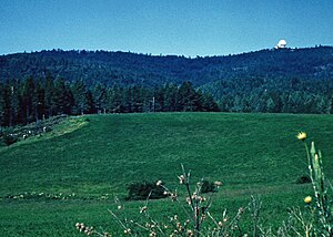
Kalispell Air Force Station is a closed United States Air Force General Surveillance Radar station. It is located 13.3 miles (21.4 km) south of Kalispell, Montana near the community of Lakeside.

Houma Air Force Station is a closed United States Air Force General Surveillance Radar station. It is located 3.5 miles (5.6 km) southeast Houma, Louisiana. It was closed in 1970.

References

  1. 1 2 3 Idaho Department of Corrections - North Idaho Correctional Institution - accessed 2011-11-27
  2. "Air Force to construct station near Lewiston". Spokane Daily Chronicle. Washington. 11 June 1955. p. 5.
  3. "Bids to be opened for Air Force radar station at Cottonwood Butte". Lewiston Morning Tribune. Idaho. 21 July 1955. p. 16.
  4. "Cottonwood radar station caught in Defense Department cutback". Lewiston Morning Tribune. Idaho. 20 November 1964. p. 16.
  5. "State signs lease on Job Corps site". Lewiston Morning Tribune. Idaho. 15 November 1974. p. 16A.

PD-icon.svg This article incorporates public domain material from the Air Force Historical Research Agency