Ralls County is a county located in the northeastern portion of the U.S. state of Missouri. As of the 2020 census, the population was 10,355. Its county seat is New London. The county was organized November 16, 1820 and named for Daniel Ralls, Missouri state legislator.
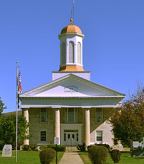
Pike County is a county on the eastern border of the U.S. state of Missouri, bounded by the Mississippi River. As of the 2010 census, the population was 18,516. Its county seat is Bowling Green. Its namesake was a city in middle Kentucky, a region from where many early migrants came. The county was organized December 14, 1818, and named for explorer Zebulon Pike. The folksong "Sweet Betsy from Pike" is generally thought to be associated with Pike County, Missouri.

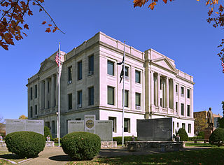
Lincoln County is located in the eastern part of the U.S. state of Missouri. As of the 2020 census, the population was 59,574. Its county seat is Troy. The county was founded December 14, 1818, and named for Major General Benjamin Lincoln of the American Revolutionary War.

Pike County is a county located in the U.S. state of Arkansas. As of the 2010 census, the population was 11,291. The county seat is Murfreesboro. Pike County is Arkansas's 25th county, formed on November 1, 1833, and named for Lieutenant Zebulon Pike, the explorer who discovered Pikes Peak. It is an alcohol prohibition or dry county. The current judge is Dewight Mack.

Arvada is a home rule municipality located in Jefferson and Adams counties, Colorado, United States. The city population was 124,402 at the 2020 United States Census, with 121,510 residing in Jefferson County and 2,892 residing in Adams County. Arvada is the seventh most populous city in Colorado. The city is a part of the Denver–Aurora–Lakewood, CO Metropolitan Statistical Area and the Front Range Urban Corridor. The Olde Town Arvada historic district is 7 miles (11 km) northwest of the Colorado State Capitol in Denver.

Franktown is an unincorporated town, a post office, and a census-designated place (CDP) located in and governed by Douglas County, Colorado, United States. The CDP is a part of the Denver–Aurora–Lakewood, CO Metropolitan Statistical Area. The Franktown post office has the ZIP Code 80116. At the United States Census 2010, the population of the Franktown CDP was 395, while the population of the 80116 ZIP Code Tabulation Area was 3,942 including adjacent areas. Douglas County governs the unincorporated town.

Parker is a home rule municipality in Douglas County, Colorado, United States. As a self-declared "town" under the home rule statutes, Parker is the second most populous town in the county; Castle Rock is the most populous. In recent years, Parker has become a commuter town at the southeasternmost corner of the Denver metropolitan area. As of the 2020 census the town population was 58,512. Parker is now the 19th most populous municipality in the state of Colorado.
Curryville is a city in western Pike County, Missouri, United States. The population was 225 at the 2010 census.

Eolia is a village in Pike County, Missouri, United States. The population was 522 at the 2010 census.

Frankford is a city in Pike County, Missouri, United States. The population was 323 at the 2010 census.

Paynesville is a village in Pike County, Missouri, United States. The population was 77 at the 2010 census.
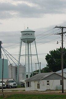
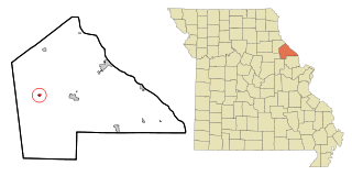
Vandalia is a city in northeastern Audrain and extending into southeastern Ralls Counties in the U.S. state of Missouri. The population was 3,553 at the 2020 census, which includes about 1,000 prisoners incarcerated at the prison located within the city limits.

Missouri City is a city in the U.S. state of Texas, within the Houston–The Woodlands–Sugar Land metropolitan area. The city is mostly in Fort Bend County, with a small portion in Harris County. As of the 2020 census, the city had a population of 74,259, up from 67,358 in 2010. The population was estimated at 75,457 in 2019.
Saint Onge is an unincorporated community and census-designated place (CDP) in Lawrence County, South Dakota, United States. As of the 2020 census, the population was 170.

Divide is an unincorporated town, a post office, and a census-designated place (CDP) located in and governed by Teller County, Colorado, United States. The CDP is a part of the Colorado Springs, CO Metropolitan Statistical Area. The Divide post office has the ZIP Code 80814. At the United States Census 2010, the population of the Divide CDP was 127, while the population of the 80814 ZIP Code Tabulation Area was 4,023 including adjacent areas.
Kirbyville is a village in Taney County, Missouri, United States. The population was 195 at the 2020 census. It is part of the Branson, Missouri Micropolitan Statistical Area.

Knob Lick is an unincorporated community in southern Saint Francois County, Missouri, United States. It is located on Missouri Route DD, just east of U.S. Route 67, approximately eight miles south of Farmington.
Ashley is a census-designated place in Pike County, Missouri, United States. It is located on Route 161, approximately six miles south of Bowling Green.

Miamitown is a census-designated place (CDP) in western Whitewater Township, Hamilton County, Ohio, United States. The population was 1,259 at the 2010 census. It has a post office with the ZIP code 45041.

Clements is an unincorporated community in Chase County, Kansas, United States. It is located about half way between Strong City and Florence near the intersection of U.S. Route 50 highway and G Rd.

