St. Mary, Montana | |
---|---|
Coordinates: 48°44′34″N113°25′39″W / 48.74278°N 113.42750°W | |
Country | United States |
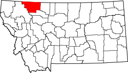
State | Montana |
County | Glacier |
Area | |
• Total | 0.75 sq mi (1.95 km2) |
• Land | 0.75 sq mi (1.95 km2) |
• Water | 0.00 sq mi (0.00 km2) |
Elevation | 4,633 ft (1,412 m) |
Population (2020) | |
• Total | 54 |
• Density | 71.71/sq mi (27.71/km2) |
Time zone | UTC-8 (Pacific (PST)) |
• Summer (DST) | UTC-7 (PDT) |
FIPS code | 30-65425 |
GNIS feature ID | 2806626 [2] |
St. Mary or Saint Mary [2] (Blackfeet: Natoaki, "Holy Woman") is an unincorporated community on the western border of the Blackfeet Indian Reservation adjacent to Glacier National Park in Glacier County, Montana, United States. The village is the eastern terminus of the Going-to-the-Sun Road which bisects the park east to west, a distance of 53 mi (85 km).
About 54 people reside in the village year-round; however, the population increases tenfold on a busy summer evening. Several lodges, restaurants and cafés, a small grocery store, two gas stations and campgrounds are located in the village. A large housing area for National Park Service personnel is located adjacent to the village, but within the park.
U.S. Route 89 passes through the village, which lies between Saint Mary Lake in Glacier National Park and Lower St. Mary Lake on the Blackfeet Indian Reservation.
This climatic region is typified by large seasonal temperature differences, with warm to hot (and often humid) summers and cold (sometimes severely cold) winters. According to the Köppen Climate Classification system, St. Mary has a humid continental climate, abbreviated "Dfb" on climate maps. [3]
Climate data for St Mary, Montana, 1991–2020 normals, 1981-2020 extremes: 4560ft (1340m) | |||||||||||||
---|---|---|---|---|---|---|---|---|---|---|---|---|---|
Month | Jan | Feb | Mar | Apr | May | Jun | Jul | Aug | Sep | Oct | Nov | Dec | Year |
Record high °F (°C) | 60 (16) | 63 (17) | 72 (22) | 82 (28) | 93 (34) | 95 (35) | 102 (39) | 99 (37) | 97 (36) | 87 (31) | 72 (22) | 58 (14) | 102 (39) |
Mean maximum °F (°C) | 51.2 (10.7) | 52.7 (11.5) | 57.3 (14.1) | 68.5 (20.3) | 78.2 (25.7) | 84.8 (29.3) | 91.3 (32.9) | 91.2 (32.9) | 86.0 (30.0) | 73.7 (23.2) | 58.4 (14.7) | 48.8 (9.3) | 93.4 (34.1) |
Mean daily maximum °F (°C) | 29.2 (−1.6) | 32.1 (0.1) | 37.9 (3.3) | 46.6 (8.1) | 57.2 (14.0) | 64.4 (18.0) | 75.0 (23.9) | 74.4 (23.6) | 63.2 (17.3) | 48.9 (9.4) | 36.3 (2.4) | 29.4 (−1.4) | 49.5 (9.8) |
Daily mean °F (°C) | 20.8 (−6.2) | 22.9 (−5.1) | 28.7 (−1.8) | 36.5 (2.5) | 45.9 (7.7) | 52.5 (11.4) | 60.6 (15.9) | 59.3 (15.2) | 50.6 (10.3) | 39.9 (4.4) | 29.4 (−1.4) | 22.4 (−5.3) | 39.1 (4.0) |
Mean daily minimum °F (°C) | 12.3 (−10.9) | 13.7 (−10.2) | 19.6 (−6.9) | 26.3 (−3.2) | 34.6 (1.4) | 40.7 (4.8) | 46.1 (7.8) | 44.2 (6.8) | 37.9 (3.3) | 30.8 (−0.7) | 22.4 (−5.3) | 15.3 (−9.3) | 28.7 (−1.9) |
Mean minimum °F (°C) | −16.9 (−27.2) | −10.1 (−23.4) | −4.3 (−20.2) | 9.6 (−12.4) | 22.3 (−5.4) | 30.9 (−0.6) | 36.9 (2.7) | 33.4 (0.8) | 25.6 (−3.6) | 13.2 (−10.4) | −1.1 (−18.4) | −12.6 (−24.8) | −25.0 (−31.7) |
Record low °F (°C) | −36 (−38) | −40 (−40) | −29 (−34) | −11 (−24) | 15 (−9) | 27 (−3) | 29 (−2) | 20 (−7) | 12 (−11) | −8 (−22) | −24 (−31) | −38 (−39) | −40 (−40) |
Average precipitation inches (mm) | 2.20 (56) | 1.95 (50) | 1.69 (43) | 1.93 (49) | 2.88 (73) | 3.37 (86) | 1.53 (39) | 1.63 (41) | 2.18 (55) | 2.05 (52) | 2.47 (63) | 2.21 (56) | 26.09 (663) |
Average snowfall inches (cm) | 15.5 (39) | 18.6 (47) | 15.9 (40) | 13.2 (34) | 4.8 (12) | 1.0 (2.5) | 0.0 (0.0) | 0.0 (0.0) | 1.7 (4.3) | 8.5 (22) | 17.8 (45) | 20.8 (53) | 117.8 (298.8) |
Average extreme snow depth inches (cm) | 12.8 (33) | 13.0 (33) | 11.6 (29) | 7.1 (18) | 2.7 (6.9) | 0.6 (1.5) | 0.0 (0.0) | 0.0 (0.0) | 0.2 (0.51) | 3.3 (8.4) | 8.8 (22) | 9.7 (25) | 20.4 (52) |
Source 1: NOAA (1981-2010 precip/snowfall) [4] [5] | |||||||||||||
Source 2: XMACIS2 (records, monthly max/mins & 1981-2010 snow depth) [6] |
Census | Pop. | Note | %± |
---|---|---|---|
2020 | 54 | — | |
U.S. Decennial Census [7] |
The Piegan are an Algonquian-speaking people from the North American Great Plains. They are the largest of three Blackfeet-speaking groups that make up the Blackfeet Confederacy; the Siksika and Kainai are the others. The Piegan dominated much of the northern Great Plains during the nineteenth century.
Glacier County is located in the U.S. state of Montana. As of the 2020 census, the population was 13,778. The county is located in northwestern Montana between the Great Plains and the Rocky Mountains, known to the Blackfeet as the "Backbone of the World". The county is geographically and culturally diverse and includes the Blackfeet Indian Reservation, Glacier National Park, and Lewis and Clark National Forest. The county is bordered by 75 miles of international boundary with two ports of entry open year-round and one seasonal international border crossing into Alberta, Canada.
Manistique is the only city and county seat of Schoolcraft County in the U.S. state of Michigan. As of the 2020 census, the city population was 2,828.
Browning is a former town and current Census-designated place in Glacier County, Montana, United States. It is the headquarters for the Blackfeet Indian Reservation and was the only incorporated town on the Reservation. The population was 1,018 at the 2020 census.
Cut Bank is a city in and the county seat of Glacier County, Montana, United States, located just east of the "cut bank" (gorge) along Cut Bank Creek. The population was 3,056 at the 2020 census, The town began in 1891 with the arrival of the Great Northern Railway.
East Glacier Park is an unincorporated community and census-designated place (CDP) in Glacier County, Montana, United States. As of the 2020 census, it had a population of 354.
St. Ignatius is a town in Lake County, Montana, United States. The population was 768 at the 2020 census. The town is located on the Flathead Indian Reservation.
St. Regis or Saint Regis is an unincorporated community and census-designated place (CDP) in Mineral County, Montana. The population was 313 at the time of the 2020 census.
Stevensville is a town in Ravalli County, Montana, United States. The population was 2,002 at the 2020 census.
Ronan is a city in Lake County, Montana, United States. It is on the Flathead Indian Reservation. The population was 1,955 at the 2020 census.
Glacier National Park is a national park of the United States located in northwestern Montana, on the Canada–United States border. The park encompasses more than 1 million acres (4,100 km2) and includes parts of two mountain ranges, more than 130 named lakes, more than 1,000 different species of plants, and hundreds of species of animals. This vast pristine ecosystem is the centerpiece of what has been referred to as the "Crown of the Continent Ecosystem", a region of protected land encompassing 16,000 sq mi (41,000 km2).
The Saint Mary River, is a cross-border tributary of the Oldman River, itself a tributary of the South Saskatchewan River. The Saint Mary together with the Belly River and Waterton River drains a small portion of Montana, in the United States, to the Hudson Bay watershed in Canada.
The Blackfeet Nation, officially named the Blackfeet Tribe of the Blackfeet Indian Reservation of Montana, is a federally recognized tribe of Siksikaitsitapi people with an Indian reservation in Montana. Tribal members primarily belong to the Piegan Blackfeet band of the larger Blackfoot Confederacy that spans Canada and the United States.
Carway is a hamlet in southern Alberta, Canada within Cardston County. It is a port of entry into the U.S. state of Montana opposite of Port of Piegan. Just on the other side of the border is the Blackfeet Indian Reservation in Glacier County, Montana.
Lewis and Clark National Forest is located in west central Montana, United States. Spanning 2,912 square miles (7,500 km2). The region was inhabited by various cultures of Native Americans for a period of at least 8,000–10,000 years. When the Lewis and Clark Expedition came to this area, different areas of the large forest territory were used by members of the Blackfeet, Sioux, Cheyenne, Flathead and Crow nations for hunting and as an area for their seasonal winter camps. The forests provided shelter from the winter.
Going-to-the-Sun Mountain is a 9,647-foot (2,940 m) mountain peak located in Glacier National Park in the U.S. state of Montana. It rises dramatically above St. Mary Valley just north of the Going-to-the-Sun Road. The mountain was named by James Willard Schultz in 1888.
Babb is a small unincorporated farming and ranching community in Glacier County, Montana, United States, on the Blackfeet Indian Reservation. The community experiences a large influx of tourists in the summer months as it is the gateway to the Many Glacier area of Glacier National Park. For statistical purposes, the United States Census Bureau has defined Babb as a census-designated place (CDP). It had a population of 174 at the 2010 census.
Turtle Mountain Indian Reservation is a reservation located in northern North Dakota, United States. It is the land base for the Turtle Mountain Band of Chippewa Indians. The population of the Turtle Mountain Indian Reservation consists of Plains Ojibwe and Métis peoples; the reservation was established in 1882.
The Regional designations of Montana vary widely within the U.S state of Montana. The state is a large geographical area that is split by the Continental Divide, resulting in watersheds draining into the Pacific Ocean, Gulf of Mexico and Hudson's Bay. The state is approximately 545 miles (877 km) east to west along the Canada–United States border and 320 miles (510 km) north to south. The fourth largest state in land area, it has been divided up in official and unofficial ways into a variety of regions. Additionally, Montana is part of a number of larger federal government administrative regions.
Sula is a census-designated place (CDP) in Ravalli County, Montana, United States. It is named after the community of Sula, which it encompasses, and was established about 2010, prior to that year's census. The population of the CDP was 37 at the 2010 census.