Starr School, Montana

Last updated

Starr School, Montana
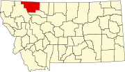
Glacier County Montana Incorporated and Unincorporated areas Starr School Highlighted.svg
Location of Starr School, Montana
Coordinates: 48°35′55″N113°08′25″W / 48.59861°N 113.14028°W / 48.59861; -113.14028
Country United States
State Montana
County Glacier
Area
[1]
  Total
4.23 sq mi (10.96 km2)
  Land4.23 sq mi (10.95 km2)
  Water0.00 sq mi (0.01 km2)
Elevation
[2]
4,705 ft (1,434 m)
Population
 (2020)
  Total
267
  Density63.17/sq mi (24.39/km2)
Time zone UTC-7 (Mountain (MST))
  Summer (DST) UTC-6 (MDT)
Area code 406
FIPS code 30-70825
GNIS feature ID2409996 [2]

Starr School (Blackfeet: Kakatosi-itaisxinaimaztakiopi) is a census-designated place (CDP) in Glacier County, Montana, United States. The population was 252 at the 2010 census. [3]

Contents

Geography

Starr School is located northwest of Browning. It is on the Blackfeet Indian Reservation.

According to the United States Census Bureau, the CDP has a total area of 4.23 square miles (10.96 km2), of which 0.004 square miles (0.01 km2), or 0.09%, is water. [3]

Demographics

Historical population
CensusPop.Note
2020 267
U.S. Decennial Census [4]

As of the census [5] of 2000, there were 248 people, 61 households, and 58 families residing in the CDP. The population density was 60.8 inhabitants per square mile (23.5/km2). There were 67 housing units at an average density of 16.4/sq mi (6.3/km2). The racial makeup of the CDP was 2.42% White, 97.18% Native American, and 0.40% from two or more races.

There were 61 households, out of which 49.2% had children under the age of 18 living with them, 50.8% were married couples living together, 29.5% had a female householder with no husband present, and 4.9% were non-families. 4.9% of all households were made up of individuals, and 1.6% had someone living alone who was 65 years of age or older. The average household size was 4.07 and the average family size was 4.14.

In the CDP, the population was spread out, with 42.3% under the age of 18, 11.7% from 18 to 24, 22.6% from 25 to 44, 18.1% from 45 to 64, and 5.2% who were 65 years of age or older. The median age was 23 years. For every 100 females, there were 112.0 males. For every 100 females age 18 and over, there were 95.9 males.

The median income for a household in the CDP was $24,531, and the median income for a family was $24,531. Males had a median income of $35,972 versus $31,250 for females. The per capita income for the CDP was $8,105. About 18.5% of families and 20.2% of the population were below the poverty line, including 22.5% of those under the age of eighteen and none of those 65 or over.

Education

The area school district is Browning Public Schools, [6] with its components being Browning Elementary School District and Browning High School District. [7]

Related Research Articles

<span class="mw-page-title-main">Glacier County, Montana</span> County in Montana, United States

Glacier County is located in the U.S. state of Montana. As of the 2020 census, the population was 13,778. The county is located in northwestern Montana between the Great Plains and the Rocky Mountains, known to the Blackfeet as the "Backbone of the World". The county is geographically and culturally diverse and includes the Blackfeet Indian Reservation, Glacier National Park, and Lewis and Clark National Forest. The county is bordered by 75 miles of international boundary with two ports of entry open year-round and one seasonal international border crossing into Alberta, Canada.

<span class="mw-page-title-main">Busby, Montana</span> Census-designated place in Big Horn County, Montana, United States

Busby is a census-designated place (CDP) in Big Horn County, Montana, United States. It is on the Northern Cheyenne reservation. The population was 745 at the 2010 census.

<span class="mw-page-title-main">Fort Smith, Montana</span> Census-designated place in Montana, United States

Fort Smith is a census-designated place (CDP) in Big Horn County, Montana, United States. The population was 161 at the 2010 census. The town is named for the former Fort C.F. Smith. The North District of Bighorn Canyon National Recreation Area is accessed at Fort Smith.

<span class="mw-page-title-main">St. Xavier, Montana</span> Unincorporated community and census-designated place in Montana, United States

St. Xavier is an unincorporated community and census-designated place (CDP) in Big Horn County, Montana, United States. The CDP population was 83 at the 2010 census.

<span class="mw-page-title-main">Black Eagle, Montana</span> CDP in Montana, United States

Black Eagle is a census-designated place (CDP) in Cascade County, Montana, United States. The population was 904 at the 2010 census. It is a suburb of Great Falls.

<span class="mw-page-title-main">Loma, Montana</span> Census-designated place in Montana, United States

Loma is a census-designated place (CDP) in Chouteau County, Montana, United States. The population was 85 at the 2010 census.

<span class="mw-page-title-main">Bigfork, Montana</span> Unincorporated community in Montana, United States

Bigfork is a census-designated place (CDP) in Flathead County, Montana, United States. It is within Montana's Rocky Mountains. The population was 5,118 at the 2020 census, up from 4,270 in 2010.

<span class="mw-page-title-main">Coram, Montana</span> Unincorporated community in Montana, United States

Coram is an unincorporated community and census-designated place (CDP) in Flathead County, Montana, United States. The population was 539 in 2010, up from 337 at the 2000 census. Coram lies 7 miles (11 km) southwest of the western entrance of Glacier National Park.

<span class="mw-page-title-main">Hungry Horse, Montana</span> Unincorporated community in Montana, United States

Hungry Horse is an unincorporated community and census-designated place (CDP) in Flathead County, Montana, United States. The population was 828 at the 2020 census. The ZIP code for Hungry Horse is 59919.

<span class="mw-page-title-main">Martin City, Montana</span> Unincorporated community in Montana, United States

Martin City is an unincorporated community and census-designated place (CDP) in Flathead County, Montana, United States. As of the 2010 census, it had a population of 500, up from 331 in 2000.

<span class="mw-page-title-main">Browning, Montana</span> Census-designated place in Montana, United States

Browning is a former town and current Census-designated place in Glacier County, Montana, United States. It is the headquarters for the Blackfeet Indian Reservation and was the only incorporated town on the Reservation. The population was 1,018 at the 2020 census.

<span class="mw-page-title-main">East Glacier Park Village, Montana</span> CDP in Montana, United States

East Glacier Park is an unincorporated community and census-designated place (CDP) in Glacier County, Montana, United States. As of the 2020 census, it had a population of 354.

<span class="mw-page-title-main">North Browning, Montana</span> Census-designated place in Montana, United States

North Browning is a census-designated place (CDP) in Glacier County, Montana, United States. The population was 2,408 at the 2010 census.

<span class="mw-page-title-main">South Browning, Montana</span> Census-designated place in Montana, United States

South Browning is a census-designated place (CDP) in Glacier County, Montana, United States. The population was 1,785 at the 2010 census. South Browning is a rural village on the Blackfeet Indian Reservation. It is bordered to the north by the town of Browning.

<span class="mw-page-title-main">Inverness, Montana</span> CDP in Montana, United States

Inverness is a census-designated place (CDP) in Hill County, Montana, United States. The population was 55 at the 2010 census. It was named after a city in Scotland.

<span class="mw-page-title-main">Orchard Homes, Montana</span> Census-designated place in Montana, United States

Orchard Homes is a census-designated place (CDP) in Missoula County, Montana, United States. It is part of the Missoula metropolitan area. The population was 5,377 at the 2020 census.

<span class="mw-page-title-main">Heart Butte, Montana</span> Census–designated place in Pondera County, Montana

Heart Butte is a census-designated place (CDP) in Pondera County, Montana, United States. The population was 698 at the 2000 census. The town is on the Blackfeet Indian Reservation.

<span class="mw-page-title-main">Noxon, Montana</span> CDP in Montana, United States

Noxon is a census-designated place (CDP) in Sanders County, Montana, United States. The population of the whole CDP was 255 at the 2020 census.

<span class="mw-page-title-main">West Alto Bonito, Texas</span> CDP in Texas, United States

West Alto Bonito is a census-designated place (CDP) in Starr County, Texas, United States. The population was 615 in 2020 census. Prior to the 2010 census, West Alto Bonito CDP was known as Alto Bonito CDP.

<span class="mw-page-title-main">La Puerta, Texas</span> CDP in Texas, United States

La Puerta is a census-designated place (CDP) in Starr County, Texas, United States. The population was 638 at the 2020 census, an increase from the figure of 632 tabulated in 2010 census.

References

  1. "ArcGIS REST Services Directory". United States Census Bureau. Retrieved September 5, 2022.
  2. 1 2 U.S. Geological Survey Geographic Names Information System: Starr School, Montana
  3. 1 2 "Geographic Identifiers: 2010 Demographic Profile Data (G001): Starr School CDP, Montana". American Factfinder. U.S. Census Bureau. Retrieved December 22, 2016.[ dead link ]
  4. "Census of Population and Housing". Census.gov. Retrieved June 4, 2016.
  5. "U.S. Census website". United States Census Bureau . Retrieved January 31, 2008.
  6. "Directory of Montana Schools". Montana Office of Public Instruction. March 13, 2024. p. 119-120/319. Retrieved March 13, 2024.
  7. "2020 CENSUS - SCHOOL DISTRICT REFERENCE MAP: Glacier County, MT" (PDF). U.S. Census Bureau. p. 2 (PDF p. 3/6). Retrieved March 13, 2024. - Text list