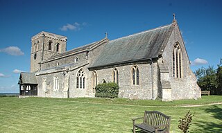
Garsington is a village and civil parish about 5 miles (8 km) southeast of Oxford in Oxfordshire. The 2011 Census recorded the parish's population as 1,689.

Saunderton is a village in the Saunderton Valley in the Chiltern Hills, Buckinghamshire, England, in the civil parish of Bledlow-cum-Saunderton. The village consists of three main areas: a linear settlement along Bledlow Road about 1 1⁄4 miles (2 km) southwest of Princes Risborough, Saunderton Lee, about 1 1⁄2 miles (2 km) further south and a residential area on the A4010 road around Saunderton railway station, about 4 1⁄2 miles (7 km) northwest of High Wycombe. This residential area, unlike the other two parts of the village, is in the HP14 postcode district, meaning its post town is High Wycombe, not Princes Risborough, the boundary between the two post towns passing just south of Grange Farm.

Lydlinch is a village and civil parish in the Blackmore Vale in north Dorset, England, about 3 miles (5 km) west of Sturminster Newton. The village is sited on Oxford clay close to the small River Lydden. The parish – which includes the village of King's Stag to the south and the hamlet of Stock Gaylard to the west – is bounded by the Lydden to the east and its tributary, the Caundle Brook, to the north.

Barby is a village and civil parish about 5 miles (8 km) north of Daventry in Northamptonshire, England. The 2011 Census recorded the parish population as 2,336. Barby is located right off the M45 motorway a short spur from the M1 motorway to the A45 Trunk Road.

Rampton is a village in the civil parish of Rampton and Woodbeck, about 6 miles (10 km) east of Retford in the Bassetlaw district, in the county of Nottinghamshire, England. The parish is long and thin, extending about 7 miles (11 km) east–west but only about 1 mile (1.6 km) north–south. Its eastern boundary is the River Trent, which here also forms the county boundary with Lincolnshire.
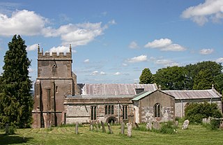
Ashbury is a village and large civil parish at the upper end (west) of the Vale of White Horse. It was part of Berkshire until the 1974 boundary changes transferred it to Oxfordshire. The village is centred 7 miles (11 km) east of Swindon in neighbouring Wiltshire. The parish includes the hamlets of Idstone and Kingstone Winslow. The 2011 Census recorded the parish's population as 506.
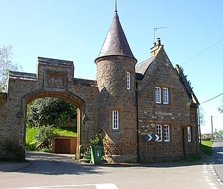
Moreton Pinkney is a village and civil parish in South Northamptonshire, about 7.5 miles (12 km) north of Brackley. The 2011 Census recorded the parish's population as 371.

Broadwell is a village and civil parish about 2 miles (3 km) south-west of Carterton in West Oxfordshire. The 2011 Census recorded the parish's population as 218.

Charlton is a village and civil parish in North Wiltshire, England, about 2 miles (3 km) northeast of Malmesbury and 4 miles (6.4 km) northwest of the village of Brinkworth. The parish includes the hamlet of Perry Green and the Charlton Park estate. The 2011 Census recorded the parish population as 425.
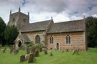
Duns Tew is an English village and civil parish about 7 1⁄2 miles (12 km) south of Banbury in Oxfordshire. The 2011 Census recorded the parish's population as 478.

Fifield is a village and civil parish about 4 miles (6.4 km) north of Burford in Oxfordshire. The western boundary of the parish forms part of the county boundary with Gloucestershire. The 2011 Census recorded the parish's population as 240.

Emmington is a village in Chinnor civil parish about 4.5 miles (7 km) southeast of Thame in Oxfordshire.

West Hanney is a village and civil parish about 3 miles (5 km) north of Wantage, Oxfordshire, England. Historically West and East Hanney were formerly a single ecclesiastical parish of Hanney. East Hanney was part of Berkshire until the 1974 boundary changes transferred the Vale of White Horse to Oxfordshire. The 2011 Census recorded the parish's population as 490.

Great Rollright is a village in the civil parish of Rollright, about 2.5 miles (4 km) north of Chipping Norton, Oxfordshire.
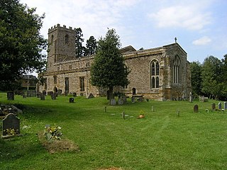
Marston St. Lawrence is a village and civil parish about 4 miles (6.4 km) northwest of Brackley in Northamptonshire. A stream flows through the village and another forms the southern boundary of the parish. The two merge as Farthinghoe Stream, a tributary of the Great Ouse. The 2001 Census recorded the parish population as 209, decreasing slightly to 202 at the 2011 Census.

The Church of St Gregory Stoke St Gregory, is a Church of England parish church in Somerset, England. Its parish is part of the Athelney Benefice, along with the parishes of St Michael, Burrowbridge, St Bartholomew, Lyng and SS Peter and Paul, North Curry.

Shellingford, historically also spelt Shillingford, is a village and civil parish about 2 1⁄2 miles (4 km) south-east of Faringdon in the Vale of White Horse in Oxfordshire, England. It was part of Berkshire until the 1974 Local Government Act transferred it to Oxfordshire. The 2011 Census recorded the parish's population as 173.

Hinton Waldrist is a village and civil parish in the Vale of White Horse, England. It was part of Berkshire until the 1974 boundary changes transferred it to Oxfordshire. The village is between Oxford and Faringdon, 9 miles (14 km) southwest of Oxford. The parish includes the hamlet of Duxford. The 2011 Census recorded the parish's population as 328.

Pillerton Hersey is a village and civil parish about 5.5 miles (9 km) north of Shipston-on-Stour in Warwickshire, England. The village is on a stream that flows northwest to join the River Dene. The 2011 Census recorded the parish's population as 170.

St Bridget's Church, Brean is the Church of England parish church of the village of Brean in Somerset, England.


